


Refine your search for walks in Les Alliés
Les Alliés walks


 Circular Alliés route via the Côte du Cerf and Les Grands Cernets
 Visorando Member
 11.53 mi
 +1,716 ft
 -1,736 ft
 6h 50
 Moderate
 Departure from Les Alliés (Doubs)
A beautiful Franco-Swiss walk that will take you from the Ruisseau des Étraches valley to the Côte du Cerf, then through a succession of Swiss mountain pastures and beautiful coniferous forests, you’ll pass lovely summer farms, cross the hamlet of Les Cernets to reach the ridge and descend towards the Ruisseau des Entreportes valley before crossing the border again and traversing the Étraches valley to return to the village of Les Alliés.
Weather permitting, you’ll be treated to lovely panoramic views of the Swiss plain and, perhaps, the Alps in the distance.
The Cerf rocks
 Association / Club / Walk leader
 7.13 mi
+879 ft
-843 ft
4h 05
Moderate
Departure from Hauterive-la-Fresse (Doubs)
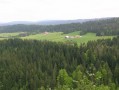
This route will take you from the forest to the cliff via the pastures of the Haut Doubs.
La Côte du Cerf
 6.37 mi
+843 ft
-820 ft
3h 40
Moderate
Departure from Hauterive-la-Fresse (Doubs)
From the old, isolated farmhouse of La Perdrix, right in the heart of Le Sauget, you’ll reach the hamlet of La Fresse and climb towards the ridge of Les Rochers du Cerf, a picturesque rocky path dotted with gentians, boundary stones and numerous views over the secluded Théverot valley, Mont Châteleu and the Swiss mountains.
The Dames des Entreportes circular route via Le Larmont and Les Cernets
12.51 mi
+2,083 ft
-2,087 ft
7h 35
 Difficult
Departure from Pontarlier (Doubs)
A beautiful Franco-Swiss walk starting from the picturesque site of Les Dames des Entreportes. From Larmont mountain, you’ll enjoy sweeping views of the Jura range and the Alps if the weather is ideal. After crossing magnificent mountain pastures and crossing the border, you’ll pass through Swiss hamlets and farms before returning to French territory and continuing your walk through the wild Vallon des Etraches.
 Simon Pion's horse riding trail
 1.86 mi
+151 ft
-151 ft
45 mins
 Easy
Departure from Pontarlier (Doubs)
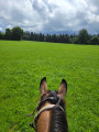
Short loop through the fields (no gates to open) on horseback, with the option of staying at the Brin d'Herbe equestrian lodge. Please note: this route is only possible when the hay has just been cut and the grass in the meadows is short.
Forests and pastures all the way to Les Papillons restaurant
 4.63 mi
+499 ft
-495 ft
2 hrs
Moderate
Departure from Pontarlier (Doubs)
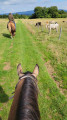
Starting from the Brin d'Herbe equestrian lodge, enjoy an unusual hike along forest paths, past cows and alpine landscapes. There is a magnificent view from the Ferme des Miroirs road, from where you can even see the Alps if the weather is not too cloudy! Enjoy a refreshing break or a good meal at the Les Papillons restaurant before returning through fields and forests.
NB: as this hike crosses several cow pastures, please be sure to dismount, open and, above all, close any gates you come across.
The mirrors
 5.27 mi
+784 ft
-748 ft
3h 05
Easy
Departure from Pontarlier (Doubs)
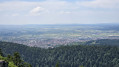
This hike will take you through a protected area and offer you a beautiful view of the town of Pontarlier.
Moderator's note A GPS device may be useful for this hike. See reviews.
Le Grand Taureau
 9.83 mi
+1,430 ft
-1,430 ft
5h 45
Moderate
Departure from Pontarlier (Doubs)
The highest point of the Montagne du Larmont, the Grand Taureau, at an altitude of 1,323 metres, offers a panoramic view of Pontarlier, the Loue Valley, the Jura mountains (the Aiguilles de Baulmes, the Knoll, the Mont d'Or), the Alps and Mont Blanc in good weather. This well-balanced route allows you to enjoy the coolness of beautiful pine forests and the sunshine of these alpine pastures dotted with gentians, accompanied by the music of our cowbells.
 Circular of Arcan to Grand Taureau
 7.88 mi
+1,073 ft
-1,096 ft
6h 04
Moderate
Departure from Pontarlier (Doubs)
Circular snowshoe loop above Pontarlier towards the Grand Taureau (altitude 1,323 m). Gentle climb. Steeper return which can be avoided by following the road, which is partly snow-covered. View of the Alps in good weather. View of Pontarlier and further north. Only part of the route is marked. Much of the route is used in winter.
The banks of the Doubs from Pontarlier to Doubs
3.63 mi
+338 ft
-335 ft
2h 00
Easy
Departure from Pontarlier (Doubs)
Follow the river from Pontarlier to the village of Doubs. Enjoy the coolness of the pine forest before crossing a pasture and looking out over the town nestled at the foot of Larmont.
View of the two castles
 3.67 mi
+745 ft
-745 ft
2h 20
Easy
Departure from La Cluse-et-Mijoux (Doubs)
A short hike for the whole family with breathtaking views of Château de Joux and Fort Malher!
The Château de Joux and Fort Mahler
 6.04 mi
+1,066 ft
-1,050 ft
3h 40
Moderate
Departure from Pontarlier (Doubs)
Pass through pastures dotted with gentians and friendly, cuddly horses, then through cool fir forests with slender trees to discover Fort Malher and Château de Joux overlooking the valley with all the imposing severity of a medieval watchtower.
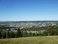
Discovering the Grand Taureau
 11.68 mi
+2,001 ft
-1,988 ft
7h 05
Moderate
Departure from Pontarlier (Doubs)
Through mountain pastures and forests, along paths and forest tracks, discover a summit above Pontarlier, with beautiful views of the Alps on a clear day.
 Pontarlier – Vuillecin – Sombacour – Chaffois
17.17 mi
+751 ft
-758 ft
2 hrs
Moderate
Departure from Doubs (Doubs) (Doubs)
Here is a hybrid bike route that will take you on a pleasant circular route through the woods between Vuillecin, Sombacour and Chaffois. Very little traffic (except perhaps on the first and last kilometres).
It’s easy to ride and suitable for everyone.
Note: this route was completed on an e-bike! Comments on difficulty and time are based on this mode of transport.
Route de découverte de Pontarlier
6.45 mi
+210 ft
-213 ft
3h 10
Moderate
Departure from Pontarlier (Doubs)
Pontarlier is a sub-prefecture of the Doubs department. The town is often regarded as its capital. Surrounded by low mountains, this town has undeniable charm and boasts a number of historic monuments such as the Porte Saint-Pierre. This walk, covering around ten kilometres, allows you to see many of these monuments as well as several parks. From the Church of Saint-Bénigne to the Parc des Ouillons, Pontarlier will reveal its many facets to you. The route presents no difficulties. It is, however, classified as ‘moderate’ as the route is over 10 kilometres long and may not be suitable for young children.
Mont Pelé
 4.24 mi
+781 ft
-761 ft
2h 40
Easy
Departure from Bugny (Doubs)
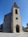
Climb Mont Pelé (1,045 m) through an open pine forest. At the summit, you will enjoy a 360° view. To the west, view Bugny and the Val des Usiers, the upper Jura mountain range. To the east, view of Crêt Monniot and, with a little luck, Mont Blanc will be visible on a clear day. To the north, above all, view of the magnificent upper Loue valley bordered by the cliffs of Moine de la Vallée and Roche de Hautepierre. Return via a superb rocky ridge with numerous viewpoints over the valley.
Mont Pelé, starting from Bugny
 5.07 mi
+784 ft
-807 ft
3 hrs
Easy
Departure from Bugny (Doubs)
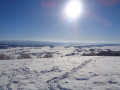
A snowshoe hike in a quiet area. Unusual views over the Hautepierre area. A view of Mont Blanc if you’re lucky. Vast snowfields to explore.
The GPX track may prove useful in areas without signposting.
Les Rochers du Cerf from Les Gras
 8.04 mi
+1,191 ft
-1,171 ft
4h 45
Moderate
Departure from Les Gras (Doubs)
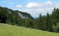
From Les Gras, you will climb through beautiful, clear forests to the Rochers du Cerf ridge trail and its many viewpoints over the discreet Théverot valley, Mont Châteleu and the Swiss mountains. Return via the Swiss pastures and their concert of cowbells.
Mont Châteleu
 8.22 mi
+1,631 ft
-1,631 ft
5h 10
Moderate
Departure from Les Gras (Doubs)
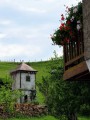
Passing through beautiful pine forests, you will walk along a small gorge, home to waterfalls where the rotation of pebbles has carved the soft rock over thousands of years, forming basins known as chaudières in our Haut-Doubs region. Then, passing isolated farms nestled in the hollows of the pastures and surrounded by our good old Montbéliard cows, you will reach a panorama stretching south-west over the Chasseron, the Suchet, the Gras topped by the Rochers du Cerf, Switzerland to the south and, in fine weather, Mont Blanc.
Crêt Monniot – Combe du Fourney – Les Cerniers
5.69 mi
+525 ft
-535 ft
3h 05
Moderate
Departure from La Chaux (Doubs)
This is an idyllic, easy walk suitable for everyone. As you pass through Crêt Monniot, you’ll wander through meadows and copses in peace and quiet. In autumn, you’ll enjoy the shimmering colours blending into the green of the conifers.
Crêt Monniot variant
 4.12 mi
+574 ft
-577 ft
2h 25
Easy
Departure from La Chaux (Doubs)
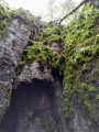
Crêt Moniot, with one or two "n"s, is well known for cross-country skiing and snowshoeing, but the site is also ideal for hiking and mountain biking.It offers typical Jura landscapes with sinkholes and sharp limestone pavement, snow all year round in the La Neigère valley, abundant wildlife and superb views of the Alps.
Château de Joux
 3.91 mi
+843 ft
-873 ft
2h 30
Easy
Departure from La Cluse-et-Mijoux (Doubs)
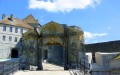
Located in the heart of a magnificent natural site, Château de Joux has overlooked its cluse since the year 1000. By installing a toll booth there, the lords of Joux were able to build this stone fortress. You will walk along both sides of the valley, climbing the Larmont anticline to Fort Mahler for superb views of this castle, which watches over the valley with all the imposing severity of a medieval watchtower.
The Cascades des Chaudieres and Le Nid du Fol waterfalls starting from Les Gras
6.09 mi
+938 ft
-942 ft
3h 35
Moderate
Departure from Les Gras (Doubs)
There are several points of interest to discover on this hike:
- what water can do in our Jura mountains,
- our beautiful mid-mountain landscapes with forests and pastures,
- the beautiful forests of the Haut-Doubs.
The Grand Tour of Château de Joux
 12.69 mi
+2,297 ft
-2,300 ft
7h 50
Difficult
Departure from Granges-Narboz (Doubs)
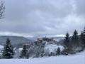
This route connects the four most beautiful viewpoints around Château de Joux. Views of the castle from every angle, as well as superb panoramas of the Doubs valley and the Fer à Cheval gorge. If you have time, you can add a visit to the castle (1 to 1½ hours). The Sandor site and the church at Oye-et-Pallet further enhance this walk.
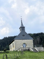
Montpetot Chapel and Roche Sarrasine
 3.93 mi
+686 ft
-686 ft
2h 25
Easy
Departure from La Cluse-et-Mijoux (Doubs)
A short route in the heart of the Haut-Doubs that will let you discover Château de Joux from an unusual angle.
La Terre aux Vieux and Mont Pelé
 5.02 mi
+1,027 ft
-1,017 ft
3h 10
Moderate
Departure from Ouhans (Doubs)
A short climb up to Mont Pelé (1,045 m) through sunny pastures. At the summit, you’ll be treated to a 360° view. To the west, views of Bugny and the Val des Usiers, and the high Jura range. To the east, views of the Crêt Monniot and, with a bit of luck, Mont Blanc on a clear day. To the north, in particular, views of the magnificent upper Loue valley, flanked by the cliffs of the Moine de la Vallée and the Roche de Hautepierre. Return via a superb rocky ridge offering numerous vantage points over the valley.
Remonot Discovery Route
2.27 mi
+318 ft
-325 ft
1h 20
Easy
Departure from Les Combes (Doubs)
Remonot is a small hamlet in the commune of Les Combes. Situated on the banks of the Doubs, in the Pays Horloger, this village has everything to offer: surrounded by the Jura mountains, it is a pleasure to stroll along these country lanes in search of little gems. The most remarkable heritage site is none other than the Chapel of Notre-Dame de Remonot, situated within a vast cavern 30 metres deep. Within this cavern are four springs, one of which is said to possess miraculous properties. The site is still used for worship today. The route also takes you past the Church of the Holy Spirit and, nearby, the Remonot viewpoint, which offers views of the highest gorges of the Doubs. The walk along the river’s right bank takes you past a drinking trough and a hand pump.
 Fort de Joux No. 80