


 Country:

 City:


Car park at the semi-circular lay-by on the N57:
on the left, 1.6 km after Saint-Gorgon-Main when coming from Besançon;
on the right, 3.3 km from La Vrine when coming from Pontarlier.
Sparse yellow-and-blue signposting in places. A large section has no signposting.
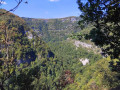
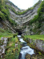
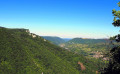
(S/E) The car park is also the starting point for two stony paths. With your back to the road, take the path on the left and continue straight on at the fork. As you emerge from the woods, at the hamlet of Les Dombelles, there is a superb view over the upper Loue valley, with the Moine de la Vallée rocks to the left and the Roche de Hautepierre to the right.
(1) Immediately after the lovely farmhouse, head right up the slope; you’ll soon reach a pasture and a stony path, which you’ll follow further up to the right. After a copse, as you enter a pasture, the stony path gives way to a dirt track which you’ll climb without hesitation, unfortunately running alongside the high-voltage power line.
At the top of the pasture, you’ll cross a barbed-wire fence (which may be closed) to reach, almost at the very top, a wider stony path, where you’ll find some faintly visible markings.
(2) Head left up into the fir forest. The path becomes tarmacked for a short while, leading you to a lovely viewpoint over the valley. Keep going straight on along this path until you emerge from the woods, then reach a large old farmhouse that has been converted into a cowshed. Note the beautiful arched doorway. Immediately after the farmhouse, you’ll come to a fork in the path.
(3) Head right up the stony path. At the top of the pasture, take a moment to pause and look back at the superb view over the valley. You’ll come to a gate (which was open when I passed through).
(4) Cross this large, flat pasture towards the pylon in the distance. Almost at the far end, look out for a beautiful solitary fir tree on your right, near the gate through which you’ll leave the pasture. Head left, keeping the pylon in your sights. At its foot, climb the hill on the far right to find the cairn marking the summit of Mont Pelé.
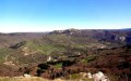
Rising to 1,045 metres, ‘Le Plé’ – as the locals call it – offers a 360° view. To the west, you can see Bugny and the Val d’Usiers, as well as the high Jura range. To the east, you can see the Crêt Monniot and, with a bit of luck, Mont Blanc on a clear day.
(5) Leave the mountain by walking down parallel to the edge of the woodland for 200 metres towards a gate and a small ladder for walkers to climb over the fence.
Continue the descent for a further 200 metres along a more or less visible pasture path, keeping the edge of the woodland on your right and passing, on your left, a few gnarled trees bearing half-faded markings.
At the last tree, cross the pasture widthways, veering slightly to the right towards a gap in the hedge of tall trees opposite, where you will find the markings again.
Enter the second pasture and cross it in the same way, heading towards a gap in the opposite edge and the start of a clearly visible path.
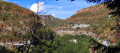
(6) Climb up this path, which quickly becomes a track veering to the right, crossing a scree slope and running alongside some beautiful sharp limestone pavements on your left. Continue for a further forty metres or so along the ledge to discover a new , unprotected viewpoint over the Loue valley and its cliffs.
(7) Retrace your steps back to the pasture.
(6) Head down to the left towards a large solitary fir tree and the village which you can see in the distance down the valley. Continue the descent along a path that you will then come across. It soon joins another path, which you follow down to the left. Behind a farm shed, you’ll reach a wider stony track.
(8) Turn right to enter the woods. You’ll soon come to a fork marked by a rather weathered signpost.
Turn left and walk a good hundred metres ; be careful to spot the path that veers sharply left into a fir forest (there’s a marker on a tree trunk on your right that won’t last long).
This leads you to a stony track which you follow to the right, with a final view of the Moine de la Vallée. Continue until the end of the stony section, where you’ll come to three forest tracks.
(9) Then head down to the far left to rejoin the starting path, turning left onto it to return to the car park (S/E).

 Visorando Member
 Easy

 Difficult

