Country:

 City:


Park at the Crêt Monniot car park.
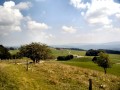
(S/E) Take the tarmac road leading up to Crêt Monniot. At the viewpoint, you can admire (weather permitting) the Alpine range and Mont Blanc.
(1) Head down towards the Ferme des Œillettes and you’ll come to a signpost. Turn slightly left and walk down through the pasture to reach a farm track and further signposts.
(2) Turn left and follow the track to a fence.
(3) Continue to the right, following the sign for “Le Haut Mont”. The downhill path winds through the woods until it reaches a junction with an uphill track.
(4) Cross this path and take the path opposite: a small sign indicates that this is a snowshoe trail. Head towards the Haut Mont farm and go round it on the right.
(5) Take a straight farm track on the left which runs along the edge of the woodland, then alternates between short wooded sections and pastures with numerous fences to cross.
(6) At this junction, keep to the right to stay on the same course and you’ll reach a clear-cut area of woodland on your left.
(7) At the corner of this, take the track on your left and begin the gentle climb up the Combe du Fournay.
(8) As you emerge from the forest, the path enters an area of pastures and copses, leading to a four-way junction.
(9) Take the path on the right. At the end of the pasture on the left, turn left: there isn’t really a path here, it’s more of a track made by farm machinery!
(10) Go through the gate leading into the pasture and follow the path , keeping a low profile in case there are any herds. Head into the woodland and you’ll come out onto the nature trail.
(11) Head to the right to follow it, then carry on straight ahead at the junction, following the direction of the sign pointing to the Crêt Monniot car park. Pass through the hamlet of Grange Nicod and reach the car park (S/E).
 Visorando Member
 Easy