


Refine your search for walks in Issendolus
Issendolus walks


 L’Hôpital-Beaulieu and the Ouysse Fossil Valley
 Visorando Member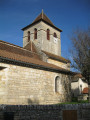
 5.64 mi
 +262 ft
 -233 ft
 2h 50
2h 50
 Easy
Easy
 Departure from Issendolus (Lot)
Starting from the square near the Issendolus chapel, this 9 km route takes you to the former convent at Hôpital-Beaulieu. You’ll follow shaded paths through the wide, dry valley of the Ouysse, which now disappears underground at Thémines.
This route follows minor roads and public footpaths.
Around Gramat Animal Park
 4.31 mi
+174 ft
-174 ft
2h 10
Easy
Departure from Gramat (Lot)
4.31 mi
+174 ft
-174 ft
2h 10
Easy
Departure from Gramat (Lot)
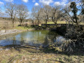
Flat route around Gramat Animal Park. The first part is on the Causse plateau in the meadows, with beautiful views of the villages and hills. From point (5), we go around the animal park where you can see a few animals.
The gariottes of Théminettes
 2.65 mi
+138 ft
-115 ft
1h 20
Easy
Departure from Théminettes (Lot)
2.65 mi
+138 ft
-115 ft
1h 20
Easy
Departure from Théminettes (Lot)
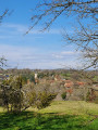
A short walk starting from the village of Théminettes in the heart of the Causses du Quercy Regional Nature Park. You will discover beautiful dry stone huts, imposing low walls, the famous Francès sinkhole (after an eventful underground journey, its waters reappear at Cabouy, near Rocamadour, before flowing into the Dordogne at Lacave) and the village of Théminettes.
The ruins of the Saut and Tournefeuille mills
 2.77 mi
+423 ft
-449 ft
1h 40
Easy
Departure from Gramat (Lot)
2.77 mi
+423 ft
-449 ft
1h 40
Easy
Departure from Gramat (Lot)
A lovely walk, very pleasant in summer, well sheltered by the Alzou valley. The ruins of the mills will delight children and adults alike.
Rocamadour via quiet paths
13.00 mi
+1,437 ft
-1,460 ft
7h 15
 Difficult
Departure from Rignac (Lot) (Lot)
Difficult
Departure from Rignac (Lot) (Lot)
This circuit allows you to discover Rocamadour as the pilgrims who came on foot did, the causse to the south of the citadel and the Alzou valley with its old mills.
Château des Anglais in Autoire
 1.57 mi
+528 ft
-531 ft
1h 10
Easy
Departure from Loubressac (Lot)
1.57 mi
+528 ft
-531 ft
1h 10
Easy
Departure from Loubressac (Lot)
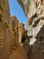
A family walk, fairly shaded, featuring a renovated ruined castle and magnificent views. Stone or metal steps in some places. An easy walk, but a little close to the cliff edge at times.
Moulin du Saut and Moulin de Tournefeuille mills
 4.83 mi
+587 ft
-587 ft
2h 45
4.83 mi
+587 ft
-587 ft
2h 45
 Moderate
Departure from Rocamadour (Lot)
Moderate
Departure from Rocamadour (Lot)
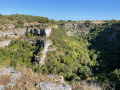
Beautiful course, above and in the Alzou valley, visiting two mills: the Moulin du Saut (fortified mill of the 12th century) and the Moulin de Tournefeuille.
Sheep trail in Espédaillac
 2.47 mi
+200 ft
-203 ft
1h 20
Easy
Departure from Espédaillac (Lot)
2.47 mi
+200 ft
-203 ft
1h 20
Easy
Departure from Espédaillac (Lot)
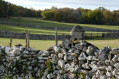
This route invites you to discover sheep and their environment. At each stage, it reveals how sheep farming has shaped the landscapes of the Causse.
Discovery trail exploring the small heritage sites of Espédaillac and the trees of the Causse.
 4.98 mi
+269 ft
-279 ft
2h 30
Easy
Departure from Espédaillac (Lot)
4.98 mi
+269 ft
-279 ft
2h 30
Easy
Departure from Espédaillac (Lot)
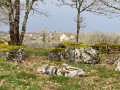
This route introduces you to around twenty trees, shrubs and bushes, as well as some examples of vernacular heritage, commonly referred to as "small heritage", found on the Causse.
During your walk, you can enrich your knowledge by scanning the QR code on each sign to access a detailed information sheet.
Approximately 8 km long, it complements the 2.5 km route (tree discovery) that already exists on Visorando, which starts at the same point.
Route to discover the trees, shrubs and small trees of Espédaillac
 1.55 mi
+49 ft
-66 ft
0h 45
Easy
Departure from Espédaillac (Lot)
1.55 mi
+49 ft
-66 ft
0h 45
Easy
Departure from Espédaillac (Lot)
This route introduces you to around twenty trees, shrubs and small trees found on the Causse.
At the foot of each one, you’ll find a sign indicating the tree’s name.
You’ll also find a QR code which you can scan using your smartphone.
See the ‘Practical Information’ section.
Route of the Espédaillac farmhouses
 6.49 mi
+276 ft
-259 ft
3h 15
Moderate
Departure from Espédaillac (Lot)
6.49 mi
+276 ft
-259 ft
3h 15
Moderate
Departure from Espédaillac (Lot)
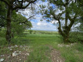
This route takes you on a tour of various farmhouses around the village of Espédaillac, along beautiful paths lined with dry stone walls. This circular route is marked with small signs depicting a hiker in a yellow arrow.
The Bois des Jonquilles in Alvignac
 Association / Club / Walk leader
 6.11 mi
+794 ft
-787 ft
3h 30
Easy
Departure from Alvignac (Lot)
6.11 mi
+794 ft
-787 ft
3h 30
Easy
Departure from Alvignac (Lot)
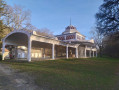
This route takes you to the Salmière spring, the site of Fort de Cantal and an astonishing fortified caselle.
The name of the village of Alvignac comes from the name of a man named Alvinius, who lived in Gallo-Roman times, to which the possessive suffix "acum" was added.
Route of the Fountains and Washhouses in Alvignac
 4.08 mi
+568 ft
-564 ft
2h 20
Moderate
Departure from Alvignac (Lot)
4.08 mi
+568 ft
-564 ft
2h 20
Moderate
Departure from Alvignac (Lot)
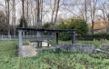
A very lovely route, offering the chance to discover the fountains and washhouses around Alvignac. The first part of the route follows a small road, and the second part takes you along paths and through woodland.
Circular walk between Autoire and Castelnau-Bretenoux Castle
 11.96 mi
+1,673 ft
-1,703 ft
6h 55
Difficult
Departure from Autoire (Lot)
11.96 mi
+1,673 ft
-1,703 ft
6h 55
Difficult
Departure from Autoire (Lot)
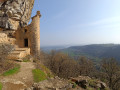
A rewarding walk offering the chance to discover three remarkable villages: Autoire, Loubressac and the castle village of Castelnau-Bretenoux. The Autoire waterfall is another must-see attraction. The detour via the Château des Anglais is also well worth the trip. There is a great variety of landscapes, ranging from the limestone plateau and its cliffs to the steep-sided Autoire valley, via the broad Bave plain – landscapes dotted with manor houses and traditional architecture of great interest.
On the limestone plateau at the start of Grèzes
13.13 mi
+1,053 ft
-1,043 ft
6h 55
Difficult
Departure from Grèzes (Lot) (Lot)
This hike, which is not particularly difficult, takes walkers from the village of Grèzes to the cliffs overlooking the River Célé at Espagnac-Sainte-Eulalie. It then heads north to the Bélinac menhir (one of the few menhirs in the department) before returning to the village of Livernon and then Grèzes.
It mostly follows wide limestone paths, lined with moss-covered walls and shaded by oak trees.
The Gouffre de Padirac and its surroundings
 11.15 mi
+1,624 ft
-1,647 ft
6h 35
Moderate
Departure from Padirac (Lot)
11.15 mi
+1,624 ft
-1,647 ft
6h 35
Moderate
Departure from Padirac (Lot)
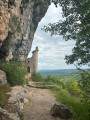
This day hike allows you to discover the Gouffre de Padirac and the listed villages of Loubressac and Autoire. From the promontory, you can enjoy a splendid view of the valley.
Double circular loop starting from Rocamadour station
 4.86 mi
+200 ft
-213 ft
2h 25
Easy
Departure from Rocamadour (Lot)
4.86 mi
+200 ft
-213 ft
2h 25
Easy
Departure from Rocamadour (Lot)
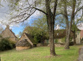
A very pleasant walk starting from Rocamadour station, including a visit to the village of Blanat; the route is flat and suitable for children, with half of the route in the shade.
The Cirque de l'Autoire via the waterfall
 6.03 mi
+1,368 ft
-1,365 ft
4h 00
Moderate
Departure from Loubressac (Lot)
6.03 mi
+1,368 ft
-1,365 ft
4h 00
Moderate
Departure from Loubressac (Lot)
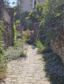
A nature trail to admire the remarkable Autoire cirque and its waterfall, not to mention the unique Château des Anglais nestled in the cliff.
Rocamadour, the sacred city of the Lot, which hides many wonders
 2.57 mi
+719 ft
-702 ft
1h 50
Difficult
Departure from Rocamadour (Lot)
2.57 mi
+719 ft
-702 ft
1h 50
Difficult
Departure from Rocamadour (Lot)
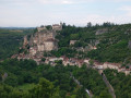
As well as its breathtaking beauty, Rocamadour is a tiny village, yet one that harbours a unique architectural and spiritual heritage. The steep, cobbled streets transport you to another era, right at the heart of history. With 216 steps and 1,000 years of history, this village in the Lot conceals millennia-old treasures on the cliffside.
Perched above the Gorges de l'Alzou, Rocamadour is undoubtedly one of the most beautiful villages in France.
Snail trails starting from Rocamadour
11.97 mi
+1,175 ft
-1,175 ft
6h 30
Moderate
Departure from Rocamadour (Lot)
The magnificent Vallée des Moulins. A 19 km route presenting no major difficulties. Spectacular landscapes, natural curiosities and, everywhere amidst the arid, barren countryside, evidence of man’s struggle to survive there.GPS essential
The Pilgrim 2
 4.92 mi
+787 ft
-787 ft
2h 55
Moderate
Departure from Rocamadour (Lot)
4.92 mi
+787 ft
-787 ft
2h 55
Moderate
Departure from Rocamadour (Lot)
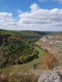
Offering a magnificent overview of the landscapes of the Causses du Quercy Regional Natural Park around Rocamadour, this hike takes you into a breathtaking site at the heart of a thousand-year-old pilgrimage dedicated to the Virgin Mary, a major Christian site since the Middle Ages and classified as a Grand Site d'Exception in the Midi-Pyrénées region.
This hike partly follows the previously published hike 1: see link in Practical Information. It is slightly shorter and has a lower elevation gain.
The pilgrim
 6.72 mi
+1,178 ft
-1,191 ft
4h 05
Moderate
Departure from Rocamadour (Lot)
6.72 mi
+1,178 ft
-1,191 ft
4h 05
Moderate
Departure from Rocamadour (Lot)
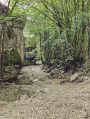
With a magnificent overview of the landscapes of the Causses du Quercy Regional Nature Park around Rocamadour, this hike takes you into a breathtaking site at the heart of a thousand-year-old pilgrimage dedicated to the Virgin Mary, a major Christian site since the Middle Ages and classified as a Grand Site d'Exception in the Midi-Pyrénées region.
The three châteaux in Saint-Céré
 5.66 mi
+738 ft
-715 ft
3h 15
Moderate
Departure from Saint-Céré (Lot)
5.66 mi
+738 ft
-715 ft
3h 15
Moderate
Departure from Saint-Céré (Lot)
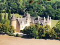
This walk takes you to the Plateau des Césarine, which overlooks the Bave valley. Here you can admire Saint-Céré and its three châteaux: Les Tours de Saint-Laurent, Castelnau-Bretenoux and Montal. You’ll walk between the limestone Causse and the Ségala, a land of chestnut trees.
Under the suns of Lurçat
 3.86 mi
+719 ft
-715 ft
2h 25
Easy
Departure from Saint-Céré (Lot)
3.86 mi
+719 ft
-715 ft
2h 25
Easy
Departure from Saint-Céré (Lot)
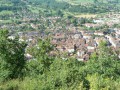
This path will take you up to the heights to the ancient castrum of a certain Sérénus, lord of the area who gave his name to the town that developed at his feet: Saint-Céré.
Around the village of Fons
 5.47 mi
+728 ft
-725 ft
3h 10
Easy
Departure from Fons (Lot) (Lot)
5.47 mi
+728 ft
-725 ft
3h 10
Easy
Departure from Fons (Lot) (Lot)
This short route will introduce you to the historic village of Fons, its monuments (castle and monastery) and allow you to admire the scenery along ridge paths for more than half the route. You’ll catch a glimpse of the towers of Cardaillac and look down over the village of Fourmagnac. The route follows small roads and public footpaths.
Cavarrot and Monteil mills from Boussac
 5.06 mi
+653 ft
-643 ft
2h 55
Easy
Departure from Boussac (Lot) (Lot)
5.06 mi
+653 ft
-643 ft
2h 55
Easy
Departure from Boussac (Lot) (Lot)
A route that will allow you to discover the landscapes of the Gorges du Célé, the small shaded paths on the Causse and the meadows along the river. It follows small roads and public paths that are often inaccessible to motor vehicles.
The Cirque de Floirac along the Dordogne river
 8.39 mi
+807 ft
-787 ft
4h 35
Moderate
Departure from Montvalent (Lot)
8.39 mi
+807 ft
-787 ft
4h 35
Moderate
Departure from Montvalent (Lot)
Between cliffs and river, undergrowth and rocks, a beautiful walk awaits. The Floirac cirque, the banks of the Dordogne, the cliffs of Gluges and the village of Floirac.
Around Montvalent
4.93 mi
+633 ft
-630 ft
2h 50
Easy
Departure from Montvalent (Lot)
A short walk in the vicinity of Montvalent, mostly through woodland until you reach the plateau, before returning to the village. The resurgence at the start of the route and the view from the heights of Montvalent before you arrive are the two main points of interest on this route. No significant difficulty or private roads.