Around the village of Fons

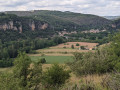
This short route will introduce you to the historic village of Fons, its monuments (castle and monastery) and allow you to admire the scenery along ridge paths for more than half the route. You’ll catch a glimpse of the towers of Cardaillac and look down over the village of Fourmagnac. The route follows small roads and public footpaths.

Details

68422742
Creation:
Last update:
Last review:
  • Walking
    Activity: Walking
  • ↔
    Distance: 5.47 mi
  • ◔
    Average duration: 3h 10 
  • ▲
    Difficulty: Easy

  • ⚐
    Back to start: Yes
  • ↗
    Ascent: + 728 ft
  • ↘
    Descent: - 725 ft

  • ▲
    Highest point: 1,214 ft
  • ▼
    Lowest point: 712 ft

Photos

Description of the walk

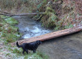
The starting point is in the car park by the stream at the Fons Village Hall on the RD148.

(S/E) Cross the Fons stream (La Dournelle), then turn right onto the D148. Continue for about three hundred metres, until you reach a cross on the left-hand side of the road.

(1) Turn left onto the path that climbs up to the Route de Belle Combe. Follow this small road straight on and cross the main Gramat–Figeac road (D840) with care. Continue along the road towards Le Pech for about a hundred metres.

(2) Turn right onto the ridge path, which will take you, after 1.4 km, to the hamlet of Pont d’Aubard.

(3) Cross the D840 again with care, take the small road opposite towards Plaisance and cross the Ruisseau de Fons. After the hairpin bend, leave the Chemin de la Bénêche on your left and continue uphill for a further 200 m. Follow the small road (Chemin de Plaisance) to the left until you reach the Route du Mas d’Assin.

(4) Cross this road and continue along the path opposite. At the Fork in the road about twenty metres further on, turn right, then ignore the private road to Fontanille and carry on until you see the houses in the hamlet known as La Remise.

(5) Before you reach them, take the path on the right and follow the yellow markings for 2.5 km. At the T-junction, turn left, pass the turn-off for the hamlet of Sabin and carry on for about fifty metres.

(6) Turn slightly left onto the Route de Reyrevignes and carry on straight ahead to the hamlet of Latille, where you should leave the road leading to Poujols on your left.

(7) Immediately afterwards, leave the yellow signposting and turn right onto a small dirt track that descends towards Château du Roc.

(8) Head down the D21 and, after 400 metres, turn left onto the small road leading to Fons church.

(9) Go down the steps on the right towards the village, then turn left to walk alongside the primary school. Continue downhill towards the former monastery, which now houses the Roitelets Medical and Educational Institute.

(10) At the corner of the monastery, turn right onto the street leading down to Fons market hall near the stream.

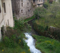
(11) Turn right, walk alongside the stream, passing the Maison des Consuls. Turn left to cross the stream, then follow the D148 to the right until you reach the car park at the start of the walk (S/E).


Waypoints

  1. S/E : mi 0 - alt. 791 ft - Car park at the Jean Roussies village hall in Fons
  2. 1 : mi 0.19 - alt. 787 ft - Croix on the D148
  3. 2 : mi 0.96 - alt. 1,040 ft - On the ridge after the D840
  4. 3 : mi 1.84 - alt. 719 ft - Cross the D840 at the Pont d’Aubard
  5. 4 : mi 2.51 - alt. 955 ft - Route du Mas d’Assin
  6. 5 : mi 3.05 - alt. 1,093 ft - View of La Remise
  7. 6 : mi 4.1 - alt. 1,171 ft - Route de Reyrevignes
  8. 7 : mi 4.57 - alt. 1,191 ft - Latille, turn right
  9. 8 : mi 4.89 - alt. 968 ft - Château du Roc
  10. 9 : mi 5.14 - alt. 922 ft - Fons Church
  11. 10 : mi 5.26 - alt. 827 ft - Corner of the former monastery
  12. 11 : mi 5.31 - alt. 801 ft - Fons market hall and stream
  13. S/E : mi 5.47 - alt. 791 ft - Car park at the Fons village hall

Notes

You can take shelter under the Fons market hall (11).
You’ll find a drinking water tap in the Fons cemetery, next to the church (9).

Worth a visit

Between (1) and (2), as you climb the hillside, there is a view over the Ruisseau de la Dournelle valley and the Château du Roc on the opposite slope.
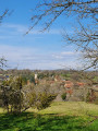
Between (2) and (3), on the ridge path, there is a view of the village of Fourmagnac and, in the distance, Cardaillac and its medieval towers.
Between (3) and (4), a beautiful old house in the hamlet of Plaisance.
Between (5) and (6) on the ridge path, a view of the hamlet of Gibardelle.
At this point, a restored wash house.
At point (8), a view of the Château du Roc (1572), listed as a Historic Monument, with its small ponds and the tall cedars and poplars in its grounds, as well as its dovecote.
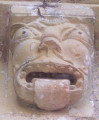
At point (9), the Romanesque church of Fons (12th and 15th centuries), listed as a Historic Monument, with its numerous figures carved on the corbel blocks of its roof cornice.
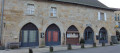
At the location (10), a former monastery, on the site of a 10th-century priory. Today, the Medical and Educational Institute (IME) is housed in this large building of cut stone.
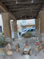
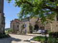
At point (11), the market hall, its old stone grain measure and the consuls’ house (13th century, restored after the Hundred Years’ War). An information panel on the building.
A short route marked by oak leaves, the ‘chemin de ronde’, will take you on a tour of the village.
As you walk along the main street (11), beside the stream, you can see old photographs showing Fons around 1900.

Reviews and comments

4.7 / 5
Based on 2 reviews

Reliability of the description
5 / 5
Ease of following the route
5 / 5
Route interest
4 / 5
stevenson12
stevenson12

Overall rating : 4.7 / 5

Date of your route : Oct 21, 2025
Reliability of the description : ★★★★★ Very good
Ease of following the route : ★★★★★ Very good
Route interest : ★★★★☆ Good
Very busy route : No

Superb walk

Machine-translated

Thierry46
Thierry46

Thank you, Annie, for your feedback – I’m really pleased to hear it!
I’ve just posted a new walk in Boussac on Visorando, which you can try out when the weather’s a bit sunnier.
Kind regards,
Thierry

Machine-translated

annie teilhard
annie teilhard

Overall rating : 4.7 / 5

Date of your route : Jan 26, 2025
Reliability of the description : ★★★★★ Very good
Ease of following the route : ★★★★★ Very good
Route interest : ★★★★☆ Good
Very busy route : No

The trail was exactly as described. Thank you to Thierry for sharing this very enjoyable walk with us.

Machine-translated

Other walks in the area

For more walks, use our search engine .

The GPS track and description are the property of this route's author. Please do not copy them without permission.