Country:

 City:
City:


The starting point is on the village square in Issendolus, in front of the town hall by the hiking information board. You can park on the square or in the car park signposted 50 metres further down.
(S/E) Walk downhill, keeping the war memorial on your left, and follow the red and white markings of the GR®6 for about 200 m. When you reach the Croix de Trémoulet, leave theGR® route, continue straight on for 130 m and pass the signs marking the village exit.
(1) Take the first street on the right, which climbs slightly towards the Mas d’Atgié farm.
(2) In the hamlet, turn left towards a large farm building; once you reach it, leave the road and follow a grassy track for 500 m, which descends to the left and then climbs back up towards the D840.
(3) Cross the D840 road linking Gramat to Figeac with care. A cattle underpass near the car park allows you to cross more safely. Continue opposite the previous track along the small road leading to the hamlet of Le Breil. Keep turning right to reach the large convent (900 m along the road).
(4) Visit the grand convent, follow its northern and eastern walls, then head south. Walk along the large Hôpital-Beaulieu square and rejoin the D840. You are now on a signposted section of the GR®6, which you should follow. At the bus shelter (elevation 336), walk alongside the D840 for 120 m (watch out for vehicles on this stretch of main road).
(5) Opposite the former Teulières campsite, turn left onto a small, shaded path. Follow the red and white markings and pass through the hamlets of Vernique and Soulestrein. Cross the Morou stream via a small bridge rebuilt in 2024. The road climbs with a hairpin bend at a place called Lestrade.
(6) When you reach the first houses, leave the GR®6 by turning right. The road becomes a track that will take you back to the D840.
(7) Cross the D840, taking care as always, and take the stony track that climbs up to the left for 160 m.
(8) At the junction by the Dolmen de la Pierre Levée (elevation 334), take the track on the right and follow the yellow markings, which will lead you to the bottom of the dry Morou valley. Continue along the lowest part of the valley on a shaded track that will take you up to the Croix du Levat.
(9) At the cross, turn left onto the small road which will take you to Place de Buzat. Leave the road on the right and walk up this grassy square towards a small barn that has been beautifully restored by the local council. Just below the barn, take a narrow street and follow it for 100 metres to the D20, at the junction with the Issendolus stadium and cemetery. Cross the D20 with care and, following a grassy path, head uphill, turning right at the 342-metre mark, until you reach the beautiful Suquet cross, adorned with a large carved heart at the centre of a quatrefoil design.
(10) At the Suquet cross, take the small road on the left and, at the first junction, turn right. After the last houses, the road becomes a track. At the first fork, take the left-hand fork to descend steeply to the bottom of the dry Morou valley.
(11) At the very bottom, head right and stay on the track at the bottom of the large dry valley. Leave the Bargade hollow on your left. At this point, the seasonal stream has exposed the pebbles. Continue to a crossroads where there is a wooden signpost and yellow markings.
(12) Turn right onto the yellow-marked path, which, after 200 metres, will take you to a four-way junction with a small iron cross adorned with a heart on a slope, at elevation 314. Turn right onto the path which, continuing straight on for 700 metres, will lead you uphill to the hamlet of Mondou and the village road.
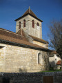
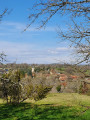
(13) At the Mondou cross, turn right (viewpoint over the village) and head down the road to the church, then return to your starting point (S/E).


 Visorando Member


 Difficult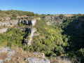
 Moderate