Country:

 City:
City:


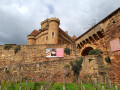
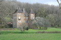
Park in the car park at the south-western exit of Autoire (Saint-Roch car park or Autoire Waterfall car park).
(S/E) From the far end of the car park, take the path signposted “Waterfall of Autoire”, which starts just to the right of the Saint-Roch Chapel. Keep to the right and head towards the Ruisseau de Goutal until you reach the footbridge.
(1) Without crossing it, stay on the right bank (upstream) and continue to the foot of the impressive Autoire waterfall.
(2) Walk back about a hundred metres to the footbridge.
(1) Cross the footbridge and continue on the left bank downstream. About 200 metres further on, you’ll come to the GR®652. Take this path on the left to climb up the hillside. After a left-hand bend, the path becomes rockier and steeper and reaches a fork at the foot of the cliff.
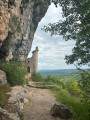
(3) Turn right towards the Château des Anglais.
(4) Turn back to return to the previous fork.
(3) Carry on straight ahead and follow the GR® path along the base of the cliff. The climb up to the plateau ends with two fine flights of metal steps.
Yellow PR® markings
(5) At the top of the cliff, leave the GR®, which heads off to the left, and take the PR® to the right; it follows the edge of the cliff. Some sections can be quite daunting: take care, as the cliff is steep!
Continue for just over a kilometre; the path heads north, then reaches a T-junction.
(6) Take the correct path on the left at a right angle. (To the right, the yellow markings head straight back down to Autoire.) Keep going in the same direction until you reach a bend in the road (GR®). Follow it to the left for about a hundred metres until you reach the start of a path.
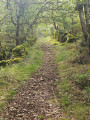
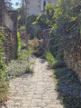
(7) Turn left (yellow signposting) to follow this very pleasant, shaded path which winds gently. About 500 m after leaving the road, you’ll reach the first houses; continue left at the path junction. You’ll come toa small tarmac road.
(8) Turn right onto this road. Pass the first street on the left, then take the second street on the left. At the junction with the main road, take the street on the left until you reach the car park, which has toilets and benches.
Unmarked
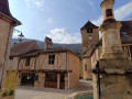
(9) The village can be explored quickly. Retrace your steps towards the war memorial, the castle and the church, then take the path that descends quite steeply to the right of the church; it leads to the steps heading down to the D118. Cross the road carefully and continue straight ahead. You’ll come out onto another road; follow it to the left. You’ll reach a junction opposite the Église Basse; opposite this, you’ll notice a large cross set on a diabolo-shaped plinth.
Yellow PR® markings, but these are old and infrequent.
(10) Take the path on the left heading north. Stay on the main path, which turns right at the entrance to the forest. Towards the end of the descent, the path first turns left then right, running alongside and then entering the pastures. You’ll reach a very good track at a place called Le Bayle.
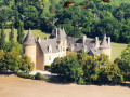
(11) Turn left onto this track and follow it, high above the D30. Pass in front of Gamot Castle; after crossing a valley, head uphill to reach the D14. Follow it for a few dozen metres before crossing it carefully and taking a path on the right. At the bottom of the descent, rejoin the D14, then turn left onto the D30. Follow it to the left as far as the Pont de Maday.
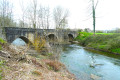
(12) Cross the River Bave over the three arches of this old bridge. About 150 metres further on, turn right onto a good path. Cross a small road, then, less than 100 metres on, you’ll come to a road on the left near the goose enclosure, where the geese are whistling and cackling aggressively, accompanied by large, caged dogs barking menacingly!
(13) Turn left quickly so as not to further agitate these birds and dogs. Cross a road and, almost directly opposite, take a path leading uphill between two low walls (the one on the right is topped by a wooden fence). Pass two large sheds on the left. The path becomes increasingly rough and reaches a fork. Turn left onto the narrow, sunken track and you’ll reach the D43.
(14) Walk along it on the right. After the road bends to the right, with Castelnau-Bretenoux Castle in view, carefully cross the D43 and turn left off it to go behind the car park. Continue uphill to the castle esplanade.
(15) Walk down the other side, passing under the porch, then turn right in front of the church (Collégiale Saint-Louis). At a bend, you’ll reach a crossroads.
GR®652 signposting
(16) Turn right onto the D43, then left after 50 metres. After a short detour towards the beautiful fountain and the Boscau pond on the right, take the first left after the Boscau manor house. At a right-hand bend, ignore the path on the left and, a few dozen metres further on, turn left towards Malbec. You’ll reach a crossroads at Colombou.
(17) Head right along the tarmac road (with two rows of vines on the right), and cross the D19 with care. After Pavanote, the road becomes a good stony track. Continue across the plain until you reach a T-junction with a road. Turn left and continue for 50 metres.
(18) Continue along a wide track until you reach the banks of the Bave. A little further on, you’ll come to a junction near a bridge. Cross the bridge over the Bave and continue along this tarmac road until you reach the D30.
(19) Cross itcarefully, then take a well-maintained stony track opposite. After about 500 m, you’ll reach the right bank of the Ruisseau d’Autoire and follow it. The path alternates between gravel and tarmac, and crosses several small bridges on the way to the D38, but you must always stay on the left bank. After a right-hand bend, you’ll reach a junction with the D135.
(20) Turn left onto the D135 and reach Autoire via the Pont de Taillefer. Leave the D135 via the lane on the right, then take the Passage des Gauzinies, and head towards the Fontaine aux Dauphins, then the D38.
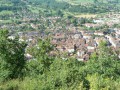
(21) Explore the town at your leisure, then return to the D38, follow it southwards and head for the Chapelle Saint-Roch car park (S/E).

 Visorando Member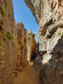
 Easy
Easy 
 Moderate
  Association / Club / Walk leader