


Refine your search for walks in Hamoir
Hamoir walks


 Walk in Filot
 Visorando Member
 9.21 mi
 +850 ft
 -869 ft
 5h 00
5h 00
 Moderate
 Departure from Hamoir (Province de Liège)
This walk takes you through the countryside and forests on either side of the Tige de Xhoris to discover, on the north side, the undulating landscape of the Ourthe valley and, on the south side, once you leave the woods, that of the Lembrée valley.
A section of the GR®57 from Hamoir to Palogne via Sy
 6.99 mi
+1,171 ft
-1,165 ft
4h 15
Moderate
Departure from Hamoir (Province de Liège)
6.99 mi
+1,171 ft
-1,165 ft
4h 15
Moderate
Departure from Hamoir (Province de Liège)
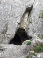
Come and discover the Vignobles cave and its climbing rock, the Sy chapel and the viewpoints from the rocks. Pass by the cross of the priest of Xhignesse, the shepherd's cross and the Saint-Donat chapel.
Circular countryside loop starting from Xhoris
 9.65 mi
+906 ft
-879 ft
5h 15
Moderate
Departure from Hamoir (Province de Liège)
9.65 mi
+906 ft
-879 ft
5h 15
Moderate
Departure from Hamoir (Province de Liège)
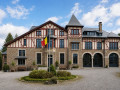
This beautiful and pleasant circular route between Xhoris and Filot, on the border between the Liège Condroz, the Calestienne, the Famenne and the Ardennes, is mainly rural and offers panoramic views of the northern slopes of the Ourthe. The two villages you pass through feature some pretty stone buildings, but the architectural highlight of the day is the Château d’Insegotte.
Circular at Logne Castle
 11.41 mi
+991 ft
-968 ft
6h 05
Moderate
Departure from Ferrières (Belgique) (Province de Liège)
11.41 mi
+991 ft
-968 ft
6h 05
Moderate
Departure from Ferrières (Belgique) (Province de Liège)
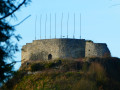
This fairly long circular loop starting from the Palogne estate (large car park) begins by following the course of the Ourthe for a few kilometres before entering a forest and then countryside setting with numerous panoramic views of the plateau overlooking the Ourthe and its tributaries. On the Ourthe: egrets, ducks, cormorants and herons await you.You will see the rocks and the "beach" of Sy, where you can read an information panel about the aborted Meuse-Moselle canal project. Further on, you will pass close to Lassus Castle, which can be glimpsed between the tall trees in its grounds. In Vieuxville, it is probably the resurgence of the Lembrée that will catch your eye, before you see the limestone grasslands further on and finally the fortified castle of Logne. With a bit of luck (in season), you can even visit (for a fee) the ruins of this fortified castle built on top of a rocky outcrop.
Ferrières and the tour of the Ruisseau de la Souris
3.70 mi
+387 ft
-387 ft
2h 00
Moderate
Departure from Ferrières (Belgique) (Province de Liège)
A peaceful stroll with magnificent views of the forests. It ends on a welcoming terrace. The walk starts in the village. Halfway along, you reach the highest point. Here, the walk takes you along a quiet road. Then you descend towards the village through a small wood, passing an enclosure occupied by long-haired pigs!
Forest walk between Saint-Roch and Sainte-Anne
 9.42 mi
+1,004 ft
-997 ft
5h 10
Moderate
Departure from Ferrières (Belgique) (Province de Liège)
9.42 mi
+1,004 ft
-997 ft
5h 10
Moderate
Departure from Ferrières (Belgique) (Province de Liège)
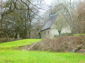
Mainly through woodland, as its name suggests, this circular walk takes you on a journey of discovery through the Pouhon valley, starting from the car park and barbecue area near the Saint-Roch secondary school, which is well known throughout the region.Shortly after crossing the Pouhon near the hamlet of La Levée, the route passes by the Sainte-Anne Chapel and a second barbecue area where you’ll find everything you need for a picnic break or shelter if it rains.At the five-kilometre mark, after the riding centre, don’t hesitate to enter the grounds of the Misery Brewery and head to the right of the manor house, as the public footpath starts right next to it, between the building and the Paradis stream.Towards the end of the route, you’ll come across Saint-Roch Chapel between two stretches of countryside.The return to the starting point follows a section of the old country lane that once linked Comblain-la-Tour to Hotton via Ferrières and Manhay.
Between Ourthe and Condroz
 10.06 mi
+1,227 ft
-1,224 ft
5h 40
Moderate
Departure from Anthisnes (Province de Liège)
10.06 mi
+1,227 ft
-1,224 ft
5h 40
Moderate
Departure from Anthisnes (Province de Liège)
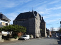
Venture into enchanting forests, walk alongside meadows and fields of wheat, flax and rye, take in superb landscapes, and pass through villages whose architectural character remains intact. As you wander along the paths and trails, discover farmhouses bearing coats of arms and humble dwellings to which sandstone or limestone lends its nobility and value; immersing yourself in the heart of the Condroz means discovering the sources of the elements: earth, stone and water.
Amblève and Salm: two valleys of legends
 58.07 mi
+9,199 ft
-8,009 ft
5 days
58.07 mi
+9,199 ft
-8,009 ft
5 days
 Difficult
Departure from Comblain-au-Pont (Province de Liège)
Difficult
Departure from Comblain-au-Pont (Province de Liège)
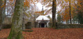
From mischievous nutons in the Ardennes forests to Satan, who in a fit of rage created the Fonds de Quarreux, to macralles bewitching hikers in the woods around Vielsalm, many legends haunt the Amblève and Salm valleys.
Comblain-au-Pont - Remouchamps
 12.17 mi
+1,677 ft
-1,585 ft
7h 05
Difficult
Departure from Comblain-au-Pont (Province de Liège)
12.17 mi
+1,677 ft
-1,585 ft
7h 05
Difficult
Departure from Comblain-au-Pont (Province de Liège)
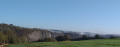
This stage ofthe GRP®571starts at Pont-de-Sçay near the confluence of the Ourthe and Amblève rivers, climbs up the Amblève slope, crosses Oneux and Chambralles, rejoins the valley and crosses the river at Martinrive. It continues on the other bank of the Amblève, passing through Aywaille, Heid des Gattes and Remouchamps.
The Ourthe Valley from Rivage to Hamoir
9.28 mi
+1,106 ft
-1,060 ft
5h 15
Moderate
Departure from Comblain-au-Pont (Province de Liège)
This hike will take you from Rivage station to Hamoir station via the villages of Pont-de-Sçay, Comblain-au-Pont and Comblain-Fairon. Along the way, you will pass through vast agricultural and forest areas, discover the Ourthe valley at times, and pass close to the Abîme cave and an imposing square farm, typical of the Condroz region.
From Bomal-sur-Ourthe Castle to the ruins of Logne Castle
 10.47 mi
+1,526 ft
-1,529 ft
6h 10
Moderate
Departure from Durbuy (Province de Luxembourg)
10.47 mi
+1,526 ft
-1,529 ft
6h 10
Moderate
Departure from Durbuy (Province de Luxembourg)
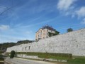
At the intersection of the Condroz, Ardennes and Famenne regions, walk through limestone grasslands, forests and country lanes to reach Logne Castle and back.
The bridges over the Aisne (5) and the Lembrée, after the (13), have temporarily disappeared. If you start this hike, please bear in mind that you may have to wade across the river (5) as there is no other alternative.
The Néblon valley as seen from Himbe Castle
 12.51 mi
+991 ft
-988 ft
6h 35
Difficult
Departure from Ouffet (Province de Liège)
12.51 mi
+991 ft
-988 ft
6h 35
Difficult
Departure from Ouffet (Province de Liège)
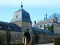
Set in the heart of the countryside, the hamlet of Himbe (and its castle) is a ‘pure nature’ spot, ideal for setting off on a lovely walk.This long walk presents no particular difficulties apart from a few rather muddy sections along the Néblon.Beavers are clearly present along the banks of the Néblon between kilometres 5 and 6.Shortly afterwards, the walk follows the Néblon leat (there is an old mill further on in Hamoir, off the route).The steepest climb of the walk takes you to the hamlet of Hermanne and its old water tower, converted into a residence and beacon overlooking the magnificent buildings.A stone’s throw further on, the walk passes through the village of Jenneret and its splendid buildings, not least the church and the castle-farm.
Along the Amblève and Oneux from Fraiture
 11.44 mi
+1,414 ft
-1,411 ft
6h 30
Difficult
Departure from Sprimont (Province de Liège)
11.44 mi
+1,414 ft
-1,411 ft
6h 30
Difficult
Departure from Sprimont (Province de Liège)
You will descend towards the Amblève, which you will follow along the left bank.
You will climb back up towards Oneux, where you will have a beautiful view of the Amblève valley.
After a circular route, you’ll return to Oneux to head down what the locals call ‘les tartines’.
A few metres after the start of the descent, straight ahead, you will see a lovely viewpoint overlooking Comblain-aux-Ponts and the Ourthe valley.
Circular route to Xhoris from Harzé
 4.73 mi
+656 ft
-640 ft
2h 45
4.73 mi
+656 ft
-640 ft
2h 45
 Easy
Departure from Aywaille (Province de Liège)
Easy
Departure from Aywaille (Province de Liège)
This route takes you through alternating woods and hedgerows with occasional unobstructed views of the countryside. The forests are generally not very overgrown. If you remain quiet, you may see game.
Around Hody via Limont and Tavier
 8.69 mi
+564 ft
-568 ft
4h 30
Moderate
Departure from Anthisnes (Province de Liège)
8.69 mi
+564 ft
-568 ft
4h 30
Moderate
Departure from Anthisnes (Province de Liège)
A pleasant, easy walk through woods and countryside in the Liège Ardennes.
Walk at Burnontige
 8.72 mi
+1,063 ft
-1,089 ft
4h 55
Moderate
Departure from Ferrières (Belgique) (Province de Liège)
8.72 mi
+1,063 ft
-1,089 ft
4h 55
Moderate
Departure from Ferrières (Belgique) (Province de Liège)
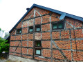
Starting from the old tram stop at Burnontige, this circular walk winds its way through the countryside, exploring the woodland and open countryside between the starting point and the village of Ferrières.The first two kilometres descend through the forest to the hamlet of Le Trou, from where the route climbs again to explore the Picherotte Nature Reserve (with a few information boards).This is followed by a series of beautiful stretches alternating between countryside and woodland, leading to the lower reaches of Ferrières village, where a path first climbs a hill before descending to the level of the old local road.On the return journey, the route does not follow the forest section of the old local road, but runs alongside it for a good while on a parallel path, gradually gaining height before emerging onto a wide, open stretch of countryside.
Burnontige and Les Arsins
 9.29 mi
+1,050 ft
-1,076 ft
5h 10
Moderate
Departure from Ferrières (Belgique) (Province de Liège)
9.29 mi
+1,050 ft
-1,076 ft
5h 10
Moderate
Departure from Ferrières (Belgique) (Province de Liège)
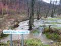
This long circular walk, centred on the theme of the old local road, winds through the woods and countryside around Burnontige. In winter,the paths are waterlogged; others are very slippery where a thin layer of ice remains, and streams swollen with rushing water overflow onto the paths and tracks in many places. The thaw can be sudden.
 From Pouhon to Quarreux
14.84 mi
+2,254 ft
-2,247 ft
4 hrs
Difficult
Departure from Aywaille (Province de Liège)
There are steep gradients and magnificent scenery. This route, designed for horse riding, starts and finishes at the La Parada riding centre in Harzé. It includes only a few short sections of tarmac on country lanes with very little traffic.
From Ernonheid to La Rouge-Minière via Le Paradis
 10.81 mi
+1,201 ft
-1,211 ft
6h 00
Moderate
Departure from Aywaille (Province de Liège)
10.81 mi
+1,201 ft
-1,211 ft
6h 00
Moderate
Departure from Aywaille (Province de Liège)
Starting from the old school in Ernonheid (Al Vîle Sicole), the hike explores forests (mainly) and countryside between the villages of Ernonheid and La Rouge-Minière, passing not only near the hamlet of Paradis, but also Sainte-Anne Chapel, Brasserie Misery and Grimonster Castle.
A circular starting from Tohogne
 8.61 mi
+699 ft
-712 ft
4h 35
Moderate
Departure from Durbuy (Province de Luxembourg)
8.61 mi
+699 ft
-712 ft
4h 35
Moderate
Departure from Durbuy (Province de Luxembourg)
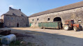
A varied hike, between quiet asphalt roads, paths, countryside, villages and crossing Durbuy. Lovely views.
The Grand Trixhe loop
7.05 mi
+367 ft
-364 ft
3h 35
Moderate
Departure from Ferrières (Belgique) (Province de Liège)
A family walk through the former commune of Werbomont.
Getaway to Houte-si-Plou
 11.95 mi
+1,273 ft
-1,289 ft
6h 35
Difficult
Departure from Anthisnes (Province de Liège)
11.95 mi
+1,273 ft
-1,289 ft
6h 35
Difficult
Departure from Anthisnes (Province de Liège)
This is a circular in the Liège Condroz region, mostly through forest, although the start and end are more rural.It is always a pure delight to walk in the woods of Esneux or Anthisnes, whatever the season.Houte-si-Plou has already been the subject of much discussion and, according to legend, much water, as it is said to be a miller asking his son to "listen for rain" when he went to bed and there was not enough water in the stream to run the mill.Nowadays, the expression Houte-si-Plou refers more to an imaginary place, unknown, non-existent or simply located at the end of the world, far from civilisation.
Septroux, Chambralle and Oneux
12.91 mi
+1,516 ft
-1,529 ft
7h 15
Moderate
Departure from Aywaille (Province de Liège)
A superb walk around Aywaille. It takes you through the region, passing by some magnificent spots. There are plenty of viewpoints to ensure you'll have some memorable souvenirs. The hike alternates between wooded areas and open spaces.
Septroux, Chambralle and Oneux via Au Grand Fawe
10.11 mi
+1,004 ft
-991 ft
5h 30
Moderate
Departure from Aywaille (Province de Liège)
A superb walk around Aywaille. It takes you through the region, passing by some magnificent spots.
There are plenty of viewpoints to take in the scenery and create lasting memories.
The hike passes through Chambralle and Oneux.
ADEPS walk to Septroux and the Bois de Bougneuse Hé
2.99 mi
+453 ft
-453 ft
1h 45
Moderate
Departure from Aywaille (Province de Liège)
A superb walk around Aywaille. It allows you to discover the surroundings of the town, through the Bois de Bougneuse Hey, first uphill and then downhill.
A very nice walk, perfect for a pleasant outing.
Septroux circular loop
6.58 mi
+951 ft
-958 ft
3h 50
Moderate
Departure from Aywaille (Province de Liège)
A superb walk around Aywaille. It takes you through the region, passing by magnificent spots and offering a circular route around Septroux.
The views are breathtaking, ensuring you'll take home some memorable souvenirs.
The area around Aywaille, following the Amblève river
3.32 mi
+108 ft
-121 ft
1h 35
Easy
Departure from Aywaille (Province de Liège)
5km route for the ADEPS 2026 walk. It offers the chance to explore the area around Aywaille whilst walking along the Amblève.A treasure hunt is included as part of this activity.This route is suitable for pushchairs.
The Amblève Valley starting from Florzé
 7.43 mi
+751 ft
-725 ft
4h 05
Moderate
Departure from Sprimont (Province de Liège)
7.43 mi
+751 ft
-725 ft
4h 05
Moderate
Departure from Sprimont (Province de Liège)
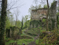
This walk, starting from Florzé Castle, runs alongside the Amblève valley at a distance and returns through the fields and woods of the Sprimont region.
NB: description updated on 30.12.22
On the heights of the Amblève, starting from Aywaille
 11.65 mi
+1,663 ft
-1,644 ft
6h 50
Moderate
Departure from Aywaille (Province de Liège)
11.65 mi
+1,663 ft
-1,644 ft
6h 50
Moderate
Departure from Aywaille (Province de Liège)
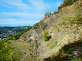
Set off to explore the countryside and forests on the heights of the Amblève around the centre of Aywaille, passing in particular through the Goiveux Former Quarries Nature Reserve, the Warnoumont Forest, the Florzé ridge path, the hamlets of Lillé and Martinrive, the former quarries at Chambralles and the meadows of Cwimont.
Circular route through the Bois d’Esneux via Lagrange and Houte-si-Plout
 7.45 mi
+814 ft
-817 ft
4h 10
Moderate
Departure from Esneux (Province de Liège)
7.45 mi
+814 ft
-817 ft
4h 10
Moderate
Departure from Esneux (Province de Liège)
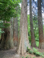
A walk through the woods of Esneux, starting from the hamlet of Rond Chêne and heading towards the hamlet of Lagrange, with the return route taking you through the lower part of the Bois de la Chapelle. The route runs mainly under the canopy of trees. It passes through the Tessenire Arboretum, amongst other places.
Discover the megaliths and puddingstone around Wéris
 11.82 mi
+1,181 ft
-1,168 ft
6h 30
Difficult
Departure from Durbuy (Province de Luxembourg)
11.82 mi
+1,181 ft
-1,168 ft
6h 30
Difficult
Departure from Durbuy (Province de Luxembourg)
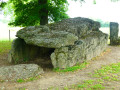
Alternating between forest and countryside, the hike takes you on a journey of discovery to some of the megaliths in the region. You will see two magnificent dolmens and a few blocks of puddingstone, some standing and some lying down.
Along the Ourthe between Bohon and Bomal
 11.31 mi
+1,289 ft
-1,266 ft
6h 20
Difficult
Departure from Durbuy (Province de Luxembourg)
11.31 mi
+1,289 ft
-1,266 ft
6h 20
Difficult
Departure from Durbuy (Province de Luxembourg)
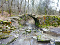
No, the walk doesn’t follow the banks of the Ourthe for 18 km… that would probably be very pretty but too monotonous over such a distance.Starting from the centre of Barvaux, the route begins by climbing the hill on the western side towards Durbuy (which you can visit off the trail) and reaches the Ourthe at the new relief car park.From there, the walk follows the river for just over 3 km before leaving it to reach the plateau between Tohogne and Herbet.After descending to the Ourthe and passing through Bomal, the walk climbs up the other side of the Ourthe and follows the lovely ridge path through the Mont des Pins and Mont Pelé Nature Reserve.
Forest walk at Deux-Rys
 9.82 mi
+1,604 ft
-1,604 ft
5h 55
Moderate
Departure from Erezée (Province de Luxembourg)
9.82 mi
+1,604 ft
-1,604 ft
5h 55
Moderate
Departure from Erezée (Province de Luxembourg)
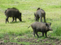
Almost entirely through woodland, this walk offers a very pleasant mix of deciduous and coniferous trees, high forests, clearings and clear-cut areas, which then reveal beautiful views over the surrounding valleys.The few rural stretches around Hoursinne (Petite and Grande) and the final kilometre also offer lovely scenery.From the Château du Bois de Harre, nothing can be seen, not even the farm, since the recent planting of a tall hedge of beech or hornbeam trees along the Chemin des Charbonniers, one of the last public paths ‘saved’ in this 550-hectare private woodland.After the first long climb, the route descends towards the Ai l’Oiseau stream – the very same one that flows at the starting point – before climbing up the opposite slope, where you can see a pond, before turning off towards Hoursinne, first Petite Hoursinne and then Grande Hoursinne, hamlets of Érezée at the end of a cul-de-sac.
Around Heyd and Morville
 10.44 mi
+1,194 ft
-1,198 ft
5h 50
Moderate
Departure from Durbuy (Province de Luxembourg)
10.44 mi
+1,194 ft
-1,198 ft
5h 50
Moderate
Departure from Durbuy (Province de Luxembourg)
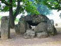
A walk offering varied scenery, alternating between countryside and woodland, paths, tracks, village streets, short stretches of country roads and cycle paths, starting from Wéris, one of Wallonia’s most beautiful villages, well known for its megaliths and its museum.