Country:

 City:


Car park at the top of Avenue Iris Crahay, just after the entrance to the Rond Chêne estate (Esneux). Alternative car park 300 m further on.
(S/E) From the car park, head towards the road and turn right onto it for approximately 650 m.
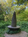
(1) About a hundred metres past the last houses, turn left onto the path leading diagonally across and follow it down to the bottom. Head left to cross the small stream, then turn right onto the forest track. This track climbs gradually, running some distance alongside the stream, before emerging at a large junction, opposite a menhir surrounded by a wooden bench.
(2) Take the path on the right, ignoring the two paths leading back the way you came. After about fifty metres, turn left and, at the Fork in the road about a hundred metres further on, head up to the right. At the top, take the forest track on the left and follow it to the end.
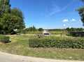
(3) When you reach the tarmac road (with a picnic spot opposite), carry on straight ahead towards the hamlet of Lagrange. At the end of the road, turn right into Rue Lagrange, and after 50 metres, just before No. 47, turn left into the small cul-de-sac. This leads onto a path (first turn right then left to find it) which winds down between the gardens and meadows. Follow it to the end.
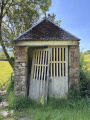
(4) Immediately after the chapel, turn right onto the tarmac road and follow it for 200 m, then turn left up the farm track running alongside a woodland and a meadow. At the top of the track, carry on straight ahead along the path leading into the woodland. This path begins a long, steep descent towards the bottom of the valley.
(5) At the bottom, take the forest track on the right which runs parallel to the hillside. At the first junction, carry on straight ahead; at the second, ignore the path leading down to the left and continue straight ahead, slightly uphill. The slope then becomes steeper.
(6) When you reach the clearing, stay on the track, which curves to the left: ignore the path that starts opposite. Once at the top, continue along the track, which then turns to the right.
(7) As you leave the woods, walk along the edge of the meadow, skirting it as you head towards the houses. Turn left before the first house (still following the edge of the meadow), and at the Fork in the road, keep right onto the forest track. Ignore the first track on the left.
(8) As the path curves to the right and becomes tarmac, carry on straight ahead along the track leading into the woods. This descends steeply to the bottom of a small valley and climbs back up just as steeply. At the top, take the forest track on the left. Follow it for 500 m and, at the end (clearing), take the track on the right. Continue uphill at the junction; the track then curves widely to the left and enters the woods: ignore the path coming from the right.
(9) At the next junction (tree in the middle of the crossroads), keep to the left. At the star-shaped junction shortly afterwards (information board and picnic table visible), turn right. Then, after about 150 m, take the path on the right which leads uphill.
(10) At the end of the path, after passing the outdoor gyms, take the wide path on the left. After 300 m, this path leads onto a forest track; follow this for about a hundred metres, then turn left onto another forest track nestled between two embankments.
(11) Go round the kiosk on the right and continue straight on along the gently sloping path. At the bottom, turn right onto the footpath to reach the car park (S/E).

 Visorando Member

 Easy
 Difficult