Burnontige and Les Arsins

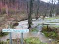
This long circular walk, centred on the theme of the old local road, winds through the woods and countryside around Burnontige. In winter,the paths are waterlogged; others are very slippery where a thin layer of ice remains, and streams swollen with rushing water overflow onto the paths and tracks in many places. The thaw can be sudden.

Details

4545715
Creation:
Last update:
Last review:
  • Walking
    Activity: Walking
  • ↔
    Distance: 9.29 mi
  • ◔
    Average duration: 5h 10 
  • ▲
    Difficulty: Moderate

  • ⚐
    Back to start: Yes
  • ↗
    Ascent: + 1,050 ft
  • ↘
    Descent: - 1,076 ft

  • ▲
    Highest point: 1,421 ft
  • ▼
    Lowest point: 883 ft

Photos

Description of the walk

There are a few steep climbs… get your calves ready.
This circular walk is a local one marked with a red rectangle crossed by a white diagonal line.
The signposting is excellent: plentiful and well-placed. It’s impossible not to see it… except for the absent-minded, of course.
A detailed description is absolutely not necessary. Simply follow the markings and/or the GPS track on the Visorando app.

Definitely worth doing again in different conditions and at other times of year – in autumn, for example, but be aware of closures due to hunting. Check on ChasseOnWeb.be

Waypoints

  1. S/E : mi 0 - alt. 1,191 ft - Tram stop at Burnontige
  2. 1 : mi 1.66 - alt. 1,417 ft - Bosi des Arsins
  3. 2 : mi 2.31 - alt. 1,407 ft - Jehonhé Wood
  4. 3 : mi 3.13 - alt. 1,089 ft - Jehonhé
  5. 4 : mi 4.52 - alt. 942 ft - Vieux Fourneau stream
  6. 5 : mi 5.36 - alt. 1,135 ft - La Hé du Pouhon
  7. 6 : mi 5.91 - alt. 1,207 ft - Le Raumont
  8. 7 : mi 7.71 - alt. 886 ft - Le Trou
  9. S/E : mi 9.29 - alt. 1,191 ft - Tram stop at Burnontige

Worth a visit

Off the route between Ferrières and Bomal: Logne Castle

Other walks in the area

For more walks, use our search engine .

The GPS track and description are the property of this route's author. Please do not copy them without permission.