


 Country:

 City:
City:


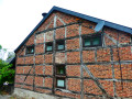
It is possible to park at the start of the walk.
(S/E) There are two parallel paths at the starting point. Take the path on the left, the one that is higher up than the other. Ignore the first path branching off to the left of the house, as well as the next one. You are now on the route of the old local road that led to the village of Ferrières.
(1) At the first crossroads in the middle of the woods, don’t miss the steep path that branches off to the left and leads to the hamlet of Le Trou.
(2) Take the path that branches off to the left between two hedges after a house. You’ll come out onto a road; follow it to the left and take the first stony track to the left.
(3) At the farm, turn onto the path that climbs diagonally to the right. Go round a clearing (beehives), come out onto a road, turn left onto it, then immediately turn right onto the path that curves and descends towards a stream.
(4) Cross the stream and climb up to a track. Turn left onto it, then follow a path that climbs the hill to the right. Continue along this path, which is faint in places. It leads to the Picherotte Nature Reserve.
(5) Continue down the path until you reach a road. Follow it uphill to the houses at Mon Legrand.
(6) Continue along the small road and take the second path branching off to the right. It crosses fields and turns into a footpath as it enters the forest. Cross the stream and take the path on the left which climbs the slope up to Le Thier.
(7) Take the road to the right and, immediately afterwards, the path branching off to the right. Follow this path to the houses at Pré du Fa. Continue straight on along the road for 200 metres.
(8) Take the path branching off to the right at the entrance to a private property … don’t hesitate: the path is definitely public and forms part of the network of local, signposted walks. Reach the edge of a woodland and take the path leading down to the left. Cross the stream and continue to the left until you reach a main road. Follow this road to the right for 100 metres.
(9) Take the steps on the right-hand side of the road just after the entrance to a private property and follow the path uphill to a small village street. 100 metres further on, take the path that branches off to the right between two houses. Further on, ignore the path that branches off to the right. Take the one on the left and follow it to Le Houpet.
(10) At the fork in the road, take the right-hand branch and head down to the stream. Cross it and take the path on the right. Cross a path running at right angles, then a small road running at right angles, and reach the route of the old local track. Follow it to the left.
(11) The local road continues straight ahead. Take the track that veers off to the left and runs alongside it for a good kilometre, gradually gaining height. Ignore all the tracks and paths branching off to the right and follow the main track.
(12) At the T-junction, turn right. The track descends slightly, crosses a stream and emerges from the forest fairly quickly for a final stretch through the countryside to (S/E).
 Visorando Member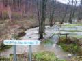



 Easy
Easy 
