


Refine your search for walks in Lac Mézan
Lac Mézan walks


 Malrif Lakes
 Visorando Member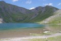
 6.44 mi
 +2,621 ft
 -2,628 ft
 5h 15
5h 15
 Moderate
 Departure from Aiguilles (Hautes-Alpes)
Beautiful mountain lakes and magnificent landscapes.
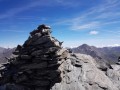
Le Grand Glaiza from the hamlet of Lombard
 11.11 mi
+5,125 ft
-5,131 ft
7 hrs
11.11 mi
+5,125 ft
-5,131 ft
7 hrs
 Very difficult
Departure from Aiguilles (Hautes-Alpes)
Very difficult
Departure from Aiguilles (Hautes-Alpes)
The start from the hamlet of Lombard offers an alternative to the classic route from the Bergerie du Lombard.
A very beautiful route to climb to the summit of Grand Glaiza, the third highest peak in Queyras, via the Malrif lakes. The breathtaking views will more than compensate for the effort required.
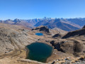
Around the Malrif Lakes
 7.91 mi
+3,468 ft
-3,468 ft
6h 40
7.91 mi
+3,468 ft
-3,468 ft
6h 40
 Difficult
Departure from Aiguilles (Hautes-Alpes)
Difficult
Departure from Aiguilles (Hautes-Alpes)
Alpine pastures in bloom, lakes, a ridge with a magnificent view!
A beautiful hike for the start of the season!
Grand Glaiza and the Malrif Lakes from Les Fonts de Cervières
11.75 mi
+5,056 ft
-5,020 ft
9h 50
Very difficult
Departure from Cervières (Hautes-Alpes)
A long walk through the Pierre Rouge valley to reach the Grand Glaiza via the Crête aux Eaux Pendantes and its rocky landscape, with the return route passing through the Lacs du Malrif to return to greenery.
Walks near Lac Mézan
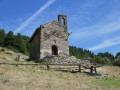
The balcony path between Aiguilles and Ville-Vieille
 6.59 mi
+1,591 ft
-1,854 ft
4h 25
Moderate
Departure from Aiguilles (Hautes-Alpes)
6.59 mi
+1,591 ft
-1,854 ft
4h 25
Moderate
Departure from Aiguilles (Hautes-Alpes)
The walk mostly follows a ridge above the Guil valley between Aiguilles and Ville-Vieille. We recommend returning via the free shuttle bus, which runs between Château-Queyras and L’Échalp.
Refuge des Fonts de Cervières – Andrea Tornior Bivouac
 9.76 mi
+4,888 ft
-3,291 ft
8h 45
Difficult
Departure from Cervières (Hautes-Alpes)
9.76 mi
+4,888 ft
-3,291 ft
8h 45
Difficult
Departure from Cervières (Hautes-Alpes)
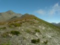
A fairly alpine stage of the Queyras Transfrontière, featuring the ascent of a magnificent 3,000-metre peak: Le Grand Glaiza.
The start of this stage is accessible by car via Cervières on the D902 from Briançon, then the D89T through Cervières.
Abriés - Aiguilles
 8.56 mi
+3,501 ft
-3,793 ft
7h 00
Moderate
Departure from Abriès (Hautes-Alpes)
8.56 mi
+3,501 ft
-3,793 ft
7h 00
Moderate
Departure from Abriès (Hautes-Alpes)
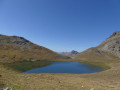
The seventh and final stage takes you past the Malrif lakes under the ridge separating Queyras and Briançonnais.
Valpréveyre - Lago Verde
 5.32 mi
+4,180 ft
-1,736 ft
6h 05
Difficult
Departure from Abriès (Hautes-Alpes)
5.32 mi
+4,180 ft
-1,736 ft
6h 05
Difficult
Departure from Abriès (Hautes-Alpes)
First stage of Circuit Franco-Italian border "Queyras in Val Pellice" punctuated by passages through three interesting passes: Malaure, Bouchet and Vampréveyre.
Lodge du Grand Rochebrune – Lodge le Teppio
 9.80 mi
+2,635 ft
-3,176 ft
6h 50
Difficult
Departure from Château-Ville-Vieille (Hautes-Alpes)
9.80 mi
+2,635 ft
-3,176 ft
6h 50
Difficult
Departure from Château-Ville-Vieille (Hautes-Alpes)
This stage follows part of theGR®® 58, then takes a route offthe GR®® to climb to the Col d’Izoard. Admittedly, this ascent is via the road, but on a day when vehicles are banned, allowing you to enjoy this lunar landscape with its monoliths. The return journey takes you through a deserted ravine. The limestone landscapes of this stage are nothing like those encountered since the start of the Tour du Queyras, which is characterised by slate.
Chateau Queyras - Montbardon
 5.97 mi
+2,717 ft
-2,169 ft
5h 05
Moderate
Departure from Château-Ville-Vieille (Hautes-Alpes)
5.97 mi
+2,717 ft
-2,169 ft
5h 05
Moderate
Departure from Château-Ville-Vieille (Hautes-Alpes)
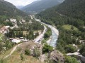
This is the first stage of the tour and is an adaptation as the route is not on theGR®58, but it allows you to visit the castle that dominates the Guil pass.
(Please note) The Montbardon stopover lodge (Le Cadran Solaire) has been closed since 2018, so the best option from Château Queyras is to go directly to Ceillac via the Col Fromage.
(Important note): See this website mentioning the reopening of this lodge for summer 2023.
Tour du Queyras
56.34 mi
+22,976 ft
-22,575 ft
7 days
Moderate
Departure from Château-Ville-Vieille (Hautes-Alpes)
The Tour du Queyras, labelledGR®58, is adaptable. The route described, starting from Château Queyras and completed in a group in September 2008, will take you through this natural park, skirting and climbing some 3,000 metres. You will discover the beautiful villages of this park with their well-known names: Ceillac, Saint Véran, Abriés... What's more, in summer the weather is almost always fine. The bright blue sky the next day will quickly make you forget the storm of the previous evening.
From the hamlet of La Monta to the village of Abriès
8.16 mi
+3,100 ft
-3,488 ft
6h 25
Difficult
Departure from Ristolas (Hautes-Alpes)
This stage of the Queyras circuit can also form part of the Mont Viso circuit. For walkers travelling by train, a bus departs from Mont-Dauphin Guillestre station and serves the village of Abriès-Ristolas.
La Chalp - Ceillac
12.81 mi
+4,272 ft
-4,416 ft
9h 35
Difficult
Departure from Arvieux (Hautes-Alpes)
Étape du GR®5 de La Chalp à Ceillac par le Col du Fromage dans le Queyras authentique et sauvage en passant par Chateau-Queyras.
From La Chalp to the Cime du Mélezet mountain hut
 15.97 mi
+4,888 ft
-4,452 ft
11h 35
Difficult
Departure from Arvieux (Hautes-Alpes)
15.97 mi
+4,888 ft
-4,452 ft
11h 35
Difficult
Departure from Arvieux (Hautes-Alpes)
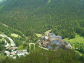
This fourteenth stage completes the crossing of the Queyras Massif. From La Chalp, the GR® 5 climbs along the left bank of the Torrent de l’Izoard above Arvieux, then reaches the hamlet of Les Maisons. From there, it heads towards Lac de Roue before descending to Château-Queyras. The route climbs the steep slope on the opposite side, on the right bank of the Torrent de Bramousse, joins a road at a hairpin bend and leaves it at the next one. It continues through the torrent’s valley, reaches the ridge separating the Bramousse and Riou Vert valleys, and, hugging the hillside beneath the peaks of La Selle and Rasis, reaches the Col Fromage. The path descends along the right bank of the Ravin de Rasis to reach Le Villard before arriving at Ceillac, from where it follows the Torrent du Mélezet, alternating between the left and right banks, before reaching the Refuge de la Cime du Mélezet.