


Refine your search for walks in Ferme-auberge du Grand Langenberg
Ferme-auberge du Grand Langenberg walks


 On the slopes of the Grand Langenberg
 Visorando Member
 7.39 mi
 +1,631 ft
 -1,637 ft
 4h 50
 Moderate
 Departure from Sewen (Haut-Rhin)
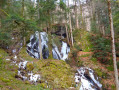
Along the banks of the Doller and then the Wagenstall waterfalls, reach the peaceful stubble fields of the narrow Grand Langenberg valley near an authentic farmhouse inn. Then descend to the foot of the Ballon d'Alsace towards the impressive glacial basin of Lake Alfeld, which dominates the Doller valley. Finally, return along the tumultuous Seebach, which calms down in a wet and marshy meadow, before dying in the peat bogs of Lake Sewen.
Please note that theGR®®531is sometimes obstructed (forestry work, overgrown vegetation, fallen trees, etc.) and maintenance is sometimes delayed. In this case, take the Fennematt path along the left bank of the Doller (marked with triangles and red trestles) and rejoin the route at point (1) or point (3).
The Wissgrut stubble fields via the Wagenstall waterfalls
 10.17 mi
+2,746 ft
-2,726 ft
7h 05
 Difficult
Departure from Sewen (Haut-Rhin)
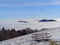
The summit peaks of the Vosges are always a delight for hikers because of the magnificent views they offer. Those of the Wissgrut (or Wisskritt) between the Belfort gap and the Masevaux valley are remarkable. You will reach them via the beautiful Wagenstall waterfalls and continue along the ridge and the upper Fennematt valley, where the Doller river has its source, and its beautiful panoramic trail.
Circular route from Grand Langenberg to La Gentiane via Wissgrut
4.37 mi
+889 ft
-886 ft
2h 45
 Easy
Departure from Sewen (Haut-Rhin)
This circular walk starts and ends near the Grand Langenberg farmhouse inn. It follows the north-facing slope of the Ballon d’Alsace National Forest above the Wagenstallbach and Doller valleys. It leads to the ridge of the Wissgrut and Gentiane scree slopes, which marks the border between departments 68 and 90, then passes beneath the Tête des Redoutes to return to the starting point.
Tour of the upper Doller valley via the Wagenstall waterfalls
9.93 mi
+2,142 ft
-2,119 ft
6h 25
Moderate
Departure from Sewen (Haut-Rhin)
This walk takes you through the upper Doller valley from its source near Fennematt to Sewen, crossing the Wissgrut moorland and beautiful deciduous forests. From the Fennematt Road (near the hamlet of Lerchenmatt), climb up the Wissgrut stubble fields past the Wagenstallbach waterfalls, passing the Grand Langenberg farmhouse inn. Cross the moors to the Tremonkopf, passing by the Virgin of Wissgrut to enjoy magnificent views, then descend via a pleasant forest path through unnamed passes and the Hirtzelach Pass to the Lochberg Pass. Return via Fennematt, the source of the Doller and the magnificent Graber shelter – built of log walls and with a thatched roof – before reaching the valley.
From the Ballon d'Alsace pass to the Grand Langenberg farmhouse inn
 Tourism professional
 6.91 mi
+1,614 ft
-1,611 ft
4h 35
Moderate
Departure from Lepuix (Territoire-de-Belfort)
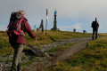
Starting from the Col du Ballon d'Alsace, this circular route takes you on a circuit around the summit before crossing wild maple forests and the rocky, steep south-eastern slopes of the mountain. A visit to the summit plateau, a future Grand Site de France, is a highlight of this hike, offering breathtaking views over Lorraine, Alsace and Franche-Comté. On the other side, far from the “crowds” of the Ballon, the unassuming farmhouse inn at Grand Langenberg is a peaceful haven where it’s lovely to stop for a break before setting off again.
Walks near Ferme-auberge du Grand Langenberg
Ballon d'Alsace - Chalet de l'Alouette
 14.19 mi
+1,860 ft
-3,665 ft
8h 10
Difficult
Departure from Lepuix (Territoire-de-Belfort)
This beautiful route begins with two remarkable peaks in the Vosges and offers beautiful views of the upper Moselle valley, before reaching the Pays des Étangs.
Ballon d'Alsace - Giromagny
 7.75 mi
+417 ft
-2,707 ft
3h 55
Moderate
Departure from Lepuix (Territoire-de-Belfort)
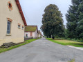
This hike takes you down from Ballon d'Alsace to Giromagny. It is the continuation of the Vosges crossing, proposed by DNA, Passion Vosges and the Journal d'Alsace (see practical information). The first few kilometres are along the ridges, with views of the Black Forest, the Rhine Valley and even the Alps. During this same section, you may come across several ski resorts, such as La Chaumière and La Gentiane. A farmhouse inn at Wissgrut offers lunch. Further on, a shelter at the Col du Chantoiseau provides a place to picnic. The descent then continues, sometimes more steeply than others. The arrival in Giromagny offers views of the city of Belfort.
Giromagny - Belfort
 12.05 mi
+400 ft
-748 ft
5h 55
Moderate
Departure from Giromagny (Territoire-de-Belfort)
This stage is the last of the Club Vosgien's red rectangle trail through the Vosges. This stage is classified as moderate as there is virtually no elevation gain. Most of the hike takes place under forest cover. The stage starts in the small town of Giromagny and ends in the beautiful city of Belfort, passing by Bartholdi's Lion, a must-see photo spot for those completing the Vosges crossing!
From Chaux to Malsaucy via Fort de Giromagny
 7.69 mi
+453 ft
-584 ft
3h 55
Moderate
Departure from Chaux (Territoire de Belfort) (Territoire-de-Belfort)
This walk follows the fortified belt around Belfort. You’ll discover lovely countryside and woodland scenery, as well as several charming villages: Chaux, La Chapelle-sous-Chaux and Évette-Salbert.You’ll pass by Giromagny Fort. The walk ends with a landscape featuring numerous ponds and the Malsaucy nature reserve. As well as a beautiful view of the Vosges, you’ll be able to spot a variety of birds.
The start and finish points are accessible by bus or train.
Auberge du Belacker – Grand Ballon
 Tourist office10.07 mi
+3,353 ft
-2,126 ft
7h 35
Difficult
Departure from Moosch (Haut-Rhin)
For this lovely new stage, which will take you from Belacker to the Grand Ballon, the highest peak in the Vosges, follow the Club Vosgien route, marked with Yellow Rectangles. These markings indicate theGR®532, an iconic walking route across the Vosges linking Woerth in the Bas-Rhin to Belfort.
Although the distance is shorter, this stage is by no means easy. After a descent towards Saint Amarin, with a 560m drop in altitude, don’t forget to save your energy, as a 1,000m climb then awaits you to reach the “roof of the Vosges”.
Ballon de Servance
 12.46 mi
+1,982 ft
-2,228 ft
7h 25
Moderate
Departure from Le Thillot (Vosges)
Hike to Ballon de Servance.Please note that for this hike, you will need two vehicles, one at (S) at the Col des Croix andthe other at the Sources de Presles reservoir (E). The path leading directly up to the Ballon is a quiet zone and is closed from 15 December to 14 July. See notices
Gsang towards the Hundsruck Pass
4.44 mi
+499 ft
-1,444 ft
2h 30
Easy
Departure from Moosch (Haut-Rhin)
Return to the Hundrunck Pass via the summit of the Vogelstein.
From Malsaucy near Évette-Salbert to Bavilliers via the forts
 8.71 mi
+1,371 ft
-1,509 ft
5h 10
Moderate
Departure from Évette-Salbert (Territoire-de-Belfort)
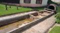
This walk follows the fortified belt around Belfort. You’ll discover lovely countryside and woodland scenery, the village of Evette Salbert and the towns near Belfort: Essert and Bavilliers. You’ll pass by Fort du Salbert and the Ouvrage de la Côte, which formed part of Belfort’s line of defence. The start and finish points are accessible by bus or train.
From the ridges towards the Petit Ballon
8.32 mi
+866 ft
-784 ft
4h 35
Moderate
Departure from Ranspach (Haut-Rhin)
The Munster Valley, Hohrodberg, Haut-Koenigsbourg Castle – just how far will the Col d’Oberlauchen take your view?
Setting off from Markstein, before crossing the resort’s ski slopes, you can stop off to visit the Notre-Dame-des-Neiges Chapel for a brief cultural break. Heading towards the Petit Ballon, this route crosses numerous passes and peaks, such as the Klintzkopf and the Hilsenfirst, not to mention the Col d’Oberlauchen, from which you’ll be able to spot many of the area’s distinctive features… Keep your eyes peeled!
Le Markstein – Thann
 17.72 mi
+2,359 ft
-5,187 ft
10h 10
 Very difficult
Departure from Oderen (Haut-Rhin)
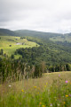
From the Markstein, the sixteenth stage of the journey across the Vosges proposed by Passion Vosges magazine continues along the Great Vosges Ridge towards the massif’s highest point, the Grand Ballon. After a visit to the Hartmannswillerkopf battlefield (1914–1918) and a climb to the summit of the Molkenrain, a long descent through the forest begins, heading towards Thann and its famous Gothic collegiate church. Franck Buchy’s account of this sixteenth stage can be found in *Passion Vosges*.