Country:
 City:
City:


Departure from Bas-Évette station.
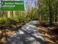
The route is marked with a yellow and red rectangle.
(S) On leaving Bas-Évette station, turn left onto the D24 (watch out for traffic). Cross the railway line carefully and continue straight on along Rue du Lac (do not take the street on the right).
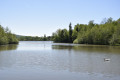
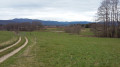
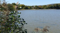
(1) Turn left onto Rue du Val and continue along the path, which climbs very gently. Don’t forget to look back from time to time to admire the beautiful views of the lakes and the Vosges. Walk past the lagoon that treats wastewater: information boards explain how it works.
(2) Cross Rue des Clarines and carry on straight ahead along Rue de Verboté. At the next junction, turn right, following our Yellow Rectangle and Red Ring signposting onto Rue du Verboté (do not go straight on following another green Rectangle or Green Ring sign). At the top of the hill, turn right onto Rue des Cerisiers and, immediately afterwards, take the path that joins the D24.
(3) Cross the D24 with care: please note this is the road to Belfort, so there is heavy traffic. Follow the road opposite along Rue des Bouleaux. The street becomes a track leading into the Salbert Forest. At the next junction, carry straight on, following our yellow and red rectangular signposts. (Do not take the track marked with a Red Ring on the right).
(4) When you reach the forest track, cross it and continue straight ahead along the path that leads uphill. Do the same at the next junction. Follow the signposts carefully.
(5) You’ll arrive at the esplanade of Fort Lefebvre or Fort du Salbert. On the summit platform there are three orientation tables: a superb 360° panoramic view over the entire Trouée de Belfort, the Vosges mountains, the Alps and the Swiss Jura. Go down the stairs and turn left. 200 m further on, leave the wide path and turn right onto a path that descends steeply.
(6) When you reach the D4 road, which has a hairpin bend, follow it for 20 metres and then take the path on the right just at the end of the bend. About 300 metres further on, join the fitness trail on the right and follow it for almost 1 km.
(7) Leave the fitness trail and head down the path to the left. Follow the signposting carefully, as it is very well marked.
(8) Cross the D16. 100 m further on, turn right and head uphill, skirting Mont Coudrai. In this section, follow the signposting carefully as there are numerous paths branching off to the left and right. Emerge from the forest with a lovely view of Essert. Head down Rue du Lieutenant Prévost.
(9) When you reach the roundabout, turn left and cross Rue du Général de Gaulle. Opposite, take the D47 (Rue de Lattre de Tassigny). Cross the Haute-Saône canal and the green corridor. Pass in front of Saint-Léger Church.
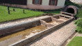
(10) Turn right onto Rue du Sergent Leiris. Cross the little river La Doucette (which further on is called La Douce). Admire the fountain. Continue along Rue Leiris until you reach the very pretty Notre-Dame-du-Vœu Chapel. At the chapel, turn right onto Chemin des Combattes. After 200 metres, turn right and head up into the forest. Follow the signposts carefully.
(11) You’ll reach the Ouvrage de la Côte, which forms part of the Belfort defence line. Just in front of the main entrance, turn left, following the signposts, and head back down onto the forest track. Leave the forest, pass under the high-voltage power line and arrive in Bavilliers via Rue du Fort.
(12) About fifty metres after entering the housing estate, turn right onto Rue des Champs Grenier, then take thesecond left onto Rue des Chênes. Cross Rue Paul Barret and continue straight ahead along the path leading to numbers 6 and 8.
Walk through the small copse and go down the stairs. At the bottom, cross Rue de la Libération, walk past the supermarket and continue straight ahead along Rue Jacques Pignot. Cross the River Douce, turn right immediately afterwards and walk alongside the river. You’ll arrive at the town hall, which is the finish line (E).
The bus stop is next door on Grande Rue François Mitterrand.



 Visorando Member
 Easy
Easy  Local authority