Country:

 City:


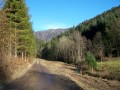
(S) With the farmhouse inn behind you, set off downhill along a dirt track towards Saint-Amarin.
Take in the unspoilt pastures of the Belacker farm, carpeted with Vosges pansies and fennel. A few majestic beech trees, white service trees and imposing holly thickets greet you as you pass.
Continue straight ahead until you reach the cattle grid – this structure prevents cows from crossing. You are now entering a forest of silver firs and beech trees. Keep left, then right, until you reach a pass.
(1) Turn right, towards the Col du Dreimarkstein. Cross one track, then, at the second set of tracks, take the second path on the right. This path winds its way through rocky scree, beneath the forest canopy, to the Col du Dreimarkstein.
Once you reach the pass, you’ll find a large crossroads with a shelter where you’re welcome to have a barbecue if you fancy it. A lovely bench allows walkers to rest their legs.
(2) Continue to follow the Yellow Rectangle markings, taking a path towards Saint-Amarin (opposite). The route, which starts as a track, turns into a narrow footpath descending to the left. Continue your descent through the woods. “To your left, below, lies the village of Mitzach.
If you’re visiting in spring (from March until 21 June), you might be lucky enough to spot the village conscripts building the St John’s bonfire (‘Fackel’). The bonfire is lit every year on the Saturday closest to the feast of St John the Baptist.” You will then come to a forest track on your right. Take a path on the left towards the Hirschbachkopf.
(3) At the foot of this small peak, above a pasture, you’ll discover a magnificent view over the upper Thur valley. Continue down the path, always following the Yellow Rectangle markings. Pass a marked path on your left, then, at the junction of several paths, carry on straight ahead. At the next fork in the road, turn sharply left, then, at the second fork, turn right. Continue straight on until you reach the river.
(4) Once you reach the lowest point of this stage, cross the River Thur before entering the village of Saint-Amarin. Head towards the village centre along Rue Joffre until you reach the A-road. Cross it and go past the main junction. The ‘Le Cheval Blanc’ hotel and restaurant is situated at this junction. A cultural and historical stop is a must at the Serret Museum (local history museum) in Saint-Amarin, located 200 metres from the junction. Walk past the museum and, at the next crossroads, keep to the right until you reach the church.
(5) Go round the building on the right, towards Rue du Kattenbach, one of the oldest neighbourhoods in Saint-Amarin. Cross a stream and head up this street on the left.
From there, looking westwards, you can make out a stately home on a rocky outcrop, built on the former site of Friedbourg Castle. Friedbourg Castle, owned by Murbach Abbey, was built in 1225. When you reach the top of Rue du Kattenbach, turn straight ahead into a small cul-de-sac where the tarmac section of your walk ends. You’ll come to a Fork in the road.
(6) Turn right. A 1,000-metre climb awaits you up to the Grand Ballon. The Yellow Rectangle continues to guide your way through the woods. Then turn left, then right, and left again. The steep path is magnificent, as is the oak woodland you pass through. At the X-shaped junction, turn right, then straight on. Keep to the right, then cut across a forest track. Pass close to the Fontaine des Mulhousiens or Mulhaeuserbrunnen, then continue straight ahead, turning right and heading uphill. Further up, you’ll enter a mixed forest of fir and beech, where you’ll cross the road leading to the village of Geishouse at a place called ‘Hoehe’. Continue along the path through the woods.
Keep your eyes peeled – does, roe deer and chamois are watching you, lurking in their discreet ‘daytime hide’ (a resting place for large wild animals during the day). Cross a track and, at the next junction, keep to the right. Pass a turning off to the right. Keep climbing until you reach a four-way junction on a ridge.
(7) Continue climbing to the right on theGR®532. Ignore a track leading downhill, then take the one going uphill to the stubble fields. You’ll pass a viewpoint from which you can see the upper Thur valley, Thann, the Alsace plain, further on the Jura mountains, and even further, on a clear day, the Bernese Alps. You’ll now reach the high-altitude beech forest and come across the pastures of the Haag farm. Once you reach the road, continue climbing to the Col du Haag, where you can sample the excellent kirsch-flavoured fromage blanc (Sieskas), skilfully crafted by the farmers and innkeepers at Haag.
(8) You’ll leave theGR®532to join the iconicGR®5, marked with a Red Rectangle, which starts off to the right. Stay on this side. You are now entering the most beautiful part of the route on the southern slopes of the Grand Ballon, through rocky scree and high-altitude scrub. The path, at times strewn with schist and at others with grassy patches, leads you to the summit of the Vosges. Leave the path leading down to the Redslob Monument on your right. As you make your final ascent, you’ll climb a small wooden staircase, just below the Monument des Diables Bleus. This monument was erected in 1927 in memory of the French Chasseurs Alpins who defended the peaks of the Vosges during the 1914–1918 conflict.
(9) Continue on your way until you reach the summit of the Vosges (1,424 m), at the foot of the civil aviation radar station, the construction of which was entrusted to the architect Claude Vasconi in 1997.
A panoramic information board, integrated into the building, allows you to see the peaks of the Vosges, Swiss and German mountains and, in clear weather, you can see Mont Blanc.
Continue down a short descent, which begins opposite the weather station. This is the final descent of this stage. The path leads you to the Grand Ballon chalet-lodge for some well-deserved rest and refreshments. (E)
 Visorando Member
 Easy

 Tourist office
 Moderate