From Chaux to Malsaucy via Fort de Giromagny

This walk follows the fortified belt around Belfort. You’ll discover lovely countryside and woodland scenery, as well as several charming villages: Chaux, La Chapelle-sous-Chaux and Évette-Salbert.
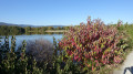
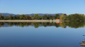
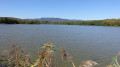
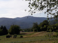
You’ll pass by Giromagny Fort. The walk ends with a landscape featuring numerous ponds and the Malsaucy nature reserve. As well as a beautiful view of the Vosges, you’ll be able to spot a variety of birds.

The start and finish points are accessible by bus or train.

This walk is part of a multi-day hike: Tour des forts en 6 étapes autour de Belfort : les forts

Details

3136311
Creation:
Last update:
Last review:
  • Walking
    Activity: Walking
  • ↔
    Distance: 7.69 mi
  • ◔
    Average duration: 3h 55 
  • ▲
    Difficulty: Moderate

  • ⚐
    Back to start: No
  • ↗
    Ascent: + 453 ft
  • ↘
    Descent: - 584 ft

  • ▲
    Highest point: 1,834 ft
  • ▼
    Lowest point: 1,276 ft

Photos

Description of the walk

The start point in Chaux is accessible by bus (see the ‘Practical Information’ section).

The route is signposted with a Yellow Rectangle and a Red Rectangle.

(S) Start on Grande Rue D465 in Chaux. Head north towards Giromagny. The signposting begins on Rue du Petit Chemin.

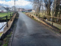
(1) Cross the road carefully, then turn left onto Rue des Oiseaux (just after Rue des Sapois and Rue Nouvelle). Cross Rue des Éparses, then the railway line. Turn right just after the railway line. Walk alongside two ponds.

(2) At the junction, turn right and continue along Rue des Oiseaux, passing the sports ground.
At the next junction, carry on straight ahead. Note: 50 metres to the left is the Bellevue Mass Grave Memorial. It pays tribute to the Resistance fighters of the 1939–45 war. Ignore the two paths on the left and continue into the forest.

(3) At this junction, theGR®®5, marked with a Red Rectangle, branches off to the right. Do not follow it, but turn left, following the Yellow Rectangle and Red Rectangle markings. At the next junction, turn right and head uphill to reach the fort.

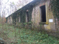
(4) Admire the entrance to Fort Dorsner or Fort de Giromagny. Continue alongside the fort and turn left at the gate, then left again 50 metres further on. Head back down via the forest track: the Chemin du Fort. At the first hairpin bend, keep left onto the Chemin du Fort and follow it until you reach the edge of the forest.

(5) At this junction, carry on straight ahead, following the Étangs de la Charbonnière, the Étang d’Amont and the Étang d’Avau.

(6) When you reach the D13 road, turn left and, 200 metres further on, turn right. Walk alongside a pond, ignoring two paths on your right, and you’ll reach Rue de la Prairie in Lachapelle-sous-Chaux.

(7) Turn right onto Rue du Rhome. At the next crossroads, turn slightly left onto Rue de la Libération and follow it for about 1 km.

(8) Turn left onto Rue de Bellevue. At the next junction, carry on straight ahead onto a path (3rd on the right or2nd on the left). Continue along this path, skirting the Étang Ludwig.

(9) At the end of this lake, carry on straight ahead and follow the banks of the Étang de la Courbe Chaussée.

(10) At this junction, turn onto a path on the right, following the signposts.

(11) Turn right just before the cycle path and the D24 road. Walk along the road beside Étang de la Véronne.

(12) On your left is the car park for the Malsaucy leisure centre. Follow Rue d’Evette, keeping an eye on the signposts (do not turn right towards the leisure centre or left towards the car park). Walk along the road by Lac du Malsaucy.

(13) At the Auberge du Lac, turn left, cross the road carefully and head straight on to Bas-Évette station (E).
N.B. This is a very small station, but please take care as some trains do not stop and pass through the station very quickly.
Waypoints

  1. S : mi 0 - alt. 1,411 ft - 50 Grande Rue, Chaux. Near the - Savoureuse (rivière)
  2. 1 : mi 0.27 - alt. 1,430 ft - Rue des Oiseaux
  3. 2 : mi 0.72 - alt. 1,476 ft - Rue des Oiseaux sports ground
  4. 3 : mi 1.41 - alt. 1,683 ft - Crossroads marked with a Red Rectangle
  5. 4 : mi 1.83 - alt. 1,834 ft - Giromagny Fort
  6. 5 : mi 3.61 - alt. 1,424 ft - Y-junction at the edge of the forest
  7. 6 : mi 4.22 - alt. 1,394 ft - D13 near Lachapelle-sous-Chaux
  8. 7 : mi 4.77 - alt. 1,352 ft - Rue du Rhome
  9. 8 : mi 5.57 - alt. 1,388 ft - Rue de la Libération – Rue de Bellevue
  10. 9 : mi 6.36 - alt. 1,296 ft - End of the Ludwig Pond
  11. 10 : mi 6.73 - alt. 1,286 ft - Étang de la Courbe Chaussée
  12. 11 : mi 7.05 - alt. 1,283 ft - Next to the cycle path and the D24
  13. 12 : mi 7.29 - alt. 1,283 ft - Malsaucy car park
  14. 13 : mi 7.64 - alt. 1,276 ft - Etang du Malsaucy
  15. E : mi 7.69 - alt. 1,283 ft - Gare de Bas-Evette

Notes

The journey from Chaux to Belfort is served by the local bus network: Optymo. The bus departs from next to No. 50 Grande Rue in Chaux. This is the D465, the main road from Belfort to the Ballon d’Alsace.

You can download the Optymo app onto your phone to check timetables. You can pay for your journey using your phone. In Belfort, take line 3 to Valdoie, then change to line 20 to reach Chaux.

You’ll arrive at Bas-Évette SNCF station. There are trains to Belfort town centre, which is very close by. If you’re travelling by car, there’s a large car park near the Malsaucy leisure centre at point (12).

Worth a visit

A fortified ring wall was built after the War of 1870. General Séré de Rivières oversaw the operations. For further details, see the following link

Fort Dorsner.
Following the French defeat in 1871, it was decided to protect the Belfort gap. Giromagny Fort was built in 1875. It is known as Fort Dorsner. Its location near the border gave it a very important role: it was tasked with monitoring the road that descends from the Ballon d’Alsace and leads to Belfort. Its armament made this fort the most powerful in the region, as in 1879 it was fitted with an unusual defence system comprising two Mougin turrets, the first of their kind in France.

Le Malsaucy,
A leisure centre 10 km from Belfort. Free, supervised swimming during the summer months. You’ll see some beautiful scenery with numerous ponds. You’ll be able to spot many birds. There is a bird observatory near point (10).

Always be cautious and plan ahead when you're outdoors. Visorando and the author of this route cannot be held responsible for any accidents occurring on this route.

The GR® and PR® markings are the intellectual property of the Fédération Française de Randonnée Pédestre.

Reviews and comments

4.8 / 5
Based on 2 reviews

Reliability of the description
5 / 5
Ease of following the route
5 / 5
Route interest
4.5 / 5
Orando974
Orando974 ★

Overall rating : 5 / 5

Date of your route : Nov 29, 2025
Reliability of the description : Not used / Not applicable
Ease of following the route : ★★★★★ Very good
Route interest : ★★★★★ Very good
Very busy route : No

I was pleasantly surprised by the beauty of this section, despite the rather overcast weather. The second part is very interesting, with numerous ponds and lakes that lend an undeniable charm to the route. The Fort de Giromagny is also interesting, but it's a shame that it's not open to visitors. I started this stage from Belfort, which considerably increases the distance. But this part is definitely the most beautiful of the route. I can't wait to see what the other stages have in store for me.

Machine-translated

Pacati Dominique
Pacati Dominique

Overall rating : 4.7 / 5

Date of your route : Dec 14, 2020
Reliability of the description : ★★★★★ Very good
Ease of following the route : ★★★★★ Very good
Route interest : ★★★★☆ Good
Very busy route : No

I went on this walk on 12 December; despite the gloomy weather, it was really lovely – the path is very accessible, even for beginner walkers.

Machine-translated

Other walks in the area

For more walks, use our search engine .

The GPS track and description are the property of this route's author. Please do not copy them without permission.