


Refine your search for walks in Esserts-Blay
Esserts-Blay walks


 Route du Château de Chantemerle (Vèryâ du stâté dè Stantamerla)
 Visorando Member
 3.29 mi
 +991 ft
 -1,014 ft
 2h 25
2h 25
 Moderate
 Departure from La Bâthie (Savoie)
A trail that takes you to the 17th-century Château de Chantemerle with its breathtaking view of the village of La Bâthie. You will also pass through the village of Biorges and cross the stream, Ruisseau du Nant Varin.
A circular route around the Dent du Corbeau from Saint-Paul-sur-Isère
5.25 mi
+2,556 ft
-2,536 ft
4h 40
 Difficult
Departure from Saint-Paul-sur-Isère (Savoie)
Difficult
Departure from Saint-Paul-sur-Isère (Savoie)
A beautiful, little-known summit at the northern end of the Lauzière massif.The approach via the Tarentaise, which is much less frequented, guarantees peace and quiet and the chance to spot chamois.
The Balconies of Saint-Thomas (Lé lôzè dè Saint Thomas)
 4.47 mi
+1,562 ft
-1,535 ft
3h 25
Moderate
Departure from Esserts-Blay (Savoie)
4.47 mi
+1,562 ft
-1,535 ft
3h 25
Moderate
Departure from Esserts-Blay (Savoie)
A route that will take you through the remote hamlets of the village of Saint-Thomas, overlooking the valley with magnificent views, a route alternating between footpaths, tracks and roads.
A sunny route early in the morning with very little traffic – enjoy it to your heart’s content.
Circular walk starting from Tours-en-Savoie, passing by Chantemerle Castle
 6.08 mi
+2,339 ft
-2,352 ft
4h 50
Moderate
Departure from Tours-en-Savoie (Savoie)
6.08 mi
+2,339 ft
-2,352 ft
4h 50
Moderate
Departure from Tours-en-Savoie (Savoie)
A pleasant route through woodland in the municipalities of Tours-en-Savoie and La Bathie, with a mix of ascents and descents. During this double circular route, you’ll discover Chantemerle Castle, the hamlet of Biorges and the waterfalls of the Grand Ruisseau. You’ll pass beneath Saint-Clément Chapel and above the EDF power station.
Route de la Chapelle Saint-Clément (Viéryâ d’la stapèla Saint Clément)
 2.30 mi
+446 ft
-446 ft
1h 25
2.30 mi
+446 ft
-446 ft
1h 25
 Easy
Departure from Tours-en-Savoie (Savoie)
Easy
Departure from Tours-en-Savoie (Savoie)
A family walk through the woodland. Pass by the 17th-century Saint-Clément Chapel, sheltered by the Brèche rock, and the Sainte-Apollonie Chapel in the centre of the village.
La Dent du Corbeau
3.53 mi
+2,234 ft
-2,234 ft
3h 35
Difficult
Departure from Notre-Dame-des-Millières (Savoie)
La Dent du Corbeau forms part of the Grand Arc massif. From the ridge, there is a superb view of the valley stretching towards Montmélian, the head of the Tarentaise valley, Mont Blanc (of course!), and the Aravis range.
Le Fort du Mont au départ de Tours en Savoie
 7.28 mi
+2,913 ft
-2,913 ft
5h 55
Difficult
Departure from Tours-en-Savoie (Savoie)
7.28 mi
+2,913 ft
-2,913 ft
5h 55
Difficult
Departure from Tours-en-Savoie (Savoie)
Une belle randonnée, assez sportive, avec un cheminement en forêt avec tout le long de la randonnée de magnifiques points de vue sur la vallée, des traversées de petit hameaux, des chalets perdus au milieu des bois et arrivée au point culminant qui est le Fort du Mont .
Refuge du Soplat des Nants par le chemin historique
5.68 mi
+3,691 ft
-3,691 ft
5h 50
Difficult
Departure from Tours-en-Savoie (Savoie)
Allez découvrir le Refuge du Soplat des Nants par le sentier historique peu fréquenté non représenté sur les cartes qui évite en grande partie la piste carrossable et vous permet de rejoindre le Chalet du Soplat des Nants en trois heures.À faire de mai à novembre pour éviter les risques d’avalanches.
Lac des Cornaches circular route via the Col de la Tourche Vernay
 6.18 mi
+3,097 ft
-3,097 ft
5h 30
Difficult
Departure from Cevins (Savoie)
6.18 mi
+3,097 ft
-3,097 ft
5h 30
Difficult
Departure from Cevins (Savoie)
Looking for space and solitude? This walk is for you.
A path that’s shaded in the morning – ideal in hot weather – will take you to Lac des Cornaches via the Col de la Tourche Vernay, with a balcony-style walkway offering views of the Bellachat mountain pastures, the Albertville valley and the Grand Mont.
The Soplat of the Stream 7 circular loop
 4.87 mi
+1,640 ft
-1,640 ft
3h 40
Moderate
Departure from La Bâthie (Savoie)
4.87 mi
+1,640 ft
-1,640 ft
3h 40
Moderate
Departure from La Bâthie (Savoie)
A little-used circular route that winds through the forest between Montagnette and the Refuge du Soplat des Nants, ideal for a long break. The return journey is on a track suitable for vehicles.This route is only accessible from May to October. Snow-covered in winter, this route is accessible with snowshoes.
Soplat des Nants mountain hut via the Déberts circular loop
 7.25 mi
+4,094 ft
-4,081 ft
6h 55
Difficult
Departure from Tours-en-Savoie (Savoie)
7.25 mi
+4,094 ft
-4,081 ft
6h 55
Difficult
Departure from Tours-en-Savoie (Savoie)
A circular route taking in the waterfalls of the Grand Ruisseau, Les Envers, the Soplat des Nants refuge, and returning via the Montagnettes des Déberts with magnificent views of the Pointe de la Grande Journée and the Tarentaise valley. Best undertaken from June to October, as the Soplat des Nants refuge remains snow-covered quite late into the season.
Lacha route via Le Raidier, starting from Tours-en-Savoie
 4.67 mi
+2,474 ft
-2,454 ft
4h 20
Moderate
Departure from Tours-en-Savoie (Savoie)
4.67 mi
+2,474 ft
-2,454 ft
4h 20
Moderate
Departure from Tours-en-Savoie (Savoie)
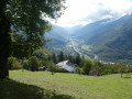
A somewhat challenging, woodland route with magnificent views over the valley.
Circuit de Roche Étroite à Tours-en-Savoie
2.68 mi
+1,585 ft
-1,585 ft
2h 35
Moderate
Departure from Tours-en-Savoie (Savoie)
Une sortie sportive en forêt avec de magnifiques points de vue sur la vallée.
The Pointe de la Grande Journée via the ridges, starting from the Belachat mountain pasture
 5.35 mi
+2,303 ft
-2,283 ft
4h 30
Difficult
Departure from La Bâthie (Savoie)
5.35 mi
+2,303 ft
-2,283 ft
4h 30
Difficult
Departure from La Bâthie (Savoie)
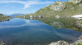
A beautiful circular hike that starts at the Bellachat mountain pastures with Beaufort cheese making, passing by the Croix de la Dormiaz and a path along the summit ridge with breathtaking views of the Albertville basin. Then head to the Pointe de la Grande Journée for stunning 360° views.
Dormiaz Ridge Route
 5.19 mi
+2,224 ft
-2,224 ft
4h 20
Moderate
Departure from La Bâthie (Savoie)
5.19 mi
+2,224 ft
-2,224 ft
4h 20
Moderate
Departure from La Bâthie (Savoie)
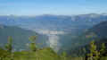
A lovely, unspoilt route that climbs via the Trimpaz Forest track to join an old path where you make your way through rhododendrons and blueberries to reach the Dormiaz ridge.
Breathtaking views over the Albertville basin, the Roche Pourrie, the Aulp de Tours, the Grande Journée and the Bellachat mountain pastures.
The Palatieux Balconies (Lè lôzè du Palatchu)
 2.51 mi
+1,270 ft
-1,260 ft
2h 15
Moderate
Departure from Tours-en-Savoie (Savoie)
2.51 mi
+1,270 ft
-1,260 ft
2h 15
Moderate
Departure from Tours-en-Savoie (Savoie)
A lovely path running along a ridge overlooking the Tarentaise valley with stunning views of Tours-en-Savoie.
Circular route around the Refuge du Soplat des Nants
 2.51 mi
+919 ft
-942 ft
1h 55
Moderate
Departure from Tours-en-Savoie (Savoie)
2.51 mi
+919 ft
-942 ft
1h 55
Moderate
Departure from Tours-en-Savoie (Savoie)
A little-known route in the mid-mountains, ideal for enjoying the cool summer air with a stop at the Refuge du Soplat des Nants and its plateau, perfect for a family picnic.Route only accessible from May to October.
Circular walk on the hills above Grignon via La Baraque Noire.
 7.56 mi
+2,264 ft
-2,264 ft
5h 25
Moderate
Departure from Grignon (Savoie) (Savoie)
7.56 mi
+2,264 ft
-2,264 ft
5h 25
Moderate
Departure from Grignon (Savoie) (Savoie)
This walk takes place, for the most part, in the forest, on paths and trails, and presents no particular difficulty, either technical or in terms of navigation. It offers beautiful panoramic views of the Isère valley, the Bauges, the Beaufortain, etc.