


Refine your search for walks in Espagnac-Sainte-Eulalie
Espagnac-Sainte-Eulalie walks


 On the cliffs of the Célé, starting from Espagnac-Sainte-Eulalie
 Visorando Member
 11.87 mi
 +2,228 ft
 -2,247 ft
 7h 25
7h 25
 Difficult
 Departure from Espagnac-Sainte-Eulalie (Lot)
Between Figeac and its confluence with the Lot, the Célé river crosses a limestone plateau. It winds its way between cliffs offering stunning views of the valley. This hike follows part of the river's course. The elevation gain on this walk will delight the more athletic, but it can also be easily split into two to suit everyone.
Espagnac-Sainte-Eulalie - Sauliac-sur-Célé
 15.03 mi
+2,605 ft
-2,677 ft
9h 10
Difficult
Departure from Espagnac-Sainte-Eulalie (Lot)
15.03 mi
+2,605 ft
-2,677 ft
9h 10
Difficult
Departure from Espagnac-Sainte-Eulalie (Lot)
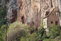
The twenty-eighth stage of the Camino de Santiago. A truly beautiful stage that winds through the Célé Valley. As you follow the river, the rocky cliffs open up to reveal their dark caves, pretty villages, cave dwellings and mills. The Célé Valley undulates along a route that is both wild and poetic, and is sure to fill you with wonder!
Route of the Château des Anglais in Brengues
 Association / Club / Walk leader5.12 mi
+1,184 ft
-1,184 ft
3h 25
Association / Club / Walk leader5.12 mi
+1,184 ft
-1,184 ft
3h 25
 Moderate
Departure from Brengues (Lot)
Moderate
Departure from Brengues (Lot)
This splendid route has many attractions: the Château des Anglais clinging to the cliff, the Priory of Espagnac-Sainte-Eulalie and several superb views of the Célé Valley.
On the limestone plateau at the start of Grèzes
13.13 mi
+1,053 ft
-1,043 ft
6h 55
Difficult
Departure from Grèzes (Lot) (Lot)
This hike, which is not particularly difficult, takes walkers from the village of Grèzes to the cliffs overlooking the River Célé at Espagnac-Sainte-Eulalie. It then heads north to the Bélinac menhir (one of the few menhirs in the department) before returning to the village of Livernon and then Grèzes.
It mostly follows wide limestone paths, lined with moss-covered walls and shaded by oak trees.
Cavarrot and Monteil mills from Boussac
 5.06 mi
+653 ft
-643 ft
2h 55
5.06 mi
+653 ft
-643 ft
2h 55
 Easy
Departure from Boussac (Lot) (Lot)
Easy
Departure from Boussac (Lot) (Lot)
A route that will allow you to discover the landscapes of the Gorges du Célé, the small shaded paths on the Causse and the meadows along the river. It follows small roads and public paths that are often inaccessible to motor vehicles.
Circular Caselles from Marcilhac-sur-Célé
 5.67 mi
+653 ft
-640 ft
3h 10
Easy
Departure from Marcilhac-sur-Célé (Lot)
5.67 mi
+653 ft
-640 ft
3h 10
Easy
Departure from Marcilhac-sur-Célé (Lot)
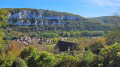
This easy circular route will allow you to discover the pretty village of Marcilhac-sur-Célé and its abbey, the peaceful, shaded banks of the Célé and, higher up, the Quercy limestone plateaus and their rural heritage: dry stone walls, caselles (stone huts), cayrou (stone shelters) and compte-moutons (stone sheep pens).
This route follows theGR®651and thePR®20departmental route of the Caselles de Marcilhac at times.
Route of the Espédaillac farmhouses
 6.49 mi
+276 ft
-259 ft
3h 15
Moderate
Departure from Espédaillac (Lot)
6.49 mi
+276 ft
-259 ft
3h 15
Moderate
Departure from Espédaillac (Lot)
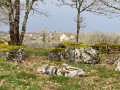
This route takes you on a tour of various farmhouses around the village of Espédaillac, along beautiful paths lined with dry stone walls. This circular route is marked with small signs depicting a hiker in a yellow arrow.
Discovery trail exploring the small heritage sites of Espédaillac and the trees of the Causse.
 4.98 mi
+269 ft
-279 ft
2h 30
Easy
Departure from Espédaillac (Lot)
4.98 mi
+269 ft
-279 ft
2h 30
Easy
Departure from Espédaillac (Lot)
This route introduces you to around twenty trees, shrubs and bushes, as well as some examples of vernacular heritage, commonly referred to as "small heritage", found on the Causse.
During your walk, you can enrich your knowledge by scanning the QR code on each sign to access a detailed information sheet.
Approximately 8 km long, it complements the 2.5 km route (tree discovery) that already exists on Visorando, which starts at the same point.
Sheep trail in Espédaillac
 2.47 mi
+200 ft
-203 ft
1h 20
Easy
Departure from Espédaillac (Lot)
2.47 mi
+200 ft
-203 ft
1h 20
Easy
Departure from Espédaillac (Lot)
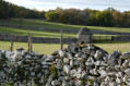
This route invites you to discover sheep and their environment. At each stage, it reveals how sheep farming has shaped the landscapes of the Causse.
Around Cabrone and its legend
 4.55 mi
+354 ft
-328 ft
2h 25
Easy
Departure from Saint-Chels (Lot)
4.55 mi
+354 ft
-328 ft
2h 25
Easy
Departure from Saint-Chels (Lot)
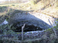
Come and discover Cabrone with its unique views of the Causse and the Tirondel Valley, its dolmens and the legend of the Foun del lout.
The 7 dolmens of the Causse de Saint-Chels
 7.08 mi
+594 ft
-623 ft
3h 45
Moderate
Departure from Saint-Chels (Lot)
7.08 mi
+594 ft
-623 ft
3h 45
Moderate
Departure from Saint-Chels (Lot)
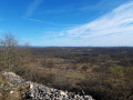
Come and discover the dolmen hike on the Causse de Saint-Chels, in the heart of the Causses du Quercy Regional Nature Park.
 Route of discovery of the commune of Saint-Chels
 15.58 mi
+1,473 ft
-1,457 ft
3 hrs
Moderate
Departure from Saint-Chels (Lot)
15.58 mi
+1,473 ft
-1,457 ft
3 hrs
Moderate
Departure from Saint-Chels (Lot)
Come and discover the small village of Saint-Chels, situated in the heart of the Causses du Quercy Regional Nature Park, via this route. Along the way, you’ll see dolmens, cazelles, wells, springs and unique viewpoints.
Larroque-Toirac and Pech de Bourrou viewpoint
 3.78 mi
+738 ft
-715 ft
2h 25
Easy
Departure from Larroque-Toirac (Lot)
3.78 mi
+738 ft
-715 ft
2h 25
Easy
Departure from Larroque-Toirac (Lot)
A lovely walk in the hills above Larroque-Toirac, offering a different perspective on the Lot valley. Viewpoints on the cliff edge overlooking the Lot valley and a walk on the limestone plateau. A short hike through woodland and open spaces. Suitable footwear is recommended.
Prajoux loop in Cajarc
7.50 mi
+1,512 ft
-1,503 ft
4h 45
Moderate
Departure from Cajarc (Lot)
This circuit in the hills above the Lot Valley offers numerous viewpoints and a chance to discover the landscapes of the Causse.
The Célé Valley in 7 stages
 66.17 mi
+7,936 ft
-8,537 ft
7 days
Moderate
Departure from Faycelles (Lot)
66.17 mi
+7,936 ft
-8,537 ft
7 days
Moderate
Departure from Faycelles (Lot)
The Célé Valley is one of several routes on the Way of St James. Some say it is one of the most beautiful.
From Faycelles, near Figeac, to Cahors, via Espagnac, Saint-Cirq-Lapopie and Vers, this 7-stage hike takes its time around the villages of the Célé and then the Lot. It’s the perfect way to appreciate the monuments, landscapes and people of this very welcoming region.Don’t hesitate: it’s beautiful, friendly and welcoming.Return to the starting point by SNCF bus.
Faycelles – Espagnac
 11.77 mi
+492 ft
-958 ft
5h 50
Moderate
Departure from Faycelles (Lot)
11.77 mi
+492 ft
-958 ft
5h 50
Moderate
Departure from Faycelles (Lot)
From the top of the Faycelles plateau, between the Lot and the Célé rivers, the route leads to the starting point ofthe GR®®651for thefirst descent into the Célé valley.Medieval villages such as Faycelles, Corn and Espagnac, ancient stone castles, churches, chapels and priories: you’re definitely on a route of the Way of St James. The most beautiful one, they say.The route is very shaded and benefits from the coolness of the Célé valley.
Circular around Cajarc through the hills and along the banks of the Lot
3.45 mi
+364 ft
-351 ft
1h 55
Easy
Departure from Cajarc (Lot)
A varied route with a slight climb at the start and a very flat return. The route runs along the edge of the village of Cajarc before climbing into the hills to the Lacaunhe cave. The return journey is along the banks of the Lot, offering coolness and an effortless finish.
The Pech de Gadal Dolmen and Old Sauliac
2.53 mi
+413 ft
-417 ft
1h 30
Easy
Departure from Sauliac-sur-Célé (Lot)
A superb, quick, easy and family-friendly circular. This walk will allow you to discover the beautiful Causse paths lined with dry stone walls, pretty cazelles (stone huts) and the imposing Pech de Gadal dolmen. The return journey is through Old Sauliac on a path clinging to the cliff, offering superb views of the valley.
Sauliac-sur-Célé – Saint-Cirq-Lapopie
 13.80 mi
+2,093 ft
-2,090 ft
8h 10
Difficult
Departure from Sauliac-sur-Célé (Lot)
13.80 mi
+2,093 ft
-2,090 ft
8h 10
Difficult
Departure from Sauliac-sur-Célé (Lot)
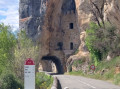
The twenty-ninth stage of the Way of St James. This beautiful stage begins with another climb, leading to the castle-museum of Cuzals with views over the Causses and the Célé valley, before reaching the heights of Cabrerets. The village nestles along the Célé and is dominated by its very impressive castle. This is followed by a visit to the Pech Merle cave, before discovering some of the stage’s most beautiful panoramas, with a lovely view from the Rochecourbe cliff. A lovely descent takes you away from the Célé to reach the Lot, near Bouziès, where the GR®651 ends. It is here that I suggest a detour from the Way of St James, heading upstream towards Saint-Cirq-Lapopie, a fantastic hilltop town and a must-see in the department. Passing through an incredible spot, you’ll have the chance to discover the towpath, a trail carved into the rock and originally used for horses to pass through.
The gariottes of Théminettes
 2.65 mi
+138 ft
-115 ft
1h 20
Easy
Departure from Théminettes (Lot)
2.65 mi
+138 ft
-115 ft
1h 20
Easy
Departure from Théminettes (Lot)
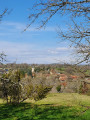
A short walk starting from the village of Théminettes in the heart of the Causses du Quercy Regional Nature Park. You will discover beautiful dry stone huts, imposing low walls, the famous Francès sinkhole (after an eventful underground journey, its waters reappear at Cabouy, near Rocamadour, before flowing into the Dordogne at Lacave) and the village of Théminettes.
The hills above Larnagol
 3.34 mi
+817 ft
-827 ft
2h 15
Easy
Departure from Larnagol (Lot)
3.34 mi
+817 ft
-827 ft
2h 15
Easy
Departure from Larnagol (Lot)
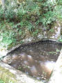
A short walk on the Larnagol plateau where you’ll see springs, caselles and dry-stone walls.
Figeac - Espagnac-Sainte-Eulalie
 15.81 mi
+1,227 ft
-1,316 ft
8 hrs
15.81 mi
+1,227 ft
-1,316 ft
8 hrs
 Very difficult
Departure from Figeac (Lot)
Very difficult
Departure from Figeac (Lot)
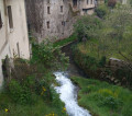
The twenty-seventh stage of the Way of St James. For this stage, you’ll leave theGR®® 65to follow a charming alternative route that will take you off the beaten track and allow you to discover unspoilt nature with breathtaking scenery. Just before the charming little village of Béduer, you’ll leave theGR®® 65 to take the Célé route on theGR®® 651. You’ll pass through the villages of Boussac and Corn, with their old houses typical of the Quercy region and their troglodyte caves. Then, nestled in the bend of the River Célé, you’ll discover Espagnac-Sainte-Eulalie – two authentic villages merged into one. It’s worth noting that the magnificent priory and its exceptional bell tower alone are well worth the detour. It’s not without reason that the area is known as Val Paradis.
The Chemin du Bout du Monde in Larnagol
 5.15 mi
+1,043 ft
-1,020 ft
3h 15
Moderate
Departure from Larnagol (Lot)
5.15 mi
+1,043 ft
-1,020 ft
3h 15
Moderate
Departure from Larnagol (Lot)
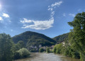
This beautiful hike will take you past the stunning Font Nègre spring to the Bout du Monde (End of the World) viewpoint, which offers magnificent views.
Note dated 25/02/2023: following the closure of the communal path that bypassed the Castanet farmhouse on the left, a new communal path has been created. It bypasses the farmhouse on the right and is now correctly signposted. The description has been amended accordingly.
Orniac Plateau
5.15 mi
+594 ft
-607 ft
2h 55
Easy
Departure from Orniac (Lot)
A lovely circular route where you can enjoy a real Causse atmosphere. Small built heritage sites (the Bourlande spring and wash house, a cazelle, Lake Saint-Namphaise), traditional Causse houses, dry stone walls, open landscapes and views to the horizon, and the pretty little village of Orniac. An easy, family-friendly walk suitable for all seasons but one to avoid at all costs in hot weather!
Circular around the Causse de Cuzals - Vieux-Sauliac
 9.70 mi
+1,568 ft
-1,568 ft
5h 50
Moderate
Departure from Orniac (Lot)
9.70 mi
+1,568 ft
-1,568 ft
5h 50
Moderate
Departure from Orniac (Lot)
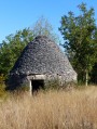
From cazelles to dolmens, above Château de Cuzals and its open-air museum, passing through old Sauliac and its cliffside houses.
From Camp de la Borie to Mas de Renayac
 4.88 mi
+240 ft
-240 ft
2h 25
Easy
Departure from Foissac (Aveyron)
4.88 mi
+240 ft
-240 ft
2h 25
Easy
Departure from Foissac (Aveyron)
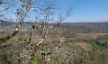
An easy family walk on the Causse plateau between Foissac and the cliffs of the Lot Valley. At the recently restored Mas de Renayac, you’ll enjoy a beautiful view of the Lot Valley, with Larroque-Toirac Castle opposite.
Circular of the lower Célé valley
 12.27 mi
+2,352 ft
-2,352 ft
7h 40
Difficult
Departure from Orniac (Lot)
12.27 mi
+2,352 ft
-2,352 ft
7h 40
Difficult
Departure from Orniac (Lot)
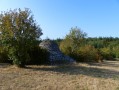
Starting from the hamlet of Les Granges in Orniac, discover the lower Célé valley to its confluence with the Lot. Beautiful view of the cliffs between Bouziès and Saint-Cirq-Lapopie and return via Pech Merle and Cabrerets.
From Foissac to Vernet-le-Bas
 4.67 mi
+564 ft
-564 ft
2h 40
Moderate
Departure from Foissac (Aveyron)
4.67 mi
+564 ft
-564 ft
2h 40
Moderate
Departure from Foissac (Aveyron)
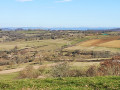
A very scenic route that follows an old path once used by locals to link Foissac to Vernet-le-Bas. This walk alternates between sections through woodland and open areas offering lovely views of the valley.
A route with a bit of an elevation gain but not very difficult on foot. It can also be done by mountain bike.
The cornices of the Causse plateau in Cénevières
10.94 mi
+1,345 ft
-1,345 ft
6h 10
Moderate
Departure from Cénevières (Lot)
This route passes through various high points offering beautiful views of different valleys and the Lot valley.
From the Cornus rock to Trou Madame
 7.11 mi
+850 ft
-833 ft
4h 00
Moderate
Departure from Cénevières (Lot)
7.11 mi
+850 ft
-833 ft
4h 00
Moderate
Departure from Cénevières (Lot)
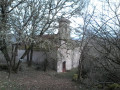
This circular walk, proposed by the Association 'les pierres vivent' and the commune of Cénevières, winds its way from the valley to the causse, sometimes along small wild paths, sometimes along wider paths, and very few roads.
Along the way, you will discover fountains, caselles, dovecotes, chapels and wash houses, as well as the Trou Madame spring and the château, which is open to visitors
Four villages, two castles and a river
 7.61 mi
+909 ft
-922 ft
4h 20
Moderate
Departure from Cénevières (Lot)
7.61 mi
+909 ft
-922 ft
4h 20
Moderate
Departure from Cénevières (Lot)
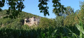
Four villages, each with its own unique character:
- Cénevières and its magnificent castle
- Calvignac, perched on the cliff
- Larnagol, nestled in a hollow in the cliff
- La Toulzanie, a troglodyte village
The River Lot flows between these four villages, with a path climbing up the cliff on the left bank and remaining on the plain on the right bank.
Saint Cirq Lapopie - Cahors
 21.40 mi
+2,418 ft
-2,467 ft
11h 55
Difficult
Departure from Saint-Cirq-Lapopie (Lot)
21.40 mi
+2,418 ft
-2,467 ft
11h 55
Difficult
Departure from Saint-Cirq-Lapopie (Lot)
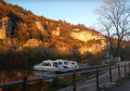
Thirtieth stage of the Way of St James. On this stage, you leave Saint-Cirq-Lapopie via the magnificent towpath and head for Bouziès. You leave theGR®651to follow theGR®36. You climb back up onto the Causse plateau, offering beautiful views of the Lot valley, before descending to Arcambal and its medieval castle. You then follow the tranquil course of the Lot to Cahors.
Old mine and viewpoint over the Lot from Crégols
4.03 mi
+699 ft
-676 ft
2h 30
Moderate
Departure from Crégols (Lot)
This is an easy hike on sharp limestone pavement, offering a beautiful viewpoint with a passage near a chasm, which is not secured, so caution is required for all.
Major geological sites around Saint-Cirq-Lapopie
 13.54 mi
+2,434 ft
-2,441 ft
8h 20
Difficult
Departure from Tour-de-Faure (Lot)
13.54 mi
+2,434 ft
-2,441 ft
8h 20
Difficult
Departure from Tour-de-Faure (Lot)
A very challenging circular walk that takes you on a figure-of-eight route (allowing you to do just part of the route), showcasing both the village of Saint-Cirq-Lapopie and the area’s most beautiful UNESCO-listed geological sites: the Cirque de Vènes, the resurgence and the karstic cave of Crégols, and the Chemin de Halage. With a few sections along cliff ledges and stunning views over the Lot Valley, this route will delight lovers of beautiful landscapes and/or geology.
The banks of the Lot in Saint-Cirq-Lapopie
10.31 mi
+1,083 ft
-1,053 ft
5h 40
Moderate
Departure from Saint-Cirq-Lapopie (Lot)
This walk allows you to discover Saint-Cirq-Lapopie, the River Lot and its towpath, then the limestone plateau above the village. I also suggest a shorter alternative route.
Moulin de Goule Circular Loop
 5.38 mi
+1,093 ft
-1,115 ft
3h 25
Moderate
Departure from Sainte-Colombe (Lot) (Lot)
5.38 mi
+1,093 ft
-1,115 ft
3h 25
Moderate
Departure from Sainte-Colombe (Lot) (Lot)
This walk through undulating terrain will take you along streams to the ridgelines, offering sweeping views of the Ségala.
According to legend, the locals did not know where to build the church. In a fit of frustration, the mason threw his hammer into the sky. A dove caught it in mid-air and then dropped it. The answer had thus come from the heavens. The image of the dove has often been used by the local council; it appears on the stained-glass windows holding a branch, as well as on the corners of the bell tower.
Saint Cirq Lapopie From La Truffière campsite in Bouziès towpath
 Tourism professional
 8.31 mi
+1,539 ft
-1,526 ft
5h 10
Moderate
Departure from Saint-Cirq-Lapopie (Lot)
8.31 mi
+1,539 ft
-1,526 ft
5h 10
Moderate
Departure from Saint-Cirq-Lapopie (Lot)
Eight-shaped loop through the Cirque de Vènes and the village of Saint-Cirq-Lapopie. Remarkable towpath to Bouziès, then return via the Causse and the Chemin de Croix.
More walks in Espagnac-Sainte-Eulalie
Select a point of interest below: