


Refine your search for walks in Diemtigen
Diemtigen walks


 Seebergsee
 Visorando Member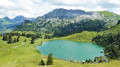
 13.63 mi
 +3,839 ft
 -3,809 ft
 7 hrs
7 hrs
 Very difficult
 Departure from Diemtigen (Canton of Bern)
A typical Bernese Oberland alpine hike featuring one of the region’s most beautiful lakes, starting from the valley and following a small stream and, in places, the road. You climb up through the mountain pastures to reach the Seebergsee; take a short detour to gain some height and enjoy a better view of the lake before heading back down and taking a dip in summer. Then descend via a different path which offers a better panorama but is more challenging towards the end.
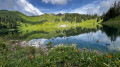
Hinderstockesee - Oberstockesee - Stockhorn
 5.34 mi
+2,087 ft
-2,087 ft
4h 15
5.34 mi
+2,087 ft
-2,087 ft
4h 15
 Moderate
Departure from Erlenbach im Simmental (Canton of Bern)
Moderate
Departure from Erlenbach im Simmental (Canton of Bern)
Starting from Erlenbach and after a cable car ride to Chrindi, this tour will take you to the summit of the Stockhorn, at an altitude of 2,190 metres, passing two beautiful lakes on the way.
Once at the top, you can admire both lakes at the same time.
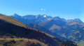
Adelboden - Lenk
 8.63 mi
+2,195 ft
-3,120 ft
5h 55
8.63 mi
+2,195 ft
-3,120 ft
5h 55
 Difficult
Departure from Adelboden (Canton of Bern)
Difficult
Departure from Adelboden (Canton of Bern)
For this fourth stage, you will follow the Via Alpina to Lenk. At the Hahnenmoospass, you can enjoy views of the Wildstrubel and Wildhorn mountains and the Plaine Morte glacier. A long descent will take you to the peaceful village of Lenk in the Simme Valley.
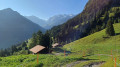
Kiental - Kandersteg
 12.21 mi
+4,098 ft
-3,360 ft
9h 10
Very difficult
Departure from Reichenbach im Kandertal (Canton of Bern)
12.21 mi
+4,098 ft
-3,360 ft
9h 10
Very difficult
Departure from Reichenbach im Kandertal (Canton of Bern)
This second stage will take you from Kiental to Kandersteg. After a fairly challenging climb to Ramslauenen, you will cross the beautiful Horewald forest and then overlook the Kander valley. You will enjoy more views of Lake Thun and the Niesen. You will also have a bird's eye view of the trains on the Lötschberg line. Kandersteg is the station where vehicles board the shuttle trains before the Lötschberg railway tunnel.
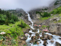
Engstligenalp Waterfall
 3.66 mi
+2,539 ft
-2,552 ft
3h 55
Moderate
Departure from Adelboden (Canton of Bern)
3.66 mi
+2,539 ft
-2,552 ft
3h 55
Moderate
Departure from Adelboden (Canton of Bern)
The Engstligen Falls, near Adelboden in the Bernese Highlands, consist of two waterfalls, Engstligen Fall I and II, with heights of 97 and 165 m respectively. They are listed in the Swiss inventory of landscapes of national importance.
Kandersteg - Selde
 6.89 mi
+4,895 ft
-3,658 ft
7h 25
Moderate
Departure from Kandersteg (Canton of Bern)
6.89 mi
+4,895 ft
-3,658 ft
7h 25
Moderate
Departure from Kandersteg (Canton of Bern)
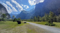
This third stage will take you from Kandersteg to the hamlet of Selde. The Kander river will accompany you throughout this beautiful route. Calm from Kandersteg to Eggeschwand, the Kander can be heard as you climb up through the gorges, where you can enjoy the various waterfalls and cascades. You will then follow it more peacefully through the wide Gastertal valley to Selde.
Lake Oeschinensee from Kandersteg
 4.13 mi
+1,371 ft
-1,358 ft
3h 05
Moderate
Departure from Kandersteg (Canton of Bern)
4.13 mi
+1,371 ft
-1,358 ft
3h 05
Moderate
Departure from Kandersteg (Canton of Bern)
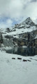
A lovely little hike offering access to Lake Oeschinen, at the mere cost of a bit of a sweat, rather than paying for the cable car. There are no difficulties on this route, apart from the fact that it’s uphill all the way on the way there, but nothing technically challenging in itself.
From Kandersteg Campsite to Lake Oeshinensee
4.64 mi
+1,476 ft
-1,503 ft
3h 25
Moderate
Departure from Kandersteg (Canton of Bern)
This hike makes for a relaxing day out. You can stroll around the lake and enjoy a bite to eat. The starting point, at Camping Kanderseg, is at an altitude of 1,228 metres, whilst Lake Oeshinensee is at 1,590 metres. You then return to the starting point
Engstligenalp - Adelboden
 4.98 mi
+551 ft
-2,520 ft
2h 45
Difficult
Departure from Adelboden (Canton of Bern)
4.98 mi
+551 ft
-2,520 ft
2h 45
Difficult
Departure from Adelboden (Canton of Bern)
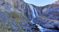
After a night in the wilderness, for this third stage you will leave the Engstlige Alp and descend into the Adelboden valley. This route is enhanced by the famous Engstlige waterfalls. The Engstlige waterfalls plunge 600 metres into the valley, offering an exceptional spectacle. They are a protected site and are the second highest waterfalls in Switzerland. In the evening, you can enjoy the charming resort of Adelboden.
Spiez - Interlaken via the Panorama Rundweg Thunersee
 12.51 mi
+2,215 ft
-2,234 ft
7h 40
Difficult
Departure from Spiez (Canton of Bern)
12.51 mi
+2,215 ft
-2,234 ft
7h 40
Difficult
Departure from Spiez (Canton of Bern)
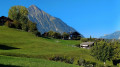
For this fourth stage, you will once again enjoy the lakeside on the Strandweg. The walk along the lake from Spiez to Faulensee is magnificent. The route then climbs from Kratttigen to Meielisalp. You will enjoy numerous views of the lake and have another opportunity to cross the 140-metre-long Leissigen bridge, suspended 60 metres above the Spissibach Gorge.
Spiez - Kiental
 9.59 mi
+2,372 ft
-1,106 ft
6h 30
Difficult
Departure from Spiez (Canton of Bern)
9.59 mi
+2,372 ft
-1,106 ft
6h 30
Difficult
Departure from Spiez (Canton of Bern)
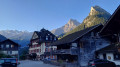
This first stage will take you from Spiez on the shores of Lake Thun to the small valley of Kiental.After following the lake’s shore as far as Faulensee, the climb up to Aeschi offers views of the pyramid-shaped Niesen, which towers over Spiez. You’ll also be impressed by the steep gradient of the funicular railway that climbs up to the Niesen. You’ll appreciate the tranquillity of the village of Kiental.
Spiez - Leukerbad (Rinderhütte) via the Lötschenpass
 44.96 mi
+18,156 ft
-12,448 ft
5 days
Difficult
Departure from Spiez (Canton of Bern)
44.96 mi
+18,156 ft
-12,448 ft
5 days
Difficult
Departure from Spiez (Canton of Bern)
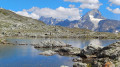
A magnificent route starting from Lake Thun in the canton of Bern and ending at the pretty spa resort of Leukerbad in Valais.
You will cross the Lötsche Glacier and the Lötsche Pass (the highest point of the hike), which marks the border between the cantons of Bern and Valais.
This route offers numerous views of the peaks of the Bernese Oberland and Valais.
Griesalp – Hundshubel
5.09 mi
+4,052 ft
-1,250 ft
5h 50
Difficult
Departure from Reichenbach im Kandertal (Canton of Bern)
Hike with 1,300 metres of elevation gain: be warned, it’s going to be tough. It’s a challenging day, all uphill from the hotel to the campsite. We’ll arrive in the heart of the countryside. We’ll need to set up camp before having a nap and getting out the card games (not forgetting the food).
Schwarenbach - Engstligenalp
 4.39 mi
+2,526 ft
-2,844 ft
4h 15
Difficult
Departure from Leukerbad (Valais)
4.39 mi
+2,526 ft
-2,844 ft
4h 15
Difficult
Departure from Leukerbad (Valais)
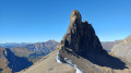
After a night spent in absolute silence, this second stage begins with a pleasant climb to Schwartzgrätli. A fairly exposed section along the Felsenhorn wall will require a little caution, despite the cables and ropes. You will then continue along the Engstlige ridge with the Tschingellochtighorn, with its remarkable relief, in your sights. To conclude the day, you will descend via the Ärtele ridge to Engstligenalp, a superb mountain pasture at the foot of the Wildstrubel.
Sigriswil - Thun via the Panorama Rundweg Thunersee
 7.40 mi
+1,142 ft
-1,959 ft
4h 25
Moderate
Departure from Sigriswil (Canton of Bern)
7.40 mi
+1,142 ft
-1,959 ft
4h 25
Moderate
Departure from Sigriswil (Canton of Bern)
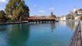
This second stage begins with a highlight: crossing the panoramic bridge at Sigriswil. At 340 metres long and suspended 180 metres above the Guntebach Gorge, you can enjoy a magnificent panorama. The route overlooks the lake for a long time before descending to the town of Thun. This town has many historic buildings. A visit to the historic centre is a must.
Thun - Spiez via the Panorama Rundweg Thunersee
 9.46 mi
+722 ft
-709 ft
5h 00
Moderate
Departure from Thun (Canton of Bern)
9.46 mi
+722 ft
-709 ft
5h 00
Moderate
Departure from Thun (Canton of Bern)
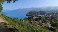
For this third stage, after following the Aare, you will return to the shores of Lake Thun, passing the magnificent Schadau Castle. Climb up the Strättlig hill for panoramic views of the lake. Before descending to Spiez, cross the Kander Gorge via the Strättligsteg suspension bridge. You will arrive in Spiez via its vineyards and castle. This charming village lives peacefully around its marina.
Giferspitz circular route from the Wasserngratbahn
 9.59 mi
+4,423 ft
-4,423 ft
8h 15
Very difficult
Departure from Saanen (Canton of Bern)
9.59 mi
+4,423 ft
-4,423 ft
8h 15
Very difficult
Departure from Saanen (Canton of Bern)
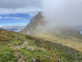
A circular route, including the ascent to the highest peak in the Saanen region, with stunning views of the Vaud, Fribourg and Bernese Alps.
Selde - Lauchernalp
 7.15 mi
+3,937 ft
-2,313 ft
6h 45
Difficult
Departure from Kandersteg (Canton of Bern)
7.15 mi
+3,937 ft
-2,313 ft
6h 45
Difficult
Departure from Kandersteg (Canton of Bern)
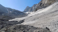
This fourth stage will take you from Selde to Lauchernalp. You will start by crossing the Kander via a suspension bridge. After Gfelalp, you will have a superb view of the Kanderfin glacier, the source of the Kander. The climb to the Lötschenpass crosses a glacier without any difficulty. An equipped passage takes you to the pass, where you can enjoy a break at the hut. You will admire the wide panorama of the 4,000-metre peaks of the Valais Dom, Weisshorn and Matterhorn. At the Lötschen Pass, as at Lauchernalp, you can see the Restipass, which is the planned route for the next day's stage.
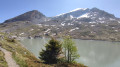
Daubensee tour from the Gemmipass
 3.96 mi
+669 ft
-673 ft
2h 25
3.96 mi
+669 ft
-673 ft
2h 25
 Easy
Departure from Leukerbad (Valais)
Easy
Departure from Leukerbad (Valais)
This circuit is suitable for almost everyone. Before starting your circuit, you can admire the peaks of the Bernese Alps from a footbridge equipped with an orientation table. You can take a leisurely walk around the lake surrounded by mountains. Several options allow you to adapt the circuit to your level.
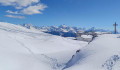
 Daubensee
 3.81 mi
+512 ft
-518 ft
2 hrs
Moderate
Departure from Leukerbad (Valais)
3.81 mi
+512 ft
-518 ft
2 hrs
Moderate
Departure from Leukerbad (Valais)
Daubensee is the largest natural lake in the Canton of Valais. It is approximately 1.6 km long and 300 metres wide. In winter, it is covered by a thick layer of snow and becomes a vast plateau ideal for winter activities. This magnificent hike takes place right on the lake.
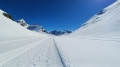
Lämmerenboden
 4.28 mi
+466 ft
-456 ft
2.5 hrs
Moderate
Departure from Leukerbad (Valais)
4.28 mi
+466 ft
-456 ft
2.5 hrs
Moderate
Departure from Leukerbad (Valais)
A superb route across the wide Lämmeren plateau, offering breathtaking views of the Wildstrubel and its glacier.
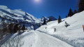
From the Gemmi Pass to Sunnbüel
 5.60 mi
+256 ft
-1,558 ft
3 hrs
Moderate
Departure from Leukerbad (Valais)
5.60 mi
+256 ft
-1,558 ft
3 hrs
Moderate
Departure from Leukerbad (Valais)
This superb route follows the historic mule track from the Gemmi Pass to Sunnbüel. It is one of the few Alpine passes well known to the Swiss that can be traversed on foot in winter.
The Sigriswil Rothorn from Schwanden
 7.08 mi
+3,474 ft
-3,461 ft
6h 15
Difficult
Departure from Sigriswil (Canton of Bern)
7.08 mi
+3,474 ft
-3,461 ft
6h 15
Difficult
Departure from Sigriswil (Canton of Bern)
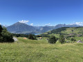
A walk offering magnificent views of Lake Thun and the snow-capped mountains.
Guggershörnli Vreneli-Weg
4.39 mi
+1,079 ft
-1,040 ft
2h 55
Easy
Departure from Guggisberg (Canton of Bern)
A short, easy loop with an ascent of the Guggershornli, which rises to 1,283 metres. There is a beautiful 360° view of the surrounding area from the top of the platform.
Ideal for families, you will encounter peaceful cows. The end of the loop is on a paved road. The route is dotted with signs explaining the legend and love story of little Vreneli.
Guggisberg - Schwarzsee via the Alpenpanorama Weg
 10.49 mi
+1,942 ft
-2,136 ft
6h 30
Moderate
Departure from Guggisberg (Canton of Bern)
10.49 mi
+1,942 ft
-2,136 ft
6h 30
Moderate
Departure from Guggisberg (Canton of Bern)
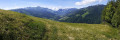
This stage will take you from Guggisberg to Schwarzsee. After a descent into the Laubbach valley, the route climbs again through beautiful forests. After skirting the rocky outcrop of Brönti Egg, you will enjoy a splendid view of the Stockhorn range as far as Gantrisch and Ochsen. At Zollhaus, you will enter the canton of Fribourg and follow the Warme Sense to Schwarzsee.
Lauchernalp - Leukerbad (Rinderhütte)
 9.12 mi
+2,854 ft
-2,011 ft
6h 40
Difficult
Departure from Wiler (Lötschen) (Valais)
9.12 mi
+2,854 ft
-2,011 ft
6h 40
Difficult
Departure from Wiler (Lötschen) (Valais)
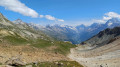
This last stage will take you from Lauchernalp to Leukerbad. The route passes through several mountain pastures, including Kummenalp and Restialp. As you climb up to the Restipass, you will enjoy magnificent views of the Lötschental and the peaks, from the Jungfrau to the Aletschhorn. The Weisshorn will also often be visible. The western slope of the Restipass will take you easily to the upper station of Leukerbad at the Rinderhütte.