


Refine your search for walks in Dennebrœucq
Dennebrœucq walks


 On the plateau between the Lys and the Aa
 Visorando Member
 15.76 mi
 +912 ft
 -922 ft
 8h 00
8h 00
 Difficult
 Departure from Dennebrœucq (Pas-de-Calais)
A long route with a significant elevation gain on paths that are generally in very good condition.
From Reclinghem to Mont d'Erny
11.08 mi
+814 ft
-797 ft
5h 50
Difficult
Departure from Reclinghem (Pas-de-Calais)
Three lovely climbs and a long stroll across the plateau make for a walk surrounded by nature. A very hilly first section, followed by a long stretch along the heights before descending to Reclinghem with magnificent views. The icing on the cake is an optional circular loop I suggest, which brings the total elevation gain to over 300 m.
The Romans Route in Reclinghem
 Local authority4.94 mi
+322 ft
-312 ft
2h 35
Local authority4.94 mi
+322 ft
-312 ft
2h 35
 Moderate
Departure from Reclinghem (Pas-de-Calais)
Moderate
Departure from Reclinghem (Pas-de-Calais)
This route will take you from the Lys valley up to the heights of Artois. It is a signposted trail managed by the Pays de Saint-Omer Urban Community.
Hills and valleys in Coyecques
9.64 mi
+991 ft
-991 ft
5h 20
Moderate
Departure from Coyecques (Pas-de-Calais)
From the Lys Valley to Noir Mont and discovery of the hidden valley of Maisnil.
The route is almost entirely off-road, either on good grassy paths or vaguely paved paths.
Do not look for markings, as there are none.
An uphill battle
 15.98 mi
+1,371 ft
-1,365 ft
8h 35
Difficult
Departure from Fauquembergues (Pas-de-Calais)
15.98 mi
+1,371 ft
-1,365 ft
8h 35
Difficult
Departure from Fauquembergues (Pas-de-Calais)
It's a route that will delight altitude enthusiasts (Carto exploreur and the Visorando app suggest it's as high as 500m). What's more, the views are stunning.
Route slightly modified in November 2019.
All trails are very good as of May 14, 2020 (even if some are very grassy).
From Turkey to Fond Breton (in less than 10 km!)
5.80 mi
+358 ft
-354 ft
3h 00
Moderate
Departure from Renty (Pas-de-Calais)
A short but fairly strenuous route with a steep hill and some very grassy paths.
On 12/08/2025: the start of the trail is once again very overgrown (brambles and nettles). It's passable but it's best to wear trousers or good gaiters and, of course, bring a walking stick or even a pair of secateurs.
Renty Wood
10.46 mi
+492 ft
-479 ft
5h 15
Moderate
Departure from Renty (Pas-de-Calais)
This route, with very little tarmac, follows the Charles Quint trail, to which a short circular loop through unspoilt countryside with lovely views has been added.
Route des sources de Bomy
7.13 mi
+423 ft
-436 ft
3h 40
Moderate
Departure from Bomy (Pas-de-Calais)
A route that allows you to discover Bomy’s heritage: the Rotonde des Tilleuls, the castle, Saint-Vaast Church, the restored vicarage, the mill, as well as the source of the Laquette, the Sainte-Frévisse Fountain and its oratory (picnic spots).
This route is signposted in red, starting from the Rotonde des Tilleuls on the village square.
Around Bomy
 3.48 mi
+102 ft
-112 ft
1h 40
3.48 mi
+102 ft
-112 ft
1h 40
 Easy
Departure from Bomy (Pas-de-Calais)
Easy
Departure from Bomy (Pas-de-Calais)
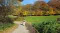
A short walk in the Artois region, particularly pleasant in autumn.
The Bois Capelle
8.23 mi
+299 ft
-299 ft
4h 05
Moderate
Departure from Coupelle-Vieille (Pas-de-Calais)
A route amongst the wind turbines with very little tarmac.
I’ve tried to stick to the ‘wildest’ paths, which may make the walk a little trickier in wet weather.
It’s easy to combine this walk with the one from Fruges to the Bois de Radinghem to make a 28 km route.
From Fruges to the Bois de Radinghem
 9.01 mi
+518 ft
-499 ft
4h 35
Moderate
Departure from Fruges (Pas-de-Calais)
9.01 mi
+518 ft
-499 ft
4h 35
Moderate
Departure from Fruges (Pas-de-Calais)
This varied, not overly difficult route is largely based on the ‘7 Bell Towers’ trail. You’ll therefore come across a few sections marked in yellow.
The Templars’ Well
 7.18 mi
+157 ft
-171 ft
3h 25
Moderate
Departure from Avroult (Pas-de-Calais)
7.18 mi
+157 ft
-171 ft
3h 25
Moderate
Departure from Avroult (Pas-de-Calais)
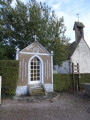
This route is situated on the Artois plateau. The view stretches across the Monts des Flandres. The trail takes its name from a well near the church, dug by the Knights Templar. It is a signposted trail maintained by the Pays de Saint-Omer Urban Community.
From Verchocq to the Vallon de Beaussart
 11.65 mi
+633 ft
-636 ft
5h 55
Moderate
Departure from Verchocq (Pas-de-Calais)
11.65 mi
+633 ft
-636 ft
5h 55
Moderate
Departure from Verchocq (Pas-de-Calais)
Exploring the Vallon de Beaussart and passing close to the Bois de Renty, always in the hope of spotting some wildlife: on 16 October, there were only a few pheasants, but they practically let you stroke them. A real treat for hunters!
There are practically no roads on this route.
The upper Lys valley
 13.55 mi
+673 ft
-666 ft
6h 50
Difficult
Departure from Lisbourg (Pas-de-Calais)
13.55 mi
+673 ft
-666 ft
6h 50
Difficult
Departure from Lisbourg (Pas-de-Calais)
The source of the Lys, the Lugy Mill and a lovely route across the plateau (beautiful views).This walk can be more difficult in wet weather as some paths are regularly churned up.Some tarmac, but on minor roads.
Please note: the path leading up through the Lugy woods after the (5) can be very difficult in wet weather.
Route des Batailles in Thérouanne
5.65 mi
+197 ft
-197 ft
2h 45
Easy
Departure from Thérouanne (Pas-de-Calais)
Thérouanne was the capital of the Gallic tribe known as the ‘Morins’. The town was conquered by Julius Caesar. In the Middle Ages, it was the seat of an important bishopric stretching from the Canche to the Yser. It was completely destroyed following the siege by Charles V’s imperial army in 1553, as it was a French enclave.
This trail pays tribute to the three battles that took place at Enguinegatte during the capture of Thérouanne. It is a signposted trail managed by the Pays de Saint-Omer Urban Community.
From Wismes to the Bois d'Esquerdes via the Montagne d'Elnes
15.89 mi
+1,050 ft
-1,030 ft
8h 15
Difficult
Departure from Wismes (Pas-de-Calais)
A long route with very little tarmac and a superb climb.
There are also a few long straight stretches through the fields that will delight many!
Late July 2020:
- the section between points 6 and 7 is in excellent condition.
- at point 13, after the copse, you cross a maize field for about fifty metres (the path is clearly marked) before finding the track.
Bois, vallée et coteau de Wavrans-sur-l'Aa
12.32 mi
+761 ft
-745 ft
6h 20
Difficult
Departure from Remilly-Wirquin (Pas-de-Calais)
Another route around the Coteau d’Elnes with very little tarmac. Crossing the Bois d’Esquerdes is even more enjoyable, and the long walk along the riverbank is most pleasant. Finally, the section through the hillside, especially in fine weather, is a real delight (even if it is a bit of a struggle!)
From the Aa to the Bois d'Esquerdes
13.22 mi
+699 ft
-709 ft
6h 40
Difficult
Departure from Remilly-Wirquin (Pas-de-Calais)
Another long route in this magnificent region.The double crossing of the Bois d’Esquerdes is very pleasant, even if wildlife seems scarce there.Discover the Cartoucherie site.
The Pihem Ravine and the Fields of Avroult
16.91 mi
+961 ft
-942 ft
7 hrs
 Very difficult
Departure from Remilly-Wirquin (Pas-de-Calais)
Very difficult
Departure from Remilly-Wirquin (Pas-de-Calais)
Another long route to explore the Ravin de Pihem (the path has been remarkably well maintained: it’s superb in early August 2026). You’ll also follow a superb path at a place called ‘Les Champs d’Avroult’ before popping over to have a look at the old quarries at Cléty.
An easy walk that can be split into two sections.
Back to the Elnes hillside
14.03 mi
+1,309 ft
-1,283 ft
7h 35
Difficult
Departure from Remilly-Wirquin (Pas-de-Calais)
This place is so beautiful that it deserves a second route.Another good climb with 2 nice climbs and a maximum of paths and trails.
Difficult in dry weather and very difficult in wet weather.
Les coteaux de la Créquoise
 10.53 mi
+709 ft
-719 ft
5h 30
Moderate
Departure from Créquy (Pas-de-Calais)
10.53 mi
+709 ft
-719 ft
5h 30
Moderate
Departure from Créquy (Pas-de-Calais)
Another option, slightly shorter but still quite challenging, offers views of the Créquoise valley.
The route through the Bois de Créquy is the same as on the other walk: ‘The Bois de Créquy’, but the return journey takes you down the other side, offering a lovely view of the valley.
The Créquy Woods
 13.09 mi
+745 ft
-732 ft
6h 40
Difficult
Departure from Créquy (Pas-de-Calais)
13.09 mi
+745 ft
-732 ft
6h 40
Difficult
Departure from Créquy (Pas-de-Calais)
A long route with virtually no roads, making use of three short-distance hiking trails: the Maury, the Têtards and the Fréniaux.It’s best to go during a dry spell, as the paths can be quite poor in wet weather.Three-quarters of the walk takes place on the edge of or within the woods.
The humpback bridge at the start of Équirre
6.95 mi
+256 ft
-256 ft
3h 25
Moderate
Departure from Équirre (Pas-de-Calais)
Starting from Équirre Castle, which was reduced by half following a fire, this walk takes you to the small village of Prédefin and back via the Lisbourg plain. The paths taken by the GRP® Tour du Ternois Nord are partly cultivated between points (8) and (9), but don't hesitate to cross them as they are often used by farmers.