


Refine your search for walks in Col de Chironne
Col de Chironne walks


 Les Rochers de Chironne / Col de Rousset
 Visorando Member
 8.01 mi
 +1,919 ft
 -1,909 ft
 5h 20
5h 20
 Moderate
 Departure from Chamaloc (Drôme)
The start is at the Col du Rousset, on the Chamaloc side.
If you want to see the Col de Rousset from a different angle, take this hike, which follows a magnificent path carved into the mountainside, with a via ferrata above if you feel so inclined. This path was used by mule drivers to reach Vassieux via the Col de Chironne.
You will also admire the magnificent Chironne rocks overlooking the Chamaloc valley.
From the Col de Rousset to the But de l'Aiglette
 6.14 mi
+1,276 ft
-1,293 ft
3h 55
Moderate
Departure from Chamaloc (Drôme)
6.14 mi
+1,276 ft
-1,293 ft
3h 55
Moderate
Departure from Chamaloc (Drôme)
From the Col de Rousset, a panoramic view of the vultures.
From the But de l'Aiglette, close-up view of these beautiful creatures.
But de Nève and But de l'Aiglette
 6.82 mi
+2,083 ft
-2,077 ft
4h 55
Moderate
Departure from Chamaloc (Drôme)
6.82 mi
+2,083 ft
-2,077 ft
4h 55
Moderate
Departure from Chamaloc (Drôme)
A superb hike offering breathtaking views of the Vercors plateau accompanied by the flight of vultures!
Best done in good weather for unobstructed views.
Loop from Col de Rousset to Refuge du Col de Vassieux
8.02 mi
+1,877 ft
-1,903 ft
5h 20
Moderate
Departure from Chamaloc (Drôme)
Loop starting from the Col du Rousset, setting off along the superb old mule track carved into the hillside, then skirting the plain of the Bergerie de Chironne to reach the Col de Vassieux refuge in the forest. Return via the path overlooking the Diois valley, via the But de l'Aiglette and the Rochers de Chironne.
A hike offering a variety of landscapes, overlooking the Diois valley, without being vertiginous. Some hikers have even spotted vultures here.
 Easy
Easy Walks near Col de Chironne
From the Baraque du Pison to the Cabane de l’Essaure
 Association / Club / Walk leader
 6.53 mi
+1,234 ft
-889 ft
4h 05
Moderate
Departure from Romeyer (Drôme)
6.53 mi
+1,234 ft
-889 ft
4h 05
Moderate
Departure from Romeyer (Drôme)
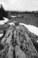
This is the third stage of this Vercors traverse. We’re now reaching the southern part of the Vercors plateau, where the terrain and vegetation make navigation very tricky, but the scenery becomes absolutely stunning!
 Pré Peyret – Col de Vassieux Hut
10.33 mi
+2,047 ft
-2,818 ft
5 hrs
 Difficult
Departure from Gresse-en-Vercors (Isère)
Difficult
Departure from Gresse-en-Vercors (Isère)
The second stage of our Corrençon–Ambel–Corrençon circular route set off from the Cabane de Pré Peyret towards the Col du Rousset and then on to the Cabane du Col de Vassieux.
Pré Peyret Shelter - Chatillon-en-Diois
 12.95 mi
+1,962 ft
-5,259 ft
7h 40
Difficult
Departure from Gresse-en-Vercors (Isère)
12.95 mi
+1,962 ft
-5,259 ft
7h 40
Difficult
Departure from Gresse-en-Vercors (Isère)
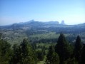
The fifth and final stage of this journey through the Vercors. We set off to tackle the Glandasse, with superb views of the high plateaus, the Veymont, Mont Aiguille and the Drôme Provençale.
Tubanet Hut – Hollowed-Out Tree Trunk Serving as Drinking Trough
16.91 mi
+4,396 ft
-4,511 ft
10 hrs
 Very difficult
Departure from Omblèze (Drôme)
Very difficult
Departure from Omblèze (Drôme)
Stage4 sets off from the Cabane de Tubanet and returns to the high plateaus of the Vercors at the Cabane des Bachassons above Saint-Agnan-en-Vercors.A very long day. It is the longest of the tour.
Pas of hollowed-out tree trunks serving as drinking troughs
 4.95 mi
+1,529 ft
-3,763 ft
3h 35
Difficult
Departure from Chichilianne (Isère)
4.95 mi
+1,529 ft
-3,763 ft
3h 35
Difficult
Departure from Chichilianne (Isère)
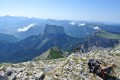
The second day takes you to the highest point of the route: Le Grand Veymont. It offers a magnificent view of the Vercors high plateaus, Mont Aiguille and the valley. There is a good chance of seeing ibex and marmots!
Cabane des Aiguillettes - Corrençon-en-Vercors
15.15 mi
+666 ft
-3,110 ft
7h 35
Difficult
Departure from Gresse-en-Vercors (Isère)
The fourth and final day of the circular route leading from the L'Aiguillette hut at the foot of the Grand Veymont to the car park at the Corrençon-en-Vercors ski stadium, where we will have left a car.
Jasse du Play shelter - Pré Peyret hut
7.16 mi
+512 ft
-528 ft
3h 45
Moderate
Departure from Gresse-en-Vercors (Isère)
The fourth stage of this crossing is also the least physically demanding. Very flat and short, it takes you across vast meadows. But you can spice it up with the Grand Veymont option.
From the Jasse du Play to the Baraque du Pison
 9.47 mi
+735 ft
-928 ft
5h 00
Moderate
Departure from Gresse-en-Vercors (Isère)
9.47 mi
+735 ft
-928 ft
5h 00
Moderate
Departure from Gresse-en-Vercors (Isère)
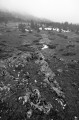
The second stage of the Vercors crossing. Less elevation gain than the previous day, but still a good distance. However, we’re now properly entering the Vercors plateau, and a map, a compass and a good sense of direction are essential, especially when it’s foggy!
From the Ambel Farm to Bouvante le Haut
 8.42 mi
+860 ft
-2,966 ft
6 hrs
Very difficult
Departure from Omblèze (Drôme)
8.42 mi
+860 ft
-2,966 ft
6 hrs
Very difficult
Departure from Omblèze (Drôme)
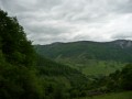
Pastoral plateau, undergrowth, flower-filled meadow. A varied and very pleasant route offering the chance to encounter a rich and unspoilt flora. This route features a very steep descent for the return to Bouvante le Haut via the Col de Rioupeysson.
From Bouvante le Haut to the Ambel Farm
 9.15 mi
+2,927 ft
-843 ft
6h 45
Moderate
Departure from Bouvante (Drôme)
9.15 mi
+2,927 ft
-843 ft
6h 45
Moderate
Departure from Bouvante (Drôme)
The route starts from the village of Bouvante-le-Haut with its distinctive double wash house. The climb up to the Ambel plateau takes you through a succession of refreshing forests, unique woodlands, flower-filled meadows and breathtaking scenery at the Col de la Bataille.