Country:

 City:
City:


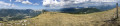
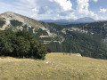
Park at the entrance to the Col de Rousset tunnel when approaching from Die.
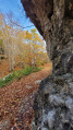
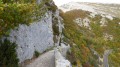
(S/E) Take the path about fifty metres before the tunnel (same access as the Via Ferrata). The upper section, carved into the rock, is visible from the road.
(1) Leave the track by going round the clearing to the left and continue along the ridges of the Rochers de Chironne. Join the path coming from the Col de Chironne.
(2) Follow it to the left. This path is more clearly marked and lined with numerous signposts. Continue along the ridge.
(3) Pass the Col de Vassieux and reach the Col de la Chau, ignoring the paths branching off to the right and left.
(4) Carry on straight ahead and begin the ascent of the But Saint-Genix.
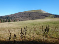
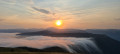
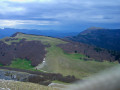
(5) At the summit, take in the superb 360° panorama, then return via the same route to the Col de la Chau.
(4) Take the path on the left which descends through the forest and then follows the bottom of a small valley to a track and the Fontaine du Plainet.
(6) Follow the forest track to the right until you reach a junction of tracks.
(7) Almost directly opposite (north-west, then quickly east), take the track that runs almost level to reach a fork at the bottom of the valley.
(8) Just before the hairpin bend, turn right and, at the bottom of the valley, turn left. The track has one final long, monotonous straight stretch. Almost at the end, ignore a turn-off to the left and reach a hairpin bend.
(9) Leave the main track and continue for a few metres straight ahead. The track then turns right and leads into an alpine pasture. You’ll arrive at the Col de Chironne.
(10) Turn right, heading due south, and rejoin the route taken on the way there.
(1) Continue to the left and head back to the car park at the tunnel entrance (S/E).

 Visorando Member
 Easy
Easy 
 Moderate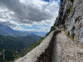
 Very difficult