From Tubanet to the Col de la Portette

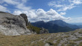
After a night in this idyllic spot, return to the starting point via a slight detour to admire the view from the D199 viewpoint.
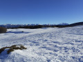
The main difficulty here is linked to weather conditions, which can make it harder to follow the route.

Details

n°20685
Creation:
Last update:
Last review:
–
  • Snowshoeing
    Activity: Snowshoeing
  • ↔
    Distance: 5.33 mi
  • ◔
    Duration according to the author: 5 hrs 
  • ▲
    Difficulty: Moderate

  • ⚐
    Back to start: No
  • ↗
    Ascent: + 125 ft
  • ↘
    Descent: - 912 ft

  • ▲
    Highest point: 4,462 ft
  • ▼
    Lowest point: 3,566 ft

Photos

Description of the walk

(S) Set off from the Tubanet refuge, following the Tubanet path back along which we arrived.
Go past the barrier (or the signs if the barrier is not visible) and continue to the crossroads at the end of Malatra.

(1). Take the forest track that we left behind on the way there and which is now on our left, heading towards the Malatra clearing (north/north-east). The track winds its way down through the Malatra forest. When you reach the first large wildlife information sign, you’ll know you’ve reached the clearing. In summer, this clearing features a fountain with an elongated basin and a picnic table. You’re still on the forest track.

Head to the right of this sign, keeping parallel to it, then follow the track through the fir trees towards the D199 road, heading for the Malatra rock (W). We then reach the D199, where a second large sign, similar to the first, is visible. It is tagged ‘No to the wolf!’. Take the road on the right to climb up to the Belvédère, passing at the foot of Mont des Milleplantes.

(2). A road sign (blue and white zebra stripes) indicating a sharp bend to the right marks the location of the viewpoint. A steep descent after this bend takes you back to the quarry junction.

After the bend, turn left onto the road we took on the way there to return to the car (E).

Waypoints

  1. S : mi 0 - alt. 4,354 ft - Refuge de Tubanet
  2. 1 : mi 1.6 - alt. 4,259 ft - Bout de Malatra junction
  3. 2 : mi 2.51 - alt. 4,167 ft - Below Mont Milleplantes
  4. E : mi 5.33 - alt. 3,576 ft - Car park on the Route de Col de la Bataille

Notes

The stated difficulty relates to finding the routes and visibility, which can make this difficult. As these sections of the route are only used by experienced hikers, there may be no signs of human activity.

The Tubanet refuge is unstaffed. You must bring all your own equipment for sleeping and eating.

Worth a visit

Continuing along this route towards the Gardiol refuge, there are superb panoramic views from the road, over Bouvante le Haut and the rocks overlooking it, as well as across the Rhône valley on very clear days.

Do not go beyond the Gardiol refuge in winter. Access to the Roc de TOULAU is prohibited during the winter months by departmental decree (significant risk of rockfalls, avalanches, etc.).

Other walks in the area

For more walks, use our search engine .

The GPS track and description are the property of this route's author. Please do not copy them without permission.