


Refine your search for walks in Cirque de Mafate
Cirque de Mafate walks


 Bottle Rock
 Tourist office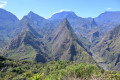
 2.08 mi
 +1,024 ft
 -1,017 ft
 1h 50
1h 50
 Moderate
 Departure from La Possession (Réunion)
This short hike offers magnificent views of the Mafate cirque on one side and the coast of La Possession on the other, with the Dos-d'Àne islet in the foreground. This is the easiest place to get a spectacular, unobstructed view of Mafate.
From Col des Bœufs to La Nouvelle
 7.02 mi
+2,087 ft
-2,073 ft
5h 05
Moderate
Departure from La Possession (Réunion)
7.02 mi
+2,087 ft
-2,073 ft
5h 05
Moderate
Departure from La Possession (Réunion)
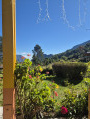
The hike from Col des Bœufs to La Nouvelle offers an accessible route for exploring the Cirque de Mafate. This excursion can be done in one day or over two days if you book a lodge. It allows you to discover the Plaine des Tamarins, the small hamlets of La Nouvelle (considered the capital of Mafate) and Marla.
Îlet des Orangers via the canal
 Visorando Member
 17.14 mi
+4,409 ft
-4,409 ft
8 hrs
17.14 mi
+4,409 ft
-4,409 ft
8 hrs
 Very difficult
Departure from Saint-Paul (La Réunion) (Réunion)
Very difficult
Departure from Saint-Paul (La Réunion) (Réunion)
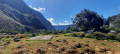
One way to access the Cirque de Mafate is from Sans Souci. The pipeline path may seem long, but the landscape overlooking the Rivière des Galets from a height of 500 m is breathtaking. From above, you can see Deux Bras and the narrow gorge through which the Rivière des Galets flows out of the Cirque de Mafate.
The canal path has a gentle slope. After the water catchment, access to Îlet des Orangers is via a narrow gorge after a steep climb.
Estimated elevation gain: approximately 700 metres.
Ascent to the Col du Taïbit
 Association / Club / Walk leader
 4.02 mi
+2,851 ft
-2,838 ft
4h 20
Moderate
Departure from Cilaos (Réunion)
4.02 mi
+2,851 ft
-2,838 ft
4h 20
Moderate
Departure from Cilaos (Réunion)
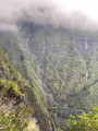
A round trip to enjoy the view at Col du Taïbit. View of the Cirque de Cilaos and, on the other side, the Cirque de Mafate. On the way, you will pass by Îlet des Salazes.
Le Grand Bénare from Le Maïdo
 10.54 mi
+2,431 ft
-2,454 ft
7h 00
10.54 mi
+2,431 ft
-2,454 ft
7h 00
 Difficult
Departure from Saint-Paul (La Réunion) (Réunion)
Difficult
Departure from Saint-Paul (La Réunion) (Réunion)
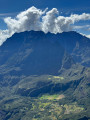
There are several notable peaks on Réunion. Two of them rise above 3,000 metres: Gros Morne and Piton des Neiges. The third is none other than Grand Bénare. The latter is accessible from several points. The routes via Le Grand Bord and La Glacière are the easiest. It is advisable to take the outward route via Le Grand Bord to enjoy the views over Mafate before the clouds roll in. The summit offers a 360-degree view, and the return via La Glacière adds a touch of history.
Roche Plate - Marla
 5.01 mi
+2,680 ft
-968 ft
4h 40
Moderate
Departure from Saint-Paul (La Réunion) (Réunion)
5.01 mi
+2,680 ft
-968 ft
4h 40
Moderate
Departure from Saint-Paul (La Réunion) (Réunion)
Second day of the hike in the Cirque de Mafate.
Le Bélier - Aurére
 5.08 mi
+1,063 ft
-3,458 ft
3h 15
Moderate
Departure from Salazie (Réunion)
5.08 mi
+1,063 ft
-3,458 ft
3h 15
Moderate
Departure from Salazie (Réunion)
First stage in the Cirque de Mafate.
Cayenne - Roche Plate
4.34 mi
+3,583 ft
-1,683 ft
5h 05
Difficult
Departure from La Possession (Réunion)
The passage near the Ravine Grand Mère caldera is breathtaking.
Marla - Cilaos
 2.65 mi
+1,588 ft
-2,687 ft
2h 35
Moderate
Departure from Saint-Paul (La Réunion) (Réunion)
2.65 mi
+1,588 ft
-2,687 ft
2h 35
Moderate
Departure from Saint-Paul (La Réunion) (Réunion)
Third and final day in the Cirque de Mafate, heading back to Cilaos.
The Col du Taïbit from the road from Ilet to Cordes
 4.62 mi
+2,805 ft
-2,805 ft
4h 35
Difficult
Departure from Cilaos (Réunion)
4.62 mi
+2,805 ft
-2,805 ft
4h 35
Difficult
Departure from Cilaos (Réunion)
This hike provides access to the Cirque de Mafate from the Îlet à Cordes road, leading to the Cirque de Cilaos. It is a classic route in this part of the island. It also forms part ofthe GR® R1 andGR® R2 trails. Admittedly, this hike is not for everyone, but the view from the pass is spectacular when the weather permits. We will pass through Îlet des Salazes, known for its herbal tea.
Marla - Roche Plate
 5.15 mi
+1,037 ft
-2,726 ft
3h 15
Moderate
Departure from Saint-Paul (La Réunion) (Réunion)
5.15 mi
+1,037 ft
-2,726 ft
3h 15
Moderate
Departure from Saint-Paul (La Réunion) (Réunion)
Stage 3 of the 6-day route in the Cirque de Mafate.
On this stage, we’ll make our way from Marla to Roche Plate via the superb site of the 3 Roches. It is here that the Galets River disappears into an impressive crevasse.
The Roche Plate site is situated directly below the Maïdo viewpoint.
La Nouvelle - Le Bélier
4.09 mi
+1,926 ft
-1,227 ft
3h 35
Moderate
Departure from La Possession (Réunion)
The final stage of the Mafate circular loop.
Scout Trail starting from Grand Place
 7.28 mi
+4,288 ft
-2,090 ft
7h 05
Difficult
Departure from La Possession (Réunion)
7.28 mi
+4,288 ft
-2,090 ft
7h 05
Difficult
Departure from La Possession (Réunion)
The famous Scout Trail, where the ridge sections offer impressive views of the Mafate cirque.
Roche Plate – La Nouvelle
5.03 mi
+2,923 ft
-1,909 ft
4h 50
Moderate
Departure from Saint-Paul (La Réunion) (Réunion)
A stage made all the more enjoyable by the unforgettable setting of the Trois Roches.
Aurére – Cayenne
 4.46 mi
+1,565 ft
-2,812 ft
3h 25
Moderate
Departure from La Possession (Réunion)
4.46 mi
+1,565 ft
-2,812 ft
3h 25
Moderate
Departure from La Possession (Réunion)
A detour to the centre of Mafate.
From Col des Bœufs to Marla
8.25 mi
+2,451 ft
-2,438 ft
5h 55
Difficult
Departure from La Possession (Réunion)
From the Col des Bœufs, a forest track leads you to the edge of the Cirque de Salazie, where you’ll discover the majestic pass and its breathtaking views over the Cirque de Mafate. Your walk begins on a path carved into the mountainside, offering a dizzying view. You’ll then enter the tamarind forest. After crossing a clearing, you’ll descend towards the pebble-strewn river, discovering a hidden pool along the way. Finally, a short climb takes you to the village of Marla, where you can rest.
Cilaos – La Nouvelle
 6.40 mi
+3,691 ft
-3,163 ft
6h 10
Moderate
Departure from Cilaos (Réunion)
6.40 mi
+3,691 ft
-3,163 ft
6h 10
Moderate
Departure from Cilaos (Réunion)
This is the first stage of a 3-day route in the Cirque de Mafate. It follows well-known trails and takes you to La Nouvelle, the largest îlet in Mafate, through idyllic countryside surrounded by the impressive peaks of Piton des Neiges and the Trois Salazes.
Mafate via the Rivière des Galets
 10.40 mi
+440 ft
-449 ft
5h 10
Moderate
Departure from La Possession (Réunion)
10.40 mi
+440 ft
-449 ft
5h 10
Moderate
Departure from La Possession (Réunion)
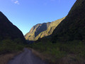
The Cirque de Mafate is accessible from many different points. The flat track is easy to follow and suitable for everyone. Families can come on this walk and turn back at any time. You can even take a dip in the Rivière des Galets. The track runs straight ahead, winding its way between rock faces that grow ever higher as you go.
Le Grand Bénare via the Tamarin Lodge
 9.30 mi
+3,629 ft
-3,629 ft
7 hrs
Very difficult
Departure from Les Trois-Bassins (Réunion)
9.30 mi
+3,629 ft
-3,629 ft
7 hrs
Very difficult
Departure from Les Trois-Bassins (Réunion)
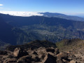
Le Grand Bénare is an iconic peak on the island. The approach via the Tamarin Lodge is much more strenuous than from Le Maïdo. You’ll need calves of steel to tackle the inevitable sharp rocks. The views are spectacular, and this is the case well before you reach the summit. The climb is steady and the elevation gain is quite significant. The route through the Caverne de la Glacière and the various shafts encountered during the ascent add an extra dimension to this hike.
Grand Place via the Augustave path and Aurère
 8.87 mi
+3,615 ft
-5,833 ft
7h 15
Moderate
Departure from Salazie (Réunion)
8.87 mi
+3,615 ft
-5,833 ft
7h 15
Moderate
Departure from Salazie (Réunion)
A beautiful route offering the chance to explore Mafate and its extraordinary and varied views.
Roche Plate – Grand Place
 6.56 mi
+2,897 ft
-4,016 ft
5h 30
Moderate
Departure from Saint-Paul (La Réunion) (Réunion)
6.56 mi
+2,897 ft
-4,016 ft
5h 30
Moderate
Departure from Saint-Paul (La Réunion) (Réunion)
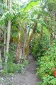
Stage 4 of the 6-day route in the Cirque de Mafate.
On this stage, we set off from Roche Plate and head for Grand Place les Hauts, passing through the hamlets of Les Orangers, Les Lataniers and Cayenne.
At a place known as La Brèche, we’ll cross the path leading up to Le Maïdo.
Mafate North Circular Walk
16.16 mi
+7,904 ft
-7,917 ft
2 days
Difficult
Departure from Salazie (Réunion)
A beautiful circular walk in the north of Mafate offering spectacular and magnificent views as you follow the famous Augustave and Scout trails.
Sans-Souci – Roche Plate
 10.39 mi
+4,117 ft
-2,087 ft
8h 20
Difficult
Departure from Saint-Paul (La Réunion) (Réunion)
10.39 mi
+4,117 ft
-2,087 ft
8h 20
Difficult
Departure from Saint-Paul (La Réunion) (Réunion)
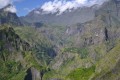
What hiker hasn’t dreamt of walking the Cirque de Mafate on Réunion? This hike is renowned for being challenging, with a considerable elevation gain. But the scenery is spectacular!
Please note: the elevation gain given is an overestimate; it is actually only about 1,200 metres uphill and 800 metres downhill.
Marla – Rivière des Galets
 1.27 mi
+0 ft
-1,056 ft
0h 35
Moderate
Departure from Saint-Paul (La Réunion) (Réunion)
1.27 mi
+0 ft
-1,056 ft
0h 35
Moderate
Departure from Saint-Paul (La Réunion) (Réunion)
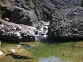
After crossing the Col du Taïbit, which offers a magnificent view of the cirques of Cilaos and Mafate, this challenging descent towards the Rivière des Galets allows you to continue exploring the southern part of the Mafate cirque. This stage can be included in a multi-day route.
From Maïdo to Le Bronchard
 9.44 mi
+4,213 ft
-4,190 ft
6 hrs
Very difficult
Departure from Saint-Paul (La Réunion) (Réunion)
9.44 mi
+4,213 ft
-4,190 ft
6 hrs
Very difficult
Departure from Saint-Paul (La Réunion) (Réunion)
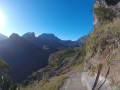
The route to Mafate via Maïdo is one of the most challenging ways to reach Mafate. This fairly strenuous round trip allows you to see the charming village of Roche Plate and go beyond it to Le Bronchard, which offers sweeping views of the surrounding area. The village of Roche Plate is typical of the villages in Mafate with its Creole houses. It is quite spread out and consists of two neighbourhoods. There are numerous lodges in the area.
The tour of the Plaine d'Affouche via Îlet à Guillaume
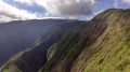 16.08 mi
+5,591 ft
-5,591 ft
12h 15
Difficult
Departure from Saint-Denis (La Réunion) (Réunion)
16.08 mi
+5,591 ft
-5,591 ft
12h 15
Difficult
Departure from Saint-Denis (La Réunion) (Réunion)
Located at an altitude of around 1,400 metres, the Plaine d’Affouche overlooks Îlet à Guillaume and forms an integral part of the Roche Écrite Reserve. Keep your ears and eyes peeled, as you may spot or hear the tuit-tuit, a bird found only on Réunion and exclusively in this part of the island.
Please note: this hike can be completed in under 8 hours. The elevation gain is overestimated: there is approximately 1,500 metres of ascent and descent, not 2,375.