From Col des Bœufs to Marla

From the Col des Bœufs, a forest track leads you to the edge of the Cirque de Salazie, where you’ll discover the majestic pass and its breathtaking views over the Cirque de Mafate. Your walk begins on a path carved into the mountainside, offering a dizzying view. You’ll then enter the tamarind forest. After crossing a clearing, you’ll descend towards the pebble-strewn river, discovering a hidden pool along the way. Finally, a short climb takes you to the village of Marla, where you can rest.

Details

41240034
Creation:
Last update:
Last review:
  • Walking
    Activity: Walking
  • ↔
    Distance: 8.25 mi
  • ◔
    Average duration: 5h 55 
  • ▲
    Difficulty: Difficult

  • ⚐
    Back to start: Yes
  • ↗
    Ascent: + 2,451 ft
  • ↘
    Descent: - 2,438 ft

  • ▲
    Highest point: 6,417 ft
  • ▼
    Lowest point: 4,820 ft

Description of the walk

From Salazie, follow the signs for Grand Îlet, then Le Bélier and the Col des Bœufs. The walk starts at the car park at the pass.

(S/E) Follow the track leading to the Col des Bœufs, keeping to the right all the way to the pass.

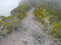
(1) Once at the pass, enjoy the spectacular view over the Cirque de Mafate. The first part of the walk consists of a descent along a ‘staircase’ carved out by the ONF, offering a panoramic view of the cirque’s landscape. Leave the path leading to the Col de Fourche on your left. After about three-quarters of an hour’s descent, the path levels out and you enter a tamarin forest, where the trees bend in mysterious ways.

(2) After passing through the tamarin forest, head towards Marla on the left. You’ll reach the edge of the plateau with a view of Îlet de Marla.

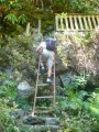
(3) Begin the descent towards the Rivière des Galets. Please be careful: the ground can be slippery in dry weather, and the path can be challenging in all weather conditions. Continue along the descending path to the river.

(4) At the bottom of the descent, you can cross the river by wading across the rocks on the left or use the footbridge if it’s raining. Continue to theGR® junction.

(5) Turn left, then leave the closed path leading to the Kelval Plateau on your left and you’ll soon reach a junction. Turn left and you’ll only have half an hour’s walk left to reach Marla.

(6) You’ll arrive in Marla, where you can rest and enjoy the hospitality of the Mafata locals before retracing your steps back to the starting point (S/E).

Waypoints

  1. S/E : mi 0 - alt. 6,089 ft - Haut Mafate forest road
  2. 1 : mi 0.68 - alt. 6,414 ft - Viewpoint over Mafate
  3. 2 : mi 1.76 - alt. 5,764 ft - Tamarin Forest
  4. 3 : mi 2.48 - alt. 5,741 ft - Viewpoint over Marla
  5. 4 : mi 3.02 - alt. 4,820 ft - Rivière des Galets
  6. 5 : mi 3.15 - alt. 4,823 ft - Junction with the GR trails
  7. 6 : mi 4.12 - alt. 5,331 ft - Marla
  8. S/E : mi 8.25 - alt. 6,089 ft - Haut Mafate forest track

Notes

Hike featuring slippery and technically challenging sections between (3) and (4).
(4) You can use the footbridge in wet weather.

Worth a visit

Always be cautious and plan ahead when you're outdoors. Visorando and the author of this route cannot be held responsible for any accidents occurring on this route.

The GR® and PR® markings are the intellectual property of the Fédération Française de Randonnée Pédestre.

Reviews and comments

5 / 5
Based on 2 reviews

Reliability of the description
5 / 5
Ease of following the route
5 / 5
Route interest
5 / 5
User 29401046

Overall rating : 5 / 5

Date of your route : May 29, 2026
Reliability of the description : ★★★★★ Very good
Ease of following the route : ★★★★★ Very good
Route interest : ★★★★★ Very good
Very busy route : No

A beautiful hike, with several vantage points offering views of the Mafate cirque. We didn’t stay overnight there; we did it all in a day and it went well. Once we arrived at La Nouvelle, we went to Marla (allow 2 hours; there are two routes, one of which is closed (PR25) due to a landslide – don’t go there as it’s impassable). The walk is a bit long, but if you go via the footbridge, it’s well worth the detour! The return journey to the pass is straightforward. In total, it took 7½ hours to do Col des Boeufs – La Nouvelle – Marla – Col des Boeufs, including breaks, of course.

Machine-translated

papywata
papywata

Overall rating : 5 / 5

Date of your route : Nov 13, 2023
Reliability of the description : ★★★★★ Very good
Ease of following the route : ★★★★★ Very good
Route interest : ★★★★★ Very good
Very busy route : Yes

A lovely walk – we didn’t do the return leg (so just the downhill section from Col des Boeufs to Marla).
It’s (very) steep in places, but the path is very well maintained.
There were quite a few people along the whole route.
As for us, it actually took us longer than the estimated time, as we’re very slow going downhill.

Machine-translated

Other walks in the area

For more walks, use our search engine .

The GPS track and description are the property of this route's author. Please do not copy them without permission.