Roche Plate – La Nouvelle

A stage made all the more enjoyable by the unforgettable setting of the Trois Roches.

This walk is part of a multi-day hike: Cirque de Mafate

Details

3295
Creation:
Last update:
Last review:
  • Walking
    Activity: Walking
  • ↔
    Distance: 5.03 mi
  • ◔
    Average duration: 4h 50 
  • ▲
    Difficulty: Moderate

  • ⚐
    Back to start: No
  • ↗
    Ascent: + 2,923 ft
  • ↘
    Descent: - 1,909 ft

  • ▲
    Highest point: 4,846 ft
  • ▼
    Lowest point: 3,589 ft

Description of the walk

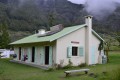
Set off from the lodge (S) heading south; at the southern exit of Roche Plate, take the GRR3 opposite (leave the GRR2 on your right, which goes to La Nouvelle via the Ravin Vallon).
Climb up to the Plateau du Cerf via a series of steep hairpin bends.

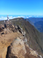
(1). From this point, the slope is less steep. Continue southwards, with a few sections where a brief descent alternates with the ascent. Keeping to the right of the Maïdo caldera, reach the 1347-metre mark. This point is known locally as ‘Le Rempart’.

(2) Descend first along the left bank, then the right bank of the Ravine Chevaquine, before following the left bank of the Rivière des Galets. You will then reach the Trois Roches, where the water has carved out a rocky beach.

(3) Continue along the GRR3 until you reach a crossroads.

(4) Pass the waterfall.

(5) Leave theGR® and take the Plaine aux Sables path on the left (signposted). Cross this plain to the 1515 contour line to join theGR® coming from Marla.

(6) Turn left to head due north towards the large islet of La Nouvelle and the stopover lodge (E).

Waypoints

  1. S : mi 0 - alt. 3,629 ft - Roche Plate lodge - Roche Plate
  2. 1 : mi 0.55 - alt. 4,147 ft - Plateau du Cerf
  3. 2 : mi 1.87 - alt. 4,439 ft - Elevation 1347
  4. 3 : mi 2.49 - alt. 4,026 ft - Trois Roches
  5. 4 : mi 2.57 - alt. 4,088 ft - Cascade des Trois Roches
  6. 5 : mi 3.13 - alt. 4,091 ft - Junction, the Plaine aux Sables path
  7. 6 : mi 4.09 - alt. 4,639 ft - Elevation 1515, junction with the GR
  8. E : mi 5.03 - alt. 4,642 ft - Lodge de la Nouvelle

Notes

Spring water available at Les Trois Roches.

Worth a visit

Les Trois Roches is the spot for a midday snack. However, you must be careful not to venture onto the wet, flat rock at the edge of the waterfall. It is approximately 300 metres high and cannot be seen from above. Venturing too close to the edge is very dangerous.
Incorrect altitude figures at the start of the route.

Always be cautious and plan ahead when you're outdoors. Visorando and the author of this route cannot be held responsible for any accidents occurring on this route.

The GR® and PR® markings are the intellectual property of the Fédération Française de Randonnée Pédestre.

Reviews and comments

4.8 / 5
Based on 3 reviews

Reliability of the description
4.7 / 5
Ease of following the route
4.7 / 5
Route interest
5 / 5
Mariclor
Mariclor

Overall rating : 5 / 5

Date of your route : Aug 01, 2024
Reliability of the description : ★★★★★ Very good
Ease of following the route : ★★★★★ Very good
Route interest : ★★★★★ Very good
Very busy route : No

Day 3 of our hike with our 7- and 9-year-old grandchildren. They weren’t even tired. We stopped for a picnic and a swim at Les Trois Roches – it was lovely. More stunning scenery

Machine-translated

jmgrislain@hotmail.com

Overall rating : 4.7 / 5

Date of your route : Oct 12, 2016
Reliability of the description : ★★★★☆ Good
Ease of following the route : ★★★★★ Very good
Route interest : ★★★★★ Very good

The first half of the walk from Roche Plate to Trois Roches presents no major difficulties, with reasonable ascents and descents.
The Trois Roches site is ideal for a picnic and a nap. Just before you get there, there’s a lovely little bistro – frequented by crows – serving fruit juice and even crêpes!
The second section towards La Nouvelle involves a steep climb before the Plaine des Sables (what sand?), but the rest is a breeze all the way to La Nouvelle. It’s easily manageable as a day trip. Set off at 9.00 am and arrive at 3.30 pm, including a nap.

Machine-translated

reg974
reg974

Overall rating : 4.7 / 5

Date of your route : May 20, 2013
Reliability of the description : ★★★★★ Very good
Ease of following the route : ★★★★☆ Good
Route interest : ★★★★★ Very good

A really enjoyable walk that isn’t too difficult

Machine-translated

Other walks in the area

For more walks, use our search engine .

The GPS track and description are the property of this route's author. Please do not copy them without permission.