Country:

 City:
City:


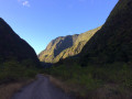

Access: head towards Le Port via the N1 and exit at the Cap Sacré-Cœur junction. Take the first exit if coming from Saint-Paul and the third if coming from Saint-Denis. Take the second exit again at the next roundabout, then the first at the following one. At the bend, carry on straight ahead along Rue de la Liberté and take the first track on the left. At the next junction, turn right onto the Route de Mafate, which is rather rough. Turn onto the first track that descends to the right into the ravine. Park at the end of the track.
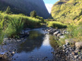
(S/E) Head right and join the track leading to the Cirque de Mafate. Cross the Rivière des Galets for the first time. You’ll need to follow it for nearly 8 kilometres. The river then runs close to the left bank and Ilet Savannah.
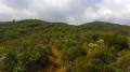
(1) You will then pass close to the Lemarchand Canal, of which only ruins remain. Cross the Rivière des Galets a second and then a third time. The vegetation is rather dry and the route is completely exposed. However, it is flat and provides good training for the climb that follows. The incline gradually increases, reaching an elevation gain of nearly 1,000 metres towards the end of the track.
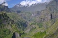
Pass in front of Îlet Malidé, situated on the left bank. On the left bank, the Canalisation des Orangers can be seen 600 metres above. To the left, Piton Pierre Jacques and Piton Sucre are visible 700 metres above the river. Far ahead, the Crête d’Aurère gradually comes into view, followed by the Roche Écrite and the Crête de la Marianne at the end of the track. It takes at least 1 hour 30 minutes’ walk to reach Îlet Flamand, dominated by Îlet Cambour.
Stay on the track until you reach Deux Bras, situated just past Îlet Flamand and after about 10 river crossings.
(2) At this point, it is possible to head off in other directions. Return to the starting point via the same route (S/E)

 Visorando Member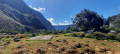
 Very difficult
 Difficult
  Tourist office
 Easy
Easy