The Méandre route in Saint-Nicolas-des-Eaux

A signposted circular walk starting from the Promenade des Estivants in Saint-Nicolas-des-Eaux. Through woodland and along the banks of the Blavet, discover the cultural and natural heritage of the area around the Saint-Nicolas-des-Eaux meander, the Castennec hill and the Blavet.

Details

105551024
Creation:
Last update:
Last review:
  • Walking
    Activity: Walking
  • ↔
    Distance: 2.79 mi
  • ◔
    Average duration: 1h 30 
  • ▲
    Difficulty: Easy

  • ⚐
    Back to start: Yes
  • ↗
    Ascent: + 203 ft
  • ↘
    Descent: - 203 ft

  • ▲
    Highest point: 315 ft
  • ▼
    Lowest point: 128 ft

Photos

Description of the walk

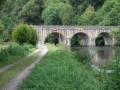
(S/E) From the Promenade des Estivants, walk along the quays following the direction of the current and take the D1 bridge to the right. After the bridge, continue left along the D1 for 50 m.

(1) Leave the road at the second house by taking the path on the left. Continue straight ahead along a sunken track, then follow the Blavet river to the pond.

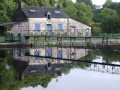
(2) Turn right onto the farm track, then after 30 m, turn left. Continue to the right until you reach the Couarde lock. This is the10th of the 28 locks on the canalised Blavet.

(3) Through the woods, a challenging climb takes you up to the campsite. After the campsite, take the path on the left below the D1 road.

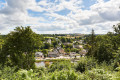
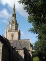
(4) At the Castennec viewpoint, walk alongside the D1 road and pass the Chapel of the Trinity. Dating fromthe 15th century, this chapel was built on the site of the ‘Castel-Noec’ castle, which gave its name to the Castennec site.

(5) About 80 metres past the chapel, take a small path on the left, between two houses. For the more curious, it is possible to reach the Saint-Gildas troglodyte chapel (1 km round trip) by taking the path that descends to the junction with the Castennec and Rimaison routes. Otherwise, keep to the right until you rejoin the D1 road.

(6) After carefully crossing the D1, turn right onto the farm track. Then head down through the woods and take the first turn right then left. Cross the road and follow the Blavet on your left to return to your starting point, turning left to cross the bridge (S/E).

Waypoints

  1. S/E : mi 0 - alt. 138 ft - Office de Tourisme La Vallée du Blavet
  2. 1 : mi 0.18 - alt. 161 ft - House, start of the signposted route along the meander - Blavet (fleuve)
  3. 2 : mi 0.86 - alt. 135 ft - Pond - Blavet (fleuve)
  4. 3 : mi 1.06 - alt. 161 ft - La Couarde Lock
  5. 4 : mi 1.51 - alt. 269 ft - Castennec viewpoint - Point de vue de Castennec
  6. 5 : mi 1.63 - alt. 299 ft - Path between two houses - Chapelle de la trinité (Castennec)
  7. 6 : mi 1.78 - alt. 315 ft - Crossing the D1
  8. S/E : mi 2.79 - alt. 138 ft - Office de Tourisme La Vallée du Blavet

Notes

Public toilets in Saint-Nicolas-des-Eaux (at the Duchesse Anne footbridge, towards the Sabotière lodge) and near the Chapelle de la Trinité.

Picnic area on the Chemin de la Couarde (on the other side of the Promenade des Estivants) near the Saint-Nicolas lock.

Worth a visit

You’ll walk along the Blavet, climb up to the Castennec viewpoint with its orientation table, pass by the Chapel of the Trinity, and you can make a round trip to the semi-troglodyte chapel of Saint-Gildas.

Other walks in the area

For more walks, use our search engine .

The GPS track and description are the property of this route's author. Please do not copy them without permission.