Country:
 City:
City:


(S/E) From the Promenade des Estivants, near the tourist office, walk along the quays following the direction of the current until you reach the D1 bridge on your right.
(1) Cross the bridge and turn right. A very steep path takes you back to the D1 road. Turn right towards the Castennec hill and the Chapelle de la Trinité.
(2) Inhabited since Neolithic times, the Castennec site is a key location from the Gallo-Roman and Medieval periods. The site’s history awaits you at the top of the viewpoint.
About 30 metres past the Chapel of the Trinity, head down to the left into the woods to reach the Chapel of Saint Gildas, nestled within a rocky setting. It houses a 2-metre-long resonant stone which Saint Gildas would strike with a piece of quartz to summon his congregation.
(3) Follow the tree-lined road past the Gamblen Lock, then take a path on the left leading to the village of Bieuzy. Then turn right to reach the village.
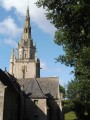
(4) From Bieuzy Church, walk round it on the left and head down to the left to the Bieuzy Fountain.
Surrounded by a paved enclosure, this Flamboyant Gothic-style fountain was built in the mid-16th century.
(5) Turn right onto a road, then take a dirt track on the right. At the junction, keep right onto the path leading to the hamlet known as La Motte
(6) Continue along the track, then, when you reach the road, turn left towards Kerfouler.
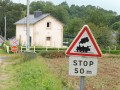
(7) Stay on the road. Watch out for a dangerous stretch: at the Stop sign, turn right, then turn left to reach Kermabon.
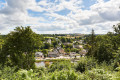
(8) Carry on to the right, then continue straight ahead. At the end of the road, you’ll look out over the Landes du Crano.
This vast expanse of heathland is home to some remarkable species that have adapted to the environment, such as the subalpine warbler, the Eurasian siskin, weasels and a wide variety of butterflies. The site is listed as a Natural Area of Ecological, Faunistic and Floristic Interest (ZNIEFF) and a Sensitive Natural Area (ENS).
(9) At the end of the track, turn left, then right, before turning left towards the Chapelle de la Vraie Croix.
(10) Turn right onto the road. At Kerdrolan, turn left, then take a long farm track on the left. At the fork, keep right, follow the railway line; further on, go under the railway and keep left onto the path leading to Rimaison.
(11) Cross the Blavet and then keep right at the junction. As you approach Kerdréhouarn, turn right, then immediately left, before continuing straight on along the tracks to the village of Kerroc’h.
(12) Turn left, then right to reach the Chapel of Saint Nicodème.
Completed in 1539, this Flamboyant Gothic-style building is one of the most impressive rural chapels in Morbihan. Legend has it that it was built on the very spot chosen by two oxen left to rest. The three-gabled fountain at Saint-Nicodème is unique in Brittany.
(13) Near the picnic area, follow the path down to the right until you reach the towpath, which you should follow to the left, leading to Saint-Nicolas-des-Eaux and the tourist office (S/E).
You can stop off at the picnic areas or in the shops lining the Blavet, or continue your day with a water sport or a visit to the Saint-Nicolas Chapel and Fountain.
 Visorando Member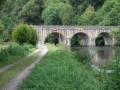
 Moderate
 Easy
Easy 
 Tourist office