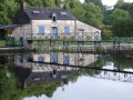
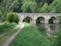
From Saint-Rivalain station to Saint-Bathélemy and the Blavet towpath

A straightforward route that weaves in and out of the narrow railway line, which is still used by a few goods trains carrying plant-based raw materials between Auray and Pontivy.
A leisurely return via the towpath.

Please note: the walk takes place in the commune of Saint-Barthélémy and not in Melrand, as indicated by the software.

Details

786889
Creation:
Last update:
Last review:
  • Walking
    Activity: Walking
  • ↔
    Distance: 7.10 mi
  • ◔
    Average duration: 3h 35 
  • ▲
    Difficulty: Moderate

  • ⚐
    Back to start: Yes
  • ↗
    Ascent: + 344 ft
  • ↘
    Descent: - 351 ft

  • ▲
    Highest point: 285 ft
  • ▼
    Lowest point: 98 ft

Photos

Description of the walk

Car park at the former Saint-Rivalain railway station near the Blavet.

Yellow signposting

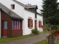
(S/E) From the car park, head back up to the road to cross the railway line; you’ll see Saint-Rivalain station on your right. This railway line is still used for freight transport between Auray and Pontivy. Turn right onto a wide path overlooking the railway line, which curves to the left to reach the entrance to the village of Talhouët Kerdec.

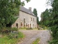
(1) Turn right, walk through this hamlet (with its beautiful stone house) and continue along the small road. At the next junction, turn right towards the hamlet of Kergouav.

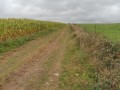
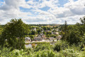
(2) Turn right onto a wide farm track that runs alongside livestock buildings. Continue straight on downhill (lovely view of the Blavet valley and the villages on the other side). Go round a small wood and join a road.

(3) Follow this road to the right and cross the railway line a second time.

(4) Turn left onto a small path that runs alongside the railway line and reach a footbridge that takes you over a stream, passing under the railway line. Continue along this path at the edge of the field.

(5) At the signpost, turn left to head up into a small wood and reach a stream that once powered a mill (the path at this point is not shown on the IGN map).

(6) At the signpost marked ‘Route des écureuils’, turn left and follow the stream. Cross a wetland area via some basic footpaths and continue along the wide, south-east-facing path.

(7) When you can see the bell tower of Saint-Barthélemy, near a shed, veer left then right and cross the hamlet of Le Resto to reach a small road.

Unmarked

(8) Follow this road to the right, then keep right at the first three-way junction. Continue along this small road for about 2.4 km, passing two roads on your right. Pass near the Talhouët mill, now converted into a residential property. Cross the railway line and arrive at the towpath at the Talhouët lock, with its micro power station.

(9) Follow the towpath to the right for about 2.1 km.

(10) Pass the Tréblavet lock and continue along the towpath for a further 1.2 km before reaching the car park where you started (S/E).


Waypoints

  1. S/E : mi 0 - alt. 112 ft - Saint-Rivalain railway station car park - Blavet (fleuve)
  2. 1 : mi 0.65 - alt. 220 ft - Turn right towards Talhouët Kerdec
  3. 2 : mi 1.13 - alt. 266 ft - Service track on the right
  4. 3 : mi 1.8 - alt. 177 ft - Turn right onto the road
  5. 4 : mi 1.98 - alt. 121 ft - Path on the left alongside the railway line
  6. 5 : mi 2.3 - alt. 194 ft - Turn left into the woods
  7. 6 : mi 2.53 - alt. 164 ft - Signpost; turn left along a stream
  8. 7 : mi 3.1 - alt. 256 ft - Towards the restaurant.
  9. 8 : mi 3.41 - alt. 266 ft - Turn right onto the road.
  10. 9 : mi 4.98 - alt. 115 ft - Talhouët Lock
  11. 10 : mi 6.32 - alt. 108 ft - Tréblavet Lock
  12. S/E : mi 7.1 - alt. 112 ft - Saint-Rivalain railway station car park

Notes

Toilets near the old station.

Worth a visit

Reviews and comments

3.7 / 5
Based on 5 reviews

Reliability of the description
3.6 / 5
Ease of following the route
4 / 5
Route interest
3.6 / 5
Periode Kara
Periode Kara

Overall rating : 4 / 5

Date of your route : Oct 03, 2022
Reliability of the description : ★★★★☆ Good
Ease of following the route : ★★★★☆ Good
Route interest : ★★★★☆ Good
Very busy route : No

There is a slight discrepancy in the route description at the finish in Saint-Barthélémy.
There are no toilets near the old station.

Machine-translated

grebonval
grebonval

Overall rating : 4 / 5

Date of your route : Apr 25, 2021
Reliability of the description : ★★★★☆ Good
Ease of following the route : ★★★★☆ Good
Route interest : ★★★★☆ Good
Very busy route : No

It was a lovely walk – we did an extra circular loop by taking the ‘Squirrel Trail’ circular loop after the mill and heading to St Adrien’s bridge to join the towpath.

Machine-translated

FLOCH
FLOCH ★

Good evening, and thank you for this review.
The choice of Melrand was displayed directly by the Visorando software.
I think I’ve worked out where this problem comes from.
The walk starts from Saint-Rivalain-gare, which is indeed located in the commune of Saint-Barthélémy.
Very close by, on the other side of the Blavet, is the village of Saint-Rivalain, which has a chapel that is actually part of Melrand.
The software therefore selected that name without taking into account the word ‘gare’ associated with it.
Yet another mystery of IT.

I’ll clarify this on my entry to avoid any confusion.

Kind regards

Machine-translated

Bigman
Bigman

Overall rating : 3.3 / 5

Date of your route : Mar 21, 2021
Reliability of the description : ★★☆☆☆ Disappointing
Ease of following the route : ★★★★☆ Good
Route interest : ★★★★☆ Good
Very busy route : No

Hello
There is an error in the route description: it is marked as being in Melrand, whereas it is entirely within the municipality of St Barthélémy. A correction would be appreciated
Kind regards

Machine-translated

fifou74
fifou74

Overall rating : 3 / 5

Date of your route : Jul 15, 2019
Reliability of the description : ★★★☆☆ Average
Ease of following the route : ★★★☆☆ Average
Route interest : ★★★☆☆ Average

The start of the walk wasn’t particularly interesting, but it was nice all the same… and I got lost after point 6, where I turned left at the signpost marked ‘Route des Écureuils’, just before it – perhaps I should have turned just after it???,and I walked along the stream through a strip of meadow that had been maintained, but I didn’t see any wide path leading uphill; so I carried on to the junction with the D142… so I didn’t complete the route. A shame, as it was still a nice walk.

Machine-translated

aclk
aclk

Overall rating : 4.3 / 5

Date of your route : Oct 16, 2018
Reliability of the description : ★★★★★ Very good
Ease of following the route : ★★★★★ Very good
Route interest : ★★★☆☆ Average

We went hiking along the southern section, starting from the Tréblavet lock. We had no particular trouble following the path.

Machine-translated

jeanclaudedronetreze
• Edited:

I haven’t done these routes yet

All the more reason to take my walking group to another county next year

Your website is brilliant

Thank you very much

Machine-translated

Other walks in the area

For more walks, use our search engine .

The GPS track and description are the property of this route's author. Please do not copy them without permission.