Country:
 City:
City:


(S/E) From the Promenade des Estivants, walk along the quays following the direction of the current until you reach the D1 bridge over the Blavet on the right.
(1) Cross the bridge and turn right. A very steep path on the left leads you to the Castennec hill and the Chapel of the Trinity. When you reach the D1 road, turn right onto it. Inhabited since Neolithic times, the Castennec site is a key location from the Gallo-Roman and medieval periods. The history of the site awaits you at the top of the viewpoint.
(2) Carry on. About 30 metres past the Chapel of the Trinity, head down to the left into the woods to reach the Chapel of Saint Gildas, nestled within a rocky setting. It houses a 2-metre-long resonant stone which Saint Gildas would strike with a piece of quartz to summon his congregation.
(3) Carry on and follow the tree-lined road to the left; then, after the Gamblen Lock, turn left twice onto a footpath leading to the village of Bieuzy. At the crossroads, keep to the right.
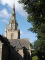
(4) From Bieuzy Church, head down to the left towards the Bieuzy Fountain. Protected by a paved enclosure, this Flamboyant Gothic-style fountain was built in themid-16th century.
(5) Turn right onto a road, then follow a dirt track to the right after the last houses. At the junction, turn right onto the track leading to the hamlet of La Motte.
(6) Carry on straight ahead before turning right and then left towards Kerfouler.
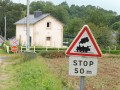
(7) Keep straight ahead. Take care at this dangerous stretch: at the Stop sign, turn right onto the D1, then turn left to reach Kermabon.
(8) Keep to the right, then cross the departmental road with care. At the end of the road, you’ll look out over the Crano moors. This vast moorland area is home to some remarkable, well-adapted species such as the pitchu warbler, the melodious linnet and weasels, as well as a wide variety of butterflies. The site is listed as a Natural Area of Ecological, Faunistic and Floristic Interest (ZNIEFF) and a Sensitive Natural Area (ENS). You’ll come to a crossroads as you leave the woods.
(9) Turn left, then keep to the right. At the Y-junction, turn left, then turn left again three times.
(10) In the Landes du Crano, you’ll find the junction between the Rimaison route (a 21 km route) on the left and the Castennec route on the right, which descends towards the Blavet. Take the latter. Turn right, then take the left-hand path at the next junction. You’ll come out onto the road.
(11) Follow it to the right before turning left.
(12) At a place called Le Strat, take the path on the right before the bridge that takes you across the Blavet. After the bridge, turn right and follow the towpath until you reach Saint-Nicolas-des-Eaux (S/E).

 Tourist office
 Easy
Easy 
 Visorando Member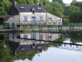
 Moderate