Jervis Refuge circular loop

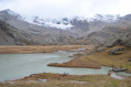
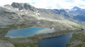
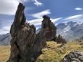
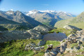
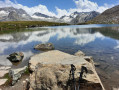
A very pleasant hike offering the chance to visit a refuge nestled in a mountain pasture overlooking the Orco Valley.

Details

1477322
Creation:
Last update:
Last review:
  • Walking
    Activity: Walking
  • ↔
    Distance: 5.32 mi
  • ◔
    Average duration: 4h 15 
  • ▲
    Difficulty: Moderate

  • ⚐
    Back to start: Yes
  • ↗
    Ascent: + 2,100 ft
  • ↘
    Descent: - 2,090 ft

  • ▲
    Highest point: 7,546 ft
  • ▼
    Lowest point: 5,446 ft

Photos

Description of the walk

A few kilometres past the village of Ceresole Reale, park in the large car park before the restaurant.

(S/E) Cross the torrent via the wide footbridge and begin a short climb through the meadow until you reach the track above the Ruisseau du Nel.

(1) Take this track, which after a few hairpin bends becomes a footpath. In the forest, continue along a pleasant path to reach the Mua Villa crossroads in Alpe Degrane.

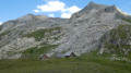
(2) Leave the path leading to Lac de Ceserole on your left and continue to the right. Carry on with a gentle climb, leave the forest and, after crossing the Torrent du Nel, reach the Refuge Jervis.

(3) Begin a circular loop through the mountain pasture to reach the ruins of the old sheepfolds.

(4) Return to the refuge.

(3) Turn left onto the path (sign on a rock) leading to Alpe Truc and head towards it.

(5) Continue the descent alongside a stream, passing old ruined industrial buildings, and reach the crossroads by the chapels further down.

(6) Take the right-hand fork towards Chiapelli di Sotta. Walk past the sheepfolds at Alpe le Rive. Continue through the woodland, then cross the Orco via the footbridge.

(7) Follow the road back to the car park where you started (S/E).

Waypoints

  1. S/E : mi 0 - alt. 5,463 ft - Car park near the restaurant
  2. 1 : mi 0.3 - alt. 5,620 ft - Track
  3. 2 : mi 1.06 - alt. 6,663 ft - Mua Villa junction
  4. 3 : mi 1.82 - alt. 7,359 ft - Jervis Mountain Hut
  5. 4 : mi 2.23 - alt. 7,421 ft - Alpe di Nel
  6. 5 : mi 3.21 - alt. 7,441 ft - Alpe Truc
  7. 6 : mi 3.89 - alt. 6,844 ft - Chiapelli di Sotto junction
  8. 7 : mi 4.95 - alt. 5,512 ft - Road
  9. S/E : mi 5.32 - alt. 5,463 ft - Car park near the restaurant

Notes

There are no springs on this route

Worth a visit

Jervis Refuge, where Italian food is, of course, available – pasta or polenta, for example.
Just a few metres past the car park, by the side of the road, lies the Guido Muzio Refuge, which served as our base camp for this trip to the magnificent Gran Paradiso massif.

Reviews and comments

4.7 / 5
Based on 2 reviews

Reliability of the description
4.5 / 5
Ease of following the route
4.5 / 5
Route interest
5 / 5
Pianfetti
Pianfetti

Overall rating : 4.3 / 5

Date of your route : Oct 23, 2019
Reliability of the description : ★★★★☆ Good
Ease of following the route : ★★★★☆ Good
Route interest : ★★★★★ Very good

A lovely autumn walk. The mountain hut was closed and the weather was a bit mixed.
The climb took 1 hour 25 minutes (1 hour 50 minutes according to the sign)
I did it with my 15-year-old son Montpetit; I’m 74. A lovely day for both of us, despite a rainy return journey.

Machine-translated

jl.bastide
jl.bastide

Overall rating : 5 / 5

Date of your route : Aug 13, 2019
Reliability of the description : ★★★★★ Very good
Ease of following the route : ★★★★★ Very good
Route interest : ★★★★★ Very good

A lovely walk. The climb up to the mountain hut was a bit steep, but what a beautiful view when you get there
Many thanks

Machine-translated

Other walks in the area

For more walks, use our search engine .

The GPS track and description are the property of this route's author. Please do not copy them without permission.