Country:

 City:
City:


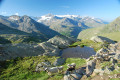
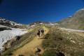
(S) From the Refuge du Carro, rejoin the balcony path you took the previous day on theGRP®® Tour de la Haute-Maurienne.
(1) This time, at the Plan Sec junction, keep to the right towards the Pont de l’Oulietta. Continue on almost level ground to reach Lac du Pys.
(2) Stay on theGRP®®, which is also the Sentier Balcon, to reach Plan des Eaux
(3) After remaining more or less level, theGR®® eventually descends to join the road about 300 metres further down at the Pont de l’Oulietta.
Once on the road (D902), the officialGR®® turns left, following it down a few hairpin bends before climbing back up towards the Pont de la Neige. The suggested route avoids this climb/descent of approximately 200m.
(4) Even if it means walking along the road, take the right-hand side of it and head towards the tunnel.
(5) Take care when passing through the tunnel. There is a footpath on both sides, but it is safer to switch on your headlamps to make yourself clearly visible. Stay on the road heading towards the Pont de la Neige.
(6) Just before reaching the Pont de la Neige, at the top of the small waterfall, look out for the path on the left that descends towards the footbridge. Take this path to cross the Lenta and rejoin theGR®®5(this is where you would have ended up if you’d followed it from the Pont de l’Oulietta).
Then follow theGR®®5to the Col des Fours.
(7) From the pass, head to the Pointe des Fours.
(8) Once at the Pointe, return to the Col des Fours via the same route.
(7) Head down the opposite side to the one you arrived on, towards the very charming Refuge du Fond des Fours, nestled in its pretty valley (E).
 Visorando Member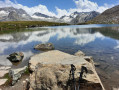
 Moderate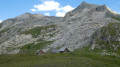
 Easy
Easy  Very difficult