Refine your search for walks in Champdor
Champdor walks


 Champdor Forest Trail
 Visorando Member
 7.44 mi
 +1,234 ft
 -1,204 ft
 4h 30
4h 30
 Moderate
 Departure from Champdor (Ain)
Follow the route guide and the signposts placed along the trail. You’re now setting off to discover the forest’s points of interest.
Col de la Rochette and Col de la Clye Via Gigimont
 4.05 mi
+502 ft
-518 ft
2h 20
4.05 mi
+502 ft
-518 ft
2h 20
 Easy
Departure from Lompnieu (Ain)
Easy
Departure from Lompnieu (Ain)
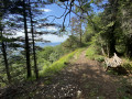
A short, quick and very pleasant walk between two passes and along a ridge (Gigimont).
Vaux marsh from the heights of Nantuy
7.22 mi
+591 ft
-568 ft
3h 50
Moderate
Departure from Hauteville-Lompnes (Ain)
A double circular loop on trails with very different atmospheres. On the heights of Nantuy, beautiful paths through the woods, a short challenging section to reach the top of the Charabotte waterfall and its viewpoint, then a pleasant and relaxing section to discover the Marais de Vaux Nature Reserve with its footbridges.
The 4 Belvédères walk
 11.66 mi
+2,339 ft
-2,359 ft
7h 25
11.66 mi
+2,339 ft
-2,359 ft
7h 25
 Difficult
Departure from Hauteville-Lompnes (Ain)
Difficult
Departure from Hauteville-Lompnes (Ain)
Four viewpoints, of course, are located at the top of the mountains. Expect some steep climbs and significant elevation changes. Be careful, as you will be following mountain bike trails in the opposite direction on part of the route.
The viewpoints are at the end: Planachat, Cornillon, l'Haïea d'Amont, and the highlight of the route, the orientation table at the top of the Hauteville Lompnès ski slopes. There, in good weather and with low UV levels, a magnificent view of the Mont Blanc massif awaits you.
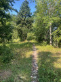
Loop with panoramic views around the Trou de la Marmite
 9.32 mi
+2,106 ft
-2,090 ft
6h 05
Moderate
Departure from Hauteville-Lompnes (Ain)
9.32 mi
+2,106 ft
-2,090 ft
6h 05
Moderate
Departure from Hauteville-Lompnes (Ain)
This hike is based on the 4 belvederes walk. The route has been modified to take into account the opinions of hikers who have given their feedback. In particular, the trail is more precise and the parts considered less interesting have been removed. We are delighted with this new version, which is particularly suitable for hot days (tested during the heatwave of August 2025).The route is mostly through woods and on unpaved paths or tracks. It offers splendid panoramic views from various viewpoints as well as iconic sites: Trou de la Marmite, Notre-Dame de Mazières Chapel, etc. On a clear day, you will have the pleasure of admiring Mont Blanc.
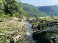
The Marais de Vaux and the Charabotte Waterfall
 8.75 mi
+479 ft
-469 ft
4h 25
Moderate
Departure from Hauteville-Lompnes (Ain)
8.75 mi
+479 ft
-469 ft
4h 25
Moderate
Departure from Hauteville-Lompnes (Ain)
A short walk around the Marais de Vaux lake and its wetlands with the opportunity to admire the Charabotte waterfall.
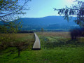
From Étang des Lésines to the Planachat ridges at La Praille
 14.28 mi
+2,612 ft
-2,612 ft
8h 50
Difficult
Departure from Hauteville-Lompnes (Ain)
14.28 mi
+2,612 ft
-2,612 ft
8h 50
Difficult
Departure from Hauteville-Lompnes (Ain)
This is a large circular that allows you to discover the different environments of the Bugiste region. Part of it is dedicated to the Lésines lake and the Marais de Vaux marsh, which can be crossed thanks to the facilities provided. The main part runs along the ridges above Cormaranche, with the climb to Golet Marmier and Planachat, the crossing from Col de la Clye to Col de la Rochette via Gigimont, then the climb to Haiea d'Amont and Cornillon. The descent passes through Notre-Dame de Mazières and Trou de la Marmite.
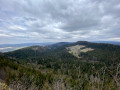
The Planachat viewpoint from Ferme Guichard
 2.96 mi
+787 ft
-827 ft
2h 05
Easy
Departure from Cormaranche-en-Bugey (Ain)
2.96 mi
+787 ft
-827 ft
2h 05
Easy
Departure from Cormaranche-en-Bugey (Ain)
A walk to discover the highest point of Hauteville-Lompnes and its panoramic views.
The Malaval farm and Crêt Maréta, starting from Aranc
 9.52 mi
+1,752 ft
-1,755 ft
5h 55
Moderate
Departure from Aranc (Ain)
9.52 mi
+1,752 ft
-1,755 ft
5h 55
Moderate
Departure from Aranc (Ain)
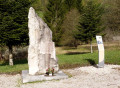
A circular route mainly through woodland and off the marked trail. A route offering a high-up view of the En Jarine marsh, a section along the Malaval (or Mandorne) leat, a walk through the hamlet of Les Pézières (Maquis memorial and viewpoint at the Ferme des Gorges), the Ferme du Marchat, then a return via the Crêt de Maréta and the Trois Croix site. Numerous small red, green and yellow signposts for the local routes along the route.
Overlooking the Gorges de l'Albarine: Lacoux - Nantuy
 11.41 mi
+1,647 ft
-1,640 ft
6h 40
Difficult
Departure from Hauteville-Lompnes (Ain)
11.41 mi
+1,647 ft
-1,640 ft
6h 40
Difficult
Departure from Hauteville-Lompnes (Ain)
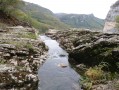
This hike takes you on a loop through the heart of the Bugey region around Hauteville-Lompnes, on the edge of the plateau overlooking the Gorges de l'Albarine, with relatively little elevation gain.
Circular route around Planachat to Hauteville
 5.97 mi
+1,145 ft
-1,142 ft
3h 45
Moderate
Departure from Cormaranche-en-Bugey (Ain)
5.97 mi
+1,145 ft
-1,142 ft
3h 45
Moderate
Departure from Cormaranche-en-Bugey (Ain)
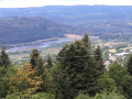
Circular route above Cormaranche around the summit of Planachat through a quiet forest, no doubt ideal for mushroom growth (though we didn’t see any – it wasn’t the right time of year).
Retord Maquis Trail
 11.40 mi
+1,834 ft
-1,808 ft
6h 50
Moderate
Departure from Hotonnes (Ain)
11.40 mi
+1,834 ft
-1,808 ft
6h 50
Moderate
Departure from Hotonnes (Ain)
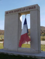
This is a very beautiful hike, featuring landscapes of pastures and beech and fir forests, along easy paths.
Created in partnership with the Museum of Resistance and Deportation in Nantua, it passes by five farms where the maquis settled in 1943-1944, on the Retord plateau between the village of Hotonnes and the Plans d'Hotonnes resort. Five panels describe the history of this maquis.
Château de Sappel and Montagne de l'Avocat as seen from Vieu-d'Izenave
10.01 mi
+1,808 ft
-1,808 ft
6h 10
Moderate
Departure from Vieu-d'Izenave (Ain)
Circular route on the heights of Vieu-d'Izenave (and Corlier), mostly through woodland. Beautiful stretches running alongside or overlooking three streams. Passing Château du Sappel, Montagne de l'Avocat and the Corlier wind farm.
Rocher du Grand Sangle loop starting from Chaley
 9.37 mi
+2,159 ft
-2,152 ft
6h 10
Difficult
Departure from Chaley (Ain)
9.37 mi
+2,159 ft
-2,152 ft
6h 10
Difficult
Departure from Chaley (Ain)
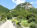
From Chaley, I suggest a beautiful route overlooking the Albarine Valley: the ascent is via the Combe Suzaire, then the route joins the Rocher du Grand Sangle plateau, where there are some beautiful views. The return leg goes through a combe towards the hamlet of La Charabotte, then continues pleasantly near the Albarine River.
There are two difficult sections:- after the point (3), the path is a little chaotic, - between points (7) and (10), the route is not always obvious and there are a few sudden drops to the edge of cliffs.
Visorando app recommended
The Rocher du Grand Sangle
6.22 mi
+1,762 ft
-1,759 ft
4h 25
Moderate
Departure from Chaley (Ain)
Starting from Chaley, in the Albarine valley, climb to the top of the Rocher du Grand Sangle, which offers a beautiful view of the gorges.
There is a longer but more difficult loop that I have unpublished , which can be seen here, with the latest review
The Crêt du Nu / Retord Plateau
 9.02 mi
+1,211 ft
-1,207 ft
5h 10
Moderate
Departure from Hotonnes (Ain)
9.02 mi
+1,211 ft
-1,207 ft
5h 10
Moderate
Departure from Hotonnes (Ain)
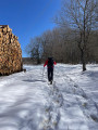
An easy loop along Retord Plateau taking you past the "Gouffre de la Bauche" sinkhole and the "Crêt du Nu" viewpoint.
Circular route in Valromey via the Pont and Puits des Tines
 11.07 mi
+1,624 ft
-1,621 ft
6h 30
Moderate
Departure from Sutrieu (Ain)
11.07 mi
+1,624 ft
-1,621 ft
6h 30
Moderate
Departure from Sutrieu (Ain)
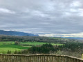
This circular route straddling the Séran river is at a moderate altitude and therefore accessible in all seasons. It combines a forest trail with a more open environment, passing by some remarkable sites in Valromey: the Pont des Tines, the Étang des Alliettes, the Belvédère de Châteauneuf and the Puits des Tines.
Circular loop on the Jargoy plateau
 4.59 mi
+719 ft
-719 ft
2h 45
Easy
Departure from Évosges (Ain)
4.59 mi
+719 ft
-719 ft
2h 45
Easy
Departure from Évosges (Ain)
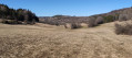
Circular hike starting from the small village of Évosges. Easy hike on a well-maintained path between forests and pastures, with just one slightly steep descent coming down from the plateau (3). A few viewpoints.
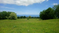
Panorama of Beauregard and Combe Danoi across open fields and paths.
 5.96 mi
+837 ft
-820 ft
3h 30
Moderate
Departure from Hotonnes (Ain)
5.96 mi
+837 ft
-820 ft
3h 30
Moderate
Departure from Hotonnes (Ain)
A varied route with beautiful views of the Alps and karst formations characteristic of these limestone plateaus. Best done in winter when the barbed wire fences are removed. If there is enough snow, the route can be done on snowshoes without any problems.
Circular route on the Retord Plateau
 9.91 mi
+988 ft
-1,010 ft
6h 00
Moderate
Departure from Hotonnes (Ain)
9.91 mi
+988 ft
-1,010 ft
6h 00
Moderate
Departure from Hotonnes (Ain)
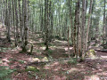
Starting from Les Bergonnes, a circular route with an ascent to the Crêt du Nû via the GR®9 to La Charnay. The first section is wooded with beautiful beech trees. At the Croix de Terments and the Crêt du Nû: climb up to the viewing points for views of the Rhône and the Alps.
The second part of the ascent takes place on the plateau. You then reach the Ferme du Retord. After the farm, head back down via the yellow-marked path towards La Grange à Lucien. Continue the descent towards Pré Brachet, then Gros Frêne and Les Granges Charpy, before finally returning to Les Bergonnes.
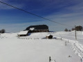
 The Retord Farm at the start of the Bergonnes trail
 9.14 mi
+1,050 ft
-1,047 ft
5 hrs
Difficult
Departure from Hotonnes (Ain)
9.14 mi
+1,050 ft
-1,047 ft
5 hrs
Difficult
Departure from Hotonnes (Ain)
The Retord Plateau is ideal for snowshoeing in wide open spaces with, in places and in good weather, panoramic views of the Alps and Mont Blanc.
You can enjoy a snack in the picnic room at the Retord farm.
A walk on the Retord plateau
 8.96 mi
+883 ft
-876 ft
4h 55
Easy
Departure from Hotonnes (Ain)
8.96 mi
+883 ft
-876 ft
4h 55
Easy
Departure from Hotonnes (Ain)
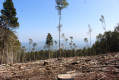
A gentle walk on the Retord plateau.
Circular de la Croix d'Évosges
3.96 mi
+266 ft
-285 ft
2h 05
Easy
Departure from Évosges (Ain)
A pretty little circular loop starting from Étang Buinand and leading to the cliff edges of the Évosges plateau, where you can enjoy superb views of the Albarine valley and the circular village of Oncieu.
Sentier de la Mémoire (Memory Trail) in Évosges
5.66 mi
+843 ft
-837 ft
3h 20
Easy
Departure from Évosges (Ain)
A hike of mainly historical interest: the route is dotted with information panels about the life and fate of resistance fighters from the Ain maquis who were hiding around Évosges No viewpoints, paths mainly in the forest, with some sections on roads.
Circular: Le Chanay - Argis - Évosges
7.24 mi
+1,818 ft
-1,821 ft
4h 55
Moderate
Departure from Tenay (Ain)
Circular on the Évosges plateau allowing you to discover three villages, with many sections in the woods and others in the middle of pastures. The pretty path that climbs from Argis takes you under the Roche de Narse.
Évosges / Oncieu
14.37 mi
+3,392 ft
-3,396 ft
9h 35
Difficult
Departure from Argis (Ain)
Setting out to do the "Plateau de Jargoy Village d'Oncieu" hike described by Chassaignon, we got it wrong at the start, which shortened the route. In the end, having arrived ahead of schedule, we looked for where the "correct" start point was... and set off again for another go.
Loop trail around the Jargoy plateau
 10.89 mi
+2,425 ft
-2,425 ft
7h 05
Difficult
Departure from Argis (Ain)
10.89 mi
+2,425 ft
-2,425 ft
7h 05
Difficult
Departure from Argis (Ain)
Steep hike offering superb views of the Jargoy plateau and the village of Oncieu.
Suerme plateau from Argis
7.99 mi
+1,768 ft
-1,759 ft
5h 15
Moderate
Departure from Argis (Ain)
From Argis, a beautiful, easy climb to the Suerme Plateau. Beautiful unobstructed views along almost the entire route, over the Albarine valley and gorges to the north, east and south, and to the west over the Ain plain.
Update: see reviews dated 02/06/2025 and 25/02/2026 and the description between (10) and (11)
Tenay fresco walk
0.53 mi
+30 ft
-30 ft
0h 15
Easy
Departure from Tenay (Ain)
A very short walk to discover the murals in the village of Tenay, which are very recent. At the time of our visit, some of them will only be finished in time for the village festival on 10 September 2022.
Le Château Narteau depuis Tenay
 Association / Club / Walk leader
 2.44 mi
+1,414 ft
-1,404 ft
2h 20
Moderate
Departure from Tenay (Ain)
2.44 mi
+1,414 ft
-1,404 ft
2h 20
Moderate
Departure from Tenay (Ain)
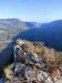
Sommet immanquable de la vallée de l’Albarine, Château Narteau est la belle pyramide rocheuse qui domine Tenay avec ses 746 m. L’accès au sommet rocheux peut se faire depuis le parking de la via ferrata d'Hostiaz mais une belle randonnée consiste à faire le tour de Château Narteau depuis Tenay en montant par le sentier du Cordaret et descendant par le chemin du facteur.