Champdor Forest Trail

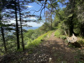
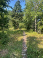
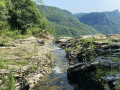
Follow the route guide and the signposts placed along the trail. You’re now setting off to discover the forest’s points of interest.

Details

4269286
Creation:
Last update:
Last review:
  • Walking
    Activity: Walking
  • ↔
    Distance: 7.44 mi
  • ◔
    Average duration: 4h 30 
  • ▲
    Difficulty: Moderate

  • ⚐
    Back to start: Yes
  • ↗
    Ascent: + 1,234 ft
  • ↘
    Descent: - 1,204 ft

  • ▲
    Highest point: 3,780 ft
  • ▼
    Lowest point: 2,726 ft

Photos

Description of the walk

Park in the square in front of Champdor Town Hall.

(S/E) Take the road to the Col de Cuvillat – this is Rue du Château. Walk past the château, then past the oven, until you reach a wash house.

(1) Turn right onto Rue de la Vie de Lompnes. Continue straight on along this street, which becomes a track, until you reach a crossroads at Les Chaumes near a stream.

(2) Take the path on the left, which first leads to the Combe Noire road. Cross this road and, at a bend, join the Col de Cuvillat road.

(3) Take the tarmac track branching off to the right. Start climbing; at the next junction, keep to the track on the right and then cross the meadows. Reach the edge of the woodland, follow it to the left and then enter the woodland. Follow this stony, uphill track to the junction at a ‘chargeoir’ – a large timber storage area.

(4) Turn left. Continue through the woods, passing a few boundary markers here (sign A); see explanations in the Practical Information section.
Then continue along the main path to the Ferrolière junction

(5) OPTION : You can continue straight ahead into the forest for about twenty metres to see a double beech tree (sign B). Then retrace your steps to rejoin the path that climbs to the left.

- If you do not take the option above: turn right onto the path that climbs. After a few hundred metres, you’ll come out onto a tarmac forest track. Turn left onto this track until you reach a crossroads. At the crossroads, turn right. After about 500 m, enter the forest again on the left via a barely visible path.

(6) Walk about ten metres uphill along this inconspicuous path, then about ten metres to the left to discover a Fayard tree (signpost C).
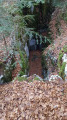
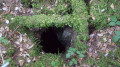
Then return to the main path and, as you come out of the next bend, on your left, you’ll soon reach a chasm (sign D). Take care here if you have children. Continue along the path.

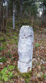
(7) At a wide bend to the right, take the stony path that climbs up to the left. This path then becomes grassy and, after a few hundred metres, you’ll reach another boundary marker with a Savoy cross (signpost E), which is only visible at the very last moment on the left.

(8) Continue along the path to a junction; turn left, then at the next junction a few dozen metres further on, opposite the first-aid post, turn left again.
Note: This is the Praille cross-country skiing area (Hauteville Plateau), which extends into the Champdor-Corcelles area for the red and black trails.
Continue along the white trail, which is almost flat and runs close to the ridge, until you reach a concrete water channel that crosses the path. Climb about twenty metres to the right to find a deep gully (signposted ‘F’). Take care, especially with children.

(9) Return to the path to reach Montfalcon. The path becomes a tarmac forest road. At the next junction, take the forest road straight ahead which leads downhill.

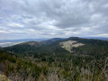
(10) Pass between two small cliffs; the view opens up and the historic village of Corcelles comes into view (sign G). Shortly after this viewpoint, take a path on the right to reach the farms at La Palud (hamlet of Champdor).

(11) Here, you have two options:
- take the shortest and easiest route by heading back down the road to the left towards the village;
- follow the route and take the road that climbs to the right. Pass by the highest farm in La Palud. Shortly after this building, take a path on the left which leads to the Cuvillat road. Follow this road for about 500 m, then take the path that descends to the left. This path, which then becomes a tarmac forest road, leads to the village. After the first house below the cemetery, take the road on the left. At the Rue du Tonkin crossing, turn right towards the bakery, then right again towards the village square (S/E).

Waypoints

  1. S/E : mi 0 - alt. 2,726 ft - Village square
  2. 1 : mi 0.26 - alt. 2,759 ft - Washing-place crossroads
  3. 2 : mi 0.46 - alt. 2,743 ft - Crossing the stream
  4. 3 : mi 0.57 - alt. 2,795 ft - Tarmac path to the right
  5. 4 : mi 1.38 - alt. 3,087 ft - Chargeoir crossroads
  6. 5 : mi 1.75 - alt. 3,205 ft - Twin beech tree
  7. 6 : mi 2.63 - alt. 3,661 ft - Magnifying glass for the twin beech tree
  8. 7 : mi 2.82 - alt. 3,714 ft - Stony path to the left
  9. 8 : mi 3.14 - alt. 3,747 ft - Savoie boundary marker
  10. 9 : mi 4.19 - alt. 3,720 ft - Cornel
  11. 10 : mi 4.99 - alt. 3,448 ft - View of Corcelles
  12. 11 : mi 5.47 - alt. 3,114 ft - La Palud
  13. S/E : mi 7.44 - alt. 2,726 ft - Village square

Notes

Between (4) and (5) along this path for about 200 metres, on your left, slightly higher up, you will see boundary markers (sign A). These marked the boundaries of the Baron de Montillet’s estates; he was the owner of the Château de Champdor. You are therefore in the Baron’s Forest.
(5) Before continuing along the route, enter the forest opposite the path you have just come from, a few metres away.
(5) You will find a twin beech tree (signpost B). This is one of the forest’s curiosities: this beech tree grew from two separate stumps that merge a few metres above the ground.

Worth a visit

The ‘fayard’: this is another name for the beech tree. A burl is a distinctive growth on the trunk or branches of certain trees. It is not a disease. It is a reaction by the tree – an anomaly or peculiarity – caused by an obstruction to the flow of sap, which gives it its rare character. Certain tree species are more suited to this than others, but the nature of the soil and the climate must also be taken into account. The difficulty in sourcing the wood explains the high price of burl wood.

The Savoy boundary marker: Following the Treaty of Lyon (1601) and the Treaty of Auxonne (1612), numerous boundary markers were erected in 1613, including in the Bugey region (France), to mark the new border. The King of France, Henry IV, had acquired the Bresse, the Bugey, the Valromey and the Pays de Gex, ceded by Charles Emmanuel I, Duke of Savoy. Situated on the borders of the territories of Champdor, Hauteville and Champagne, you can see this historic boundary marker bearing the Cross of Savoy. Together with a 1.5-metre-deep ditch, it marked the boundary of the Dukes of Savoy’s possessions. The ditch is also still visible in several places.

La Cornelle: this is the regional name given to a sharp limestone pavement. It is a surface geological formation in limestone rock, created by rainwater runoff dissolving the rock.

Corcelles: this is a very ancient village, undoubtedly the oldest on the Hauteville-Brénod plateau. It has the appearance of a linear village but also comprises several hamlets. For several years now, Corcelles and Champdor have formed the commune of Champdor-Corcelles.

Reviews and comments

3.5 / 5
Based on 6 reviews

Reliability of the description
3.3 / 5
Ease of following the route
3.7 / 5
Route interest
3.5 / 5
MARIEFO28
MARIEFO28

Overall rating : 4 / 5

Date of your route : May 24, 2026
Reliability of the description : ★★★★☆ Good
Ease of following the route : ★★★★☆ Good
Route interest : ★★★★☆ Good
Very busy route : No

A lovely walk in the forest, which was just what we needed on this sweltering day. Unfortunately, despite our best efforts, we couldn’t find the beech tree’s magnifying glass or the first chasm (signs C and D). It’s a shame, as the other points of interest are very interesting and even impressive!

Machine-translated

Commune de Champdor-Corcelles

Thank you for pointing that out. Unfortunately, that’s often the case round here...

Machine-translated

pascal gritti
pascal gritti

Overall rating : 4 / 5

Date of your route : Apr 15, 2024
Reliability of the description : ★★★★☆ Good
Ease of following the route : ★★★★☆ Good
Route interest : ★★★★☆ Good
Very busy route : Yes

It’s a shame……there are lots of places where timber has been felled and the area’s been badly damaged; as usual

Machine-translated

Giorgio
Giorgio

Thank you to the author of this walk for sharing it with us – we really appreciate it.
All the best,
Georges

Machine-translated

Commune de Champdor-Corcelles
• Edited:

Hello, and thank you for your comments, which we have now taken on board.
We would also like to thank you for pointing out that it is best to download the Visorando app to follow this route, and that you can also collect a paper copy of the roadbook from the town hall or the campsite.

Machine-translated

Giorgio
Giorgio

Overall rating : 4.3 / 5

Date of your route : Aug 28, 2023
Reliability of the description : ★★★★☆ Good
Ease of following the route : ★★★★☆ Good
Route interest : ★★★★★ Very good
Very busy route : No

I’ve read in reviews that this route is difficult to follow due to its lack of signposting. It’s worth noting that it’s designed for people who have the Visorando app and, as such, have a reliable tool to help them find their way… We really enjoyed this route. As we did it in hot weather, we appreciated the many shaded areas. Above all, we learnt some very interesting facts, both historically and environmentally. Thank you to the route designer for a lovely time. Just a quick note: at point 5, I think the instructions should say “take the path on the right” rather than on the left. Kind regards,

Machine-translated

randonneur_beta
randonneur_beta

Overall rating : 2.7 / 5

Date of your route : Jul 11, 2022
Reliability of the description : ★★★☆☆ Average
Ease of following the route : ★★★☆☆ Average
Route interest : ★★☆☆☆ Disappointing
Very busy route : No

I did this walk from point 11 to point 1 (in the opposite direction to the description). It’s true that there aren’t any views, as the walk is almost entirely through woodland (which is pleasant if it’s hot).
You’ll need to use the GPS on the Visorando app, as some sections are difficult to find – they’re logging tracks overgrown with vegetation (mainly brambles).
It was still very enjoyable, though, as I came across several species of orchids that were still in bloom.

Machine-translated

Marcel Rivière
Marcel Rivière

Overall rating : 3 / 5

Date of your route : Jun 20, 2022
Reliability of the description : ★★★☆☆ Average
Ease of following the route : ★★★☆☆ Average
Route interest : ★★★☆☆ Average
Very busy route : No

A pleasant walk even in the heat of summer, as you’re always sheltered by the forest. As a result, there are never any views. Luckily I had my GPS, as the route description is very vague.
Great for getting back into shape.
I did enjoy it, though.

Machine-translated

gerlandais
gerlandais

Overall rating : 3 / 5

Date of your route : Jun 13, 2021
Reliability of the description : ★★☆☆☆ Disappointing
Ease of following the route : ★★★★☆ Good
Route interest : ★★★☆☆ Average
Very busy route : No

The only thing this route has going for it is that it’s very shady; otherwise:
There are no views except when you reach the top above Corcelles
No signposts; the A, B, C etc. signs are difficult to find
Why give names to the various numbered points when most of these names do not appear on the IGN map… for example, ‘La Loupe de Fayard’, ‘Le Chargeoir’, etc.

This route gives the impression of having been created by someone familiar with the area, and the only signposts are those for Hauteville, for the cross-country ski trails
Put simply, if you don’t have a GPS, you’re taking a risk…

Machine-translated

Other walks in the area

For more walks, use our search engine .

The GPS track and description are the property of this route's author. Please do not copy them without permission.