Circular route around Planachat to Hauteville

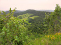
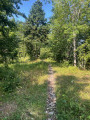
Circular route above Cormaranche around the summit of Planachat through a quiet forest, no doubt ideal for mushroom growth (though we didn’t see any – it wasn’t the right time of year).

Details

12194278
Creation:
Last update:
Last review:
  • Walking
    Activity: Walking
  • ↔
    Distance: 5.97 mi
  • ◔
    Average duration: 3h 45 
  • ▲
    Difficulty: Moderate

  • ⚐
    Back to start: Yes
  • ↗
    Ascent: + 1,145 ft
  • ↘
    Descent: - 1,142 ft

  • ▲
    Highest point: 3,786 ft
  • ▼
    Lowest point: 3,133 ft

Photos

Description of the walk

Park in the bike park car park.

(S/E) From the start car park, take the small tarmac road – which is in poor condition – that climbs northwards. After a sharp right-hand bend, the tarmac ends in front of an aerial.

(1) The path soon takes a sharp left-hand bend and you arrive at Golet Marmier, where a pretty, colourful bench offers a place to rest.

(2) You then descend down the other side and reach a junction with a track.

(3) Follow this track to the right, going slightly uphill, then ignore it and carry on along a track in better condition which descends nicely.

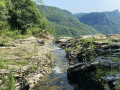
(4) Just before a left-hand bend, you can take a shortcut that brings you back to the track at the bottom of the valley. Follow this forest track until you approach a small stream.

(5) You then take a path which, after crossing the stream, climbs gently through the woods towards the south-east, then turns sharply left and joins the tarmac road leading to the Auberge de la Ferme Guichard.

(6) Turn right and follow the road to the little Col de la Clye, where a path leads to the Planachat viewpoint and, opposite, a trail heads towards the Gigimont ridge. Ignore both of them.

(7) Ignore both of these and carry on along the road. 100 metres further on, you’ll come to a large crossroads: to the left, a forest road heads north towards the Col de la Rochette; to the right, a forest track heads south. We prefer to stay out of the rain by following the tarmac forest road for about 1 km, until we reach a junction where a road heads north towards Valromey.

(8) We carry on straight ahead, heading south on the road, which then gradually turns westwards to reach the Poutet crossroads.

(9) Head west, then turn north-west onto the road towards the Tour de Planachat, and carry on until you reach the houses at the top of Cormaranche, where you leave the road.

(10) Leave the road and take a path heading north, which leads back just above the bike park car park (S/E).

Waypoints

  1. S/E : mi 0 - alt. 3,182 ft - Bike park car park
  2. 1 : mi 1.1 - alt. 3,665 ft - Branch
  3. 2 : mi 1.29 - alt. 3,743 ft - Golet Marmier
  4. 3 : mi 1.39 - alt. 3,648 ft - Trail junction
  5. 4 : mi 1.6 - alt. 3,392 ft - Shortcut
  6. 5 : mi 2.01 - alt. 3,238 ft - Fork in the stream
  7. 6 : mi 2.44 - alt. 3,533 ft - Guichard Farm, on the right
  8. 7 : mi 3 - alt. 3,786 ft - Col de la Clyde
  9. 8 : mi 3.75 - alt. 3,366 ft - Crossroads on the Route du Valromey
  10. 9 : mi 4.82 - alt. 3,314 ft - Poutet crossroads
  11. 10 : mi 5.35 - alt. 3,146 ft - The first houses in Upper Cormaranche
  12. S/E : mi 5.97 - alt. 3,186 ft - Bike park car park

Notes

The only suitable shelter: the Auberge de la Ferme Guichard.

Worth a visit

Auberge de la Ferme Guichard: open from Wednesday lunchtime to Sunday lunchtime.

Reviews and comments

4 / 5
Based on 3 reviews

Reliability of the description
4.3 / 5
Ease of following the route
4.3 / 5
Route interest
3.3 / 5
andomir
andomir

Overall rating : 3.7 / 5

Date of your route : Aug 18, 2025
Reliability of the description : ★★★★☆ Good
Ease of following the route : ★★★★☆ Good
Route interest : ★★★☆☆ Average
Very busy route : No

A circuit with little interest. Very few views apart from the Guichard farm. Nothing but forest... Good for training, but that's about it!

Machine-translated

gridou de  mex
gridou de mex
• Edited:

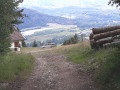
Not the best walk in the Ain, and it’s just as well we didn’t skip the Planachat viewpoint as the itinerary suggested, because it was well worth a look.
The final stretch along the tarmac road isn’t particularly interesting; there are several footpaths, so I think it’s a shame about these sections on the road...

Machine-translated

Sophie GRN
Sophie GRN

Overall rating : 4.7 / 5

Date of your route : Feb 17, 2024
Reliability of the description : ★★★★★ Very good
Ease of following the route : ★★★★★ Very good
Route interest : ★★★★☆ Good
Very busy route : No

A very pleasant walk, starting off through the woods (up to around the Guichard farm). There’s a bit of a climb, but it’s perfectly manageable! I’d recommend a detour to the summit of Planachat – a magnificent viewpoint!
The second part of the walk follows tarmacked forest tracks!

Machine-translated

Greg et Aude
Greg et Aude

Overall rating : 3.7 / 5

Date of your route : Aug 17, 2023
Reliability of the description : ★★★★☆ Good
Ease of following the route : ★★★★☆ Good
Route interest : ★★★☆☆ Average
Very busy route : No

A lovely walk through the trees – a real treat during these heatwaves!
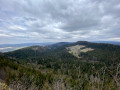
We deviated slightly from the route suggested by PIT. At point 2, we turned off towards the PLANACHAT viewpoint. It would have been such a shame to miss this spot: a panoramic view and a flock of birds of prey soaring above our heads!
We then rejoined the route at point 7 after walking down to the Guichard farm
At point 8, the sign reads: “Carrefour du Bois Perrin sous Pré Bournu”. At this point, you need to turn right
On that note, I think it’s worth pointing out that the route from the GUICHARD farm to point 10 follows a tarmac road, which is admittedly very quiet
At point 10, the path running alongside the houses is not maintained, so you must take the path leading back up into the woods (on the right just before the first house). Then, at the next junction, turn right again before coming out above the car park

Machine-translated

Other walks in the area

For more walks, use our search engine .

The GPS track and description are the property of this route's author. Please do not copy them without permission.