


Refine your search for walks in Champagneux
Champagneux walks

 Loop starting from Grésin
 Visorando Member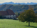
 7.39 mi
 +1,549 ft
 -1,532 ft
 4h 45
4h 45
 Moderate
 Departure from Gresin (Savoie)
This loop starting from the village of Grésin allows you to discover the site where the Italian engineer Galetti installed his harp antenna.
Today, the site on the edge of a cliff offers a beautiful view of the Rhône canalised between the departments of Savoie and Ain.
It then follows a section of the Way of St James.
The route is dotted with shells, of course, but also with stone and metal crosses.
Circular Mont Tournier hike via the Chemin de la Boissière
 5.40 mi
+1,030 ft
-1,010 ft
3h 25
5.40 mi
+1,030 ft
-1,010 ft
3h 25
 Difficult
Departure from Saint-Maurice-de-Rotherens (Savoie)
Difficult
Departure from Saint-Maurice-de-Rotherens (Savoie)
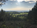
The Mont Tournier area offers numerous combinations of forest trails, which are often signposted and relatively well-used. This circular path deviates from these paths in part to reveal an ancient passage between two levels of the cliff overlooking the Rhône, leading to the Trou de la Mule and the Grotte de Jean Gonet, known only to a select few and a handful of hunters.
Please note: the route is in poor condition and difficult to follow in places: see Practical Information
Mont Gela and Château de Tavollet circular
 6.06 mi
+1,266 ft
-1,263 ft
3h 55
Moderate
Departure from Murs-et-Gélignieux (Ain)
6.06 mi
+1,266 ft
-1,263 ft
3h 55
Moderate
Departure from Murs-et-Gélignieux (Ain)
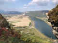
Mont Gela is a micro-range at the southern end of the Bugey, which offers a variety of routes despite its low altitude and limited size. The proposed circular visits its main sites and endeavours to pass by the viewpoints of its limestone ridge. Feasible in all seasons, it requires a good sense of direction, as some forgotten passages are poorly marked on the ground and vegetation sometimes obstructs the path.
Mont Tournier from Saint-Maurice
 8.33 mi
+1,155 ft
-1,145 ft
4h 50
Moderate
Departure from Saint-Maurice-de-Rotherens (Savoie)
8.33 mi
+1,155 ft
-1,145 ft
4h 50
Moderate
Departure from Saint-Maurice-de-Rotherens (Savoie)
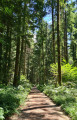
A modest peak in the Savoyard foothills, Mont Tournier offers the opportunity for a pleasant hike to discover the vestiges of the past and the history of the Italian engineer Galetti.
Circular route via Mont Chaffaron from Saint-Maurice-de-Rotherens
 4.64 mi
+955 ft
-932 ft
3h 00
Moderate
Departure from Saint-Maurice-de-Rotherens (Savoie)
4.64 mi
+955 ft
-932 ft
3h 00
Moderate
Departure from Saint-Maurice-de-Rotherens (Savoie)
A circular loop mainly through woodland, venturing slightly off the beaten track and suitable for all seasons.
Circular route from La Lattaz to Mont Tournier from Saint-Maurice-de-Rotherens
 8.00 mi
+1,368 ft
-1,355 ft
4h 50
Moderate
Departure from Saint-Maurice-de-Rotherens (Savoie)
8.00 mi
+1,368 ft
-1,355 ft
4h 50
Moderate
Departure from Saint-Maurice-de-Rotherens (Savoie)
This circular route, suitable for all seasons, takes you along the ridge of the Montagne du Tournier, which runs from the Col de la Lattaz to Mont Tournier (877m), passing through various characteristic spots in the area, with unobstructed views of the surrounding mountain ranges.
Mont Tournier
6.80 mi
+1,201 ft
-1,194 ft
4h 10
Moderate
Departure from Saint-Maurice-de-Rotherens (Savoie)
The Mont Tournier hike is described several times on the site, and this circular route differs from previous descriptions in a few ways. Part of this route is on tarmac roads, but there is very little traffic.
Montagne d’Izieu and Grand Thur from Murs
 5.89 mi
+1,821 ft
-1,798 ft
4h 20
Moderate
Departure from Murs-et-Gélignieux (Ain)
5.89 mi
+1,821 ft
-1,798 ft
4h 20
Moderate
Departure from Murs-et-Gélignieux (Ain)
The Montagne d’Izieu and the Grand Thur are accessible all year round via numerous paths criss-crossing the area. The circular route described here takes you along these paths from the Route de Fay via pleasant wooded trails.
La Croix de Saint-Clair from Izieu
 3.44 mi
+764 ft
-774 ft
2h 15
Moderate
Departure from Izieu (Ain)
3.44 mi
+764 ft
-774 ft
2h 15
Moderate
Departure from Izieu (Ain)
A hike from the picturesque village of Izieu, steeped in history, to a breathtaking viewpoint overlooking the Rhône and its valley.
 Circular route around the confluence of the Guiers and the Rhône
 10.16 mi
+66 ft
-39 ft
1.5 hrs
10.16 mi
+66 ft
-39 ft
1.5 hrs
 Easy
Departure from Saint-Genix-sur-Guiers (Savoie)
Easy
Departure from Saint-Genix-sur-Guiers (Savoie)
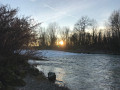
An easy walk with no significant inclines or difficulty, suitable for everyone. The walk takes in three departments, offering families the chance to explore the sometimes unspoilt banks of the Guiers and the Rhône.
Circular of the Hauts de Saint-Genix-sur-Guiers
 8.79 mi
+1,119 ft
-1,089 ft
5h 00
Moderate
Departure from Saint-Genix-sur-Guiers (Savoie)
8.79 mi
+1,119 ft
-1,089 ft
5h 00
Moderate
Departure from Saint-Genix-sur-Guiers (Savoie)
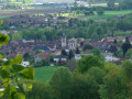
This walk allows you to discover the village of Saint-Genix and climb to its heights to cross a rural area offering beautiful views of the Chartreuse, then follow a section of the Way of St James leading back to the village after crossing a forest.
The main viewpoints in the Bois de Glaize
 5.13 mi
+732 ft
-751 ft
3h 00
Difficult
Departure from Loisieux (Savoie)
5.13 mi
+732 ft
-751 ft
3h 00
Difficult
Departure from Loisieux (Savoie)
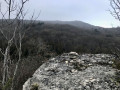
The Bois de Glaize offers a variety of route combinations suitable for all seasons: this circular route takes in the main viewpoints in the area, alternating between marked paths and off-trail sections – some of which are quite wild – where your sense of direction will be put to the test.
Moderator’s note A GPS device is recommended for this walk. Please read the reviews carefully.
Mont de Cordon from La Bruyère
 4.60 mi
+837 ft
-833 ft
2h 50
Moderate
Departure from Brégnier-Cordon (Ain)
4.60 mi
+837 ft
-833 ft
2h 50
Moderate
Departure from Brégnier-Cordon (Ain)
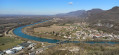
A lovely walk starting from the banks of the Rhône, leading to the Mont de Cordon viewpoint (altitude 400 m) and offering a beautiful panorama of the Rhône and the Izieu mountain. During the climb, you pass a beautiful private castle and on the way back, you can see three caves that were inhabited during prehistoric times: the Bonne Femme cave, an unnamed cave and the Liévrin cave.
The Grand Thur circular loop from Izieu
 3.41 mi
+1,030 ft
-1,030 ft
2h 30
Moderate
Departure from Izieu (Ain)
3.41 mi
+1,030 ft
-1,030 ft
2h 30
Moderate
Departure from Izieu (Ain)
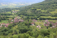
Circular route above Izieu, suitable for all seasons. The route is mainly through forest but offers some views of the Rhône valley and the surrounding mountains.
Bois de Glaize: Saint-Martin Chapel, Recorba and Mont Tournier
 5.12 mi
+988 ft
-984 ft
3h 15
Moderate
Departure from Loisieux (Savoie)
5.12 mi
+988 ft
-984 ft
3h 15
Moderate
Departure from Loisieux (Savoie)
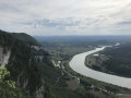
This circular route takes place mainly in the forest and can be completed in any season in half a day, allowing you to visit the characteristic sites and viewpoints of this area crossed by pilgrims on the Way of St James.
Water Trail in Brégnier-Cordon
 4.72 mi
+728 ft
-751 ft
2h 50
Moderate
Departure from Brégnier-Cordon (Ain)
4.72 mi
+728 ft
-751 ft
2h 50
Moderate
Departure from Brégnier-Cordon (Ain)
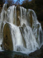
A signposted route taking you through several water-related areas (hillside, stream, marsh) around Glandieu and its waterfall.
Mont Tournier circular loop
10.93 mi
+1,532 ft
-1,529 ft
6h 20
Moderate
Departure from Loisieux (Savoie)
A hike through the heart of the Savoyard foothills in the Mont Tournier massif. Discover sites steeped in history and remarkable views from the many viewing points, with their steep cliffs overlooking the Rhône plain.
Circular walk of Chenevières, via the Roche des Millières
 2.55 mi
+705 ft
-715 ft
1h 45
Easy
Departure from Sainte-Marie-d'Alvey (Savoie)
2.55 mi
+705 ft
-715 ft
1h 45
Easy
Departure from Sainte-Marie-d'Alvey (Savoie)
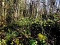
Les Chenevières is a wooded rocky ridge connecting Banchet to Mont Tournier, between the Cols de la Crusille and Cols de la Lattaz. This short circular route, which can be completed in half a day with the family, passes by the Pierre des Millières viewpoint and numerous daffodil sites in spring.