Refine your search for walks in Cabane de Châtillon
Cabane de Châtillon walks


 Le Glandasse from Chatillon-en-Diois via the Fontaine des Tuiles
 Visorando Member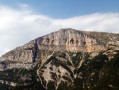
 13.70 mi
 +5,535 ft
 -5,535 ft
 7 hrs
7 hrs
 Very difficult
 Departure from Châtillon-en-Diois (Drôme)
The aim of the route is to reach the summit of Glandasse mountain (known as the Dôme or Pié Ferré - 2,041 metres above sea level) via an alternative routeto the GR®91: Pié de Boeuf, near the Col de Caux (overlooking the Baïn valley), Fontaine des Tuiles (dominated by the Roc d'Ambane). The return journey is via theGR®91.
Discover the Glandasse massif from Châtillon-en-Diois via the GR® 91
 7.82 mi
+4,160 ft
-4,131 ft
7h 15
7.82 mi
+4,160 ft
-4,131 ft
7h 15
 Difficult
Departure from Châtillon-en-Diois (Drôme)
Difficult
Departure from Châtillon-en-Diois (Drôme)
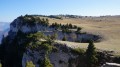
A beautiful hike that takes you to the southern tip of the Vercors plateau and its vast mountain pastures. The end of the route offers superb panoramic views of the Diois and the Cirque d'Archiane.
5-day crossing of the Vercors from Grenoble to Châtillon-en-Diois
 54.45 mi
+10,722 ft
-9,469 ft
5 days
Difficult
Departure from Seyssinet-Pariset (Isère)
54.45 mi
+10,722 ft
-9,469 ft
5 days
Difficult
Departure from Seyssinet-Pariset (Isère)
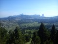
This is a trek across the Vercors via the high plateaus, the wildest and most unspoilt part of the Vercors.
From the north to the south of the Vercors, an 88km hike through spectacular landscapes. You’ll be camping in tents or in the various shelters lining theGR®.
Montagne de Glandasse, long circular loop
 23.36 mi
+6,450 ft
-6,450 ft
12 hrs
Very difficult
Departure from Châtillon-en-Diois (Drôme)
23.36 mi
+6,450 ft
-6,450 ft
12 hrs
Very difficult
Departure from Châtillon-en-Diois (Drôme)
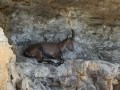
A long circular walk starting from the picturesque Mediterranean village of Châtillon-en-Diois. Fabulous scenery over the Glandasse and the Vercors High Plateaus, with a bit of a challenge when it comes to navigation. It is possible to spread the walk over two days by stopping for the night near the magnificent Pas de l’Aiguille.
The Dôme du Glandasse via Valcroissant Abbey and back via Châtillon
 18.70 mi
+7,785 ft
-7,730 ft
10 hrs
Very difficult
Departure from Die (Drôme)
18.70 mi
+7,785 ft
-7,730 ft
10 hrs
Very difficult
Departure from Die (Drôme)
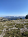
A challenging and demanding hike, with superb views of all the surrounding mountain ranges: Vercors, Dévoluy, Écrins, Mont Ventoux and the Trois Becs. Guaranteed wildlife sightings: marmots, ibex...A change of scenery and a sense of well-being...
⚠️ 21/04/2026: 2 km before the Abbey, the road is closed due to a landslide; it is currently not possible to access the start of this hike.
Pré Peyret Shelter - Chatillon-en-Diois
12.95 mi
+1,962 ft
-5,259 ft
7h 40
Difficult
Departure from Gresse-en-Vercors (Isère)
The fifth and final stage of this journey through the Vercors. We set off to tackle the Glandasse, with superb views of the high plateaus, the Veymont, Mont Aiguille and the Drôme Provençale.
Walks near Cabane de Châtillon
Châtillon-en-Diois (Le Beffroi) – Die (SNCF station), through the vineyards
 11.32 mi
+541 ft
-1,152 ft
5h 40
11.32 mi
+541 ft
-1,152 ft
5h 40
 Moderate
Departure from Châtillon-en-Diois (Drôme)
Moderate
Departure from Châtillon-en-Diois (Drôme)
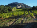
This lovely walk allows visitors staying in Châtillon-en-Diois to reach Die on foot, passing through vineyards and walnut groves situated in the foothills of the Glandasse, the southern outcrop of the Vercors overlooking the Drôme valley and the Baronnies.
The route allows time to appreciate the uniformity of this geographical landscape, which characterises the upper Drôme and its tributary, the Bez.
From the Cabane de l’Essaure to Clelles station
 Association / Club / Walk leader
 5.54 mi
+174 ft
-2,858 ft
2h 40
5.54 mi
+174 ft
-2,858 ft
2h 40
 Easy
Departure from Treschenu-Creyers (Drôme)
Easy
Departure from Treschenu-Creyers (Drôme)
The fourth and final stage of the Vercors crossing. We leave the plateau to descend via Chichilianne to the foot of Mont Aiguille. Choosing Clelles station as the end point for this crossing means you can do the whole thing from Grenoble, but it’s of course possible to arrange for a car to be waiting in Chichilianne before setting off.
From the Baraque du Pison to the Cabane de l’Essaure
 6.53 mi
+1,234 ft
-889 ft
4h 05
Moderate
Departure from Romeyer (Drôme)
6.53 mi
+1,234 ft
-889 ft
4h 05
Moderate
Departure from Romeyer (Drôme)
This is the third stage of this Vercors traverse. We’re now reaching the southern part of the Vercors plateau, where the terrain and vegetation make navigation very tricky, but the scenery becomes absolutely stunning!
 Pré Peyret – Col de Vassieux Hut
10.33 mi
+2,047 ft
-2,818 ft
5 hrs
Difficult
Departure from Gresse-en-Vercors (Isère)
The second stage of our Corrençon–Ambel–Corrençon circular route set off from the Cabane de Pré Peyret towards the Col du Rousset and then on to the Cabane du Col de Vassieux.
Chichilianne - Bénevise via the Pas de l'Essaure and the Vallon Combau
 8.98 mi
+2,365 ft
-2,254 ft
6h 10
Difficult
Departure from Chichilianne (Isère)
8.98 mi
+2,365 ft
-2,254 ft
6h 10
Difficult
Departure from Chichilianne (Isère)
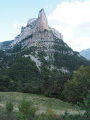
This beautiful hike takes you to the Hauts Plateaux du Vercors National Nature Reserve via the Pas de l'Essaure, then down the Drôme side through one of the most beautiful sites in the Vercors, the Vallon Combau, before reaching the hamlet of Bénevise on a promontory.It offers beautiful views of Mont Aiguille, the valley and the Combau rock, a feast for the senses, combined with the historical, geological, botanical and faunal riches of the area you are crossing.
From Chichilianne to Clelles-Mens station
 3.14 mi
+161 ft
-646 ft
1h 35
Easy
Departure from Chichilianne (Isère)
3.14 mi
+161 ft
-646 ft
1h 35
Easy
Departure from Chichilianne (Isère)
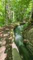
Chichilianne is a treasure trove of hikes towards the Vercors plateau. Once finished, some people take the train which stops at Clelles. But few hikers know that you can set off from Chichilianne or La Richardière and reach Clelles station in under two hours, walking alongside an irrigation canal for nearly three kilometres. This return walk to Clelles can also be taken in the opposite direction when you start your journey.
Pas of hollowed-out tree trunks serving as drinking troughs
 4.95 mi
+1,529 ft
-3,763 ft
3h 35
Difficult
Departure from Chichilianne (Isère)
4.95 mi
+1,529 ft
-3,763 ft
3h 35
Difficult
Departure from Chichilianne (Isère)
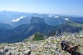
The second day takes you to the highest point of the route: Le Grand Veymont. It offers a magnificent view of the Vercors high plateaus, Mont Aiguille and the valley. There is a good chance of seeing ibex and marmots!
Cabane des Aiguillettes - Corrençon-en-Vercors
15.15 mi
+666 ft
-3,110 ft
7h 35
Difficult
Departure from Gresse-en-Vercors (Isère)
The fourth and final day of the circular route leading from the L'Aiguillette hut at the foot of the Grand Veymont to the car park at the Corrençon-en-Vercors ski stadium, where we will have left a car.