Ferme du Désert – Glandage

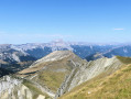
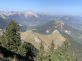
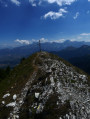
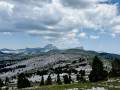
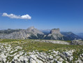
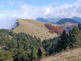
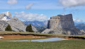
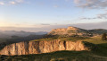
Another very difficult and long stage, starting in a landscape of mountain pastures and ending in a vast, dark forest. The view of the Dévoluy peaks (Obiou, Grand Ferrand) from the Jocou (2,051 m, the highest point of these five days) makes up for the gruelling climb leading up to it.

This walk is part of a multi-day hike: Grande Traversée du Vercors entre Clelles et Die

Details

n°150835
Creation:
Last update:
Last review:
  • Walking
    Activity: Walking
  • ↔
    Distance: 13.96 mi
  • ◔
    Duration according to the author: 8 hrs 
  • ▲
    Difficulty: Very difficult

  • ⚐
    Back to start: No
  • ↗
    Ascent: + 5,377 ft
  • ↘
    Descent: - 5,377 ft

  • ▲
    Highest point: 6,713 ft
  • ▼
    Lowest point: 2,831 ft

Photos

Description of the walk

(S) From the Ferme du Désert, follow the path (not always visible) along the stream up through the mountain pasture. Pass a track on the left.

(1) At the junction for the Col de Jiboui, keep left and head straight towards the Jiboui ridge (stay on the GTV –GR® 93). Follow the ridge to the right up to the Col de Seysse.

(2) TheGR® heads down to the right. Stay on the GTV to the left, more or less level, before climbing steeply up a rather rough path (it’s tough!). Once you reach the flat section, carry on straight towards the Jocou to enjoy a superb panorama and a well-deserved break.

Head back down towards the Col Pigeon.

(3) Ignore theGR®93alternative route on the right and carry on to the Col Vente-Cul (the path is sometimes hard to follow; generally speaking, stick to the stream, keeping to the right bank).

(4) Leave theGR®93alternative route on your right and carry on straight ahead to rejoin theGR®93at La Pouyat.

(5) Turn left onto it and carry on until you reach the road and a car park. Take the road on the left up to the Col de Grimone.

(6) There, do not take the section of the GTV that heads towards Grimone, but the one that leads to the Col des Aiguilles.

(7) Once at the pass, head down to Les Maillefauds, which you’ll pass through quickly (fountain).

(8) Continue towards Glandage, heading north-west (last chance to top up your water supplies for the day).

At Glandage, take the road on the right towards La Révolte. Look out for the path that branches off to the left behind a house (not easy to spot).

(9) From there, you’ll be in a very dense forest and the going gets steep. From the Col de la Chaumette (1,157 m), stop as soon as you find a suitable spot to pitch your tent (not easy, as it’s mostly on a slope). It’s no better on the other side of the pass, so there’s no point in pushing on as far up as possible in the hope that things will improve (E).

Waypoints

  1. S : mi 0 - alt. 4,206 ft - Ferme du Désert
  2. 1 : mi 1.23 - alt. 5,220 ft - Junction towards the Col de Jiboui
  3. 2 : mi 2.97 - alt. 5,712 ft - Col de Seysse (1744m)
  4. 3 : mi 4.54 - alt. 6,053 ft - Col Pigeon (1835m)
  5. 4 : mi 5.05 - alt. 5,390 ft - Col Vente-Cul (1650m)
  6. 5 : mi 5.77 - alt. 4,423 ft - La Pouyat
  7. 6 : mi 6.69 - alt. 4,331 ft - Col de Grimone
  8. 7 : mi 9.5 - alt. 4,442 ft - Col des Aiguilles (1364m)
  9. 8 : mi 10.51 - alt. 3,294 ft - Towards Glandange. On the left, the - Bez ou Bès (rivière) à finaliser
  10. 9 : mi 11.95 - alt. 2,930 ft - La Révolte
  11. E : mi 13.96 - alt. 4,206 ft - Campsite after the Col de la Chaumette

Notes

Fountains at Maillefauds and Glandage.
No opportunity to stock up on supplies today.

Ideally, we’d need to find somewhere to stay near Glandage and before heading up above La Révolte; that would balance out this stage with the next one, which is shorter. We didn’t see anything we liked, but that doesn’t mean there isn’t…

Always be cautious and plan ahead when you're outdoors. Visorando and the author of this route cannot be held responsible for any accidents occurring on this route.

The GR® and PR® markings are the intellectual property of the Fédération Française de Randonnée Pédestre.

Reviews and comments

5 / 5
Based on 1 review

Reliability of the description
5 / 5
Ease of following the route
5 / 5
Route interest
Non utilisé
Anne-Renelde
Anne-Renelde

Overall rating : 5 / 5

Date of your route : Aug 17, 2019
Reliability of the description : ★★★★★ Very good
Ease of following the route : ★★★★★ Very good
Route interest : Not used / Not applicable

A lovely walk.
It was a bit long at times, with some climbs.
We didn’t go as far as Glandage but only as far as the Col de Grimone.
You can camp before Les Chaumets (not possible before that).
Make sure to fill up with water from the fountain (drinking water) at Grimone.
On the second day, you can return to Lus-la-Croix-Haute to catch the train.

Machine-translated

Other walks in the area

For more walks, use our search engine .

The GPS track and description are the property of this route's author. Please do not copy them without permission.