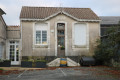
Vallet
By prefectural decree of 19 December 1972, the commune was incorporated into that of Montendre on 1 January 1973 as part of a merger-association, similar to that of Chardes.
Vallet is a small French village, situated in the Charente-Maritime department and the Nouvelle-Aquitaine region (formerly the Poitou-Charentes region).
The commune has had a population of 277 since the last census.
Surrounded by the communes of Sousmoulins, Pommiers-Moulons and Montendre, Vallet is situated 4 km north-east of Montendre, the largest town in the area.
Local heritage
The Church of Saint-Babylas
Like its neighbour in Chardes, the parish church of Vallet is thought to date from the 11th or 12th century. Records concerning this church are scarce and uncertain: a priory of ‘Valas’ is mentioned in the cartulary of Baignes Abbey (1191), though it is not certain that this refers to the small parish of Vallet. Like its neighbour in Chardes, it was partly destroyed by the lords of Montendre during the Wars of Religion, and rebuilt in the 17th century. The condition of the building became a cause for concern in the 19th century, prompting the relevant authorities to undertake the reconstruction of the façade, topped by a campanile (1860, rebuilt in 1980), the demolition of the old bell tower, and the repair of the south wall (1879). A restoration programme was carried out less than a century later, in 1969. Further work was undertaken in 1998 and 1999 as part of youth community projects: the chancel window (15th century), which had previously been bricked up, was restored, as was the roof structure.
The church, which is very modest in appearance, consists of a single nave, covered by an exposed, slightly arched roof structure. A small chapel runs along the north wall. The chancel is flat and features a pointed arch. On the outside, it is flanked by two fairly massive buttresses, likely remnants of the medieval church. The crypt, accessed via a narrow staircase, probably dates from the late 11th or early 12th century. It is covered by vaults in an archaic Romanesque style, supported by two piers. The lords of Bessac (a small castellany in the surrounding area) were buried there, and celebrations in honour of Saint Babylas, the church’s patron saint, who was reputed to cure headaches, were held there. The bell tower houses a bell dating from 1660, which has been listed as a historic monument (as an object) since 1911.
Croix-Gente Chapel
This modest oratory, dedicated to ‘Our Lady of the Seven Sorrows’, is a renowned place of pilgrimage in the region. According to tradition, it is said to have been founded in the 14th century by a peasant distraught at the loss of his son in the surrounding woods. Putting his trust in the Virgin Mary, he is said to have vowed to build a chapel at the exact spot where he would find his child. After searching the woods for days on end, he eventually found his son’s body and kept his promise. A statue of the Virgin Mary, placed in the chapel, became the object of great devotion.
In the 16th century, during the Wars of Religion, the chapel suffered the same fate as most of the churches in the region and was almost entirely destroyed. The locals, too poor to restore it, nevertheless continued to come and venerate the statue of the Virgin, which had been left amidst the ruins. Smashed twice during the Revolution, it was pieced back together and hidden in the crypt of the church at Vallet. Around 1860, Father Maud had it restored.
In 1862, a new chapel (the one that still stands today) was built. The bell tower was consecrated on 28 September 1862, in the presence of the Bishop of La Rochelle and Saintes and numerous local dignitaries; a large cross was erected near the sanctuary two years later. In 1933, in response to the growing number of pilgrims, the chapel was enlarged. Work was carried out between 1964 and 1966 (repair of the roof structure) and a fresco was painted in 1985.
Montendre
Centred around the ruins of its medieval castle, this small town in the south of Haute Saintonge, on the border with Guyenne, is a commercial, administrative and tourist hub, best known for hosting the Free Music Festival since 2001. Its historic centre, with its winding streets, is home to old buildings, a Neo-Romanesque church and curious polygonal market halls dating from the 19th century. The villages of Chardes and Vallet, which form an associated community, each also preserve a church of Romanesque origin and a number of historic buildings. On the outskirts of the town lies the Forest of La Double, which, dotted with ponds and featuring a mix of maritime pines, pedunculate oaks and chestnut trees, is the department’s main wooded area.
Montendre is well-equipped with facilities in the fields of education (Samuel-Dumenieu secondary school), culture (François-Mitterrand cultural centre) and healthcare (EPD des 2-Monts). A commercial and industrial estate has been developed on the outskirts, and an Environmental Craft Zone has been established near the town centre on a former industrial wasteland.
Since 2001, the town of Montendre has organised the Free Music Festival, which attracts tens of thousands of people every year to see both well-known (on the national and international scene) and up-and-coming artists. The line-up gives pride of place to electronic music, rap, rock and metal, featuring artists such as Snoop Dog79 (2012 edition), Kaiser Chiefs80 (2013 edition), The Offspring81 and Skip the Use82 (2014 edition) and No One Is Innocent83 (2015 edition).
Places and monuments
Montendre Castle
Perched on a 114-metre-high spur overlooking vast expanses of heathland and woodland (the Forêt de la Double) and the small town below, Montendre Castle is thought to have originated as a Roman castrum.
Historical records suggest that the first castle (presumably wooden) was built around the 9th century, followed by a stone reconstruction in the 12th century. Extensively remodelled in the 15th century (notably, the square tower above the entrance dates from this period), and having been fiercely contested during the Hundred Years’ War, it became a Protestant stronghold during the Wars of Religion. In the 18th century, the engineer and geographer Claude Masse described a ‘low enclosure of sound masonry (…) but now badly ruined’, noting, however, that ‘if the parapets were slightly repaired, this stronghold could withstand a surprise attack and it would take cannon fire to take it’. However, at that time, there was no proper residential block apart from the square tower, which had been converted into living quarters. The residential block known as ‘La Rochefoucauld’ was built in 1735; though still standing at the start of the 20th century, all that remains today is a section of the façade, which serves as a backdrop to the open-air theatre built in 1959.
Today, the castle retains features from various periods, including part of the ramparts, a round tower, a square tower (which now houses the museum of art and folk traditions), the façade of the main residence and the underground passages. The site has been converted into a promenade and is home to an open-air theatre which hosts performances during the summer months. A dolmen stands on one of the paths leading up to the castle hill.
The old market halls.
The old market halls of Montendre are an unusual structure: octagonal in shape, covered by a roof framework shaped like the hull of an upturned boat (‘en erse’), with no pillars at all; there are only eight of this type in France. Opened in 1863, they replaced the medieval market halls, which had fallen into disrepair. These earlier halls, similar to those at Villebois-Lavalette (Charente), Cozes or Pisany (Charente-Maritime), were much larger than the current building. Their dimensions, known precisely thanks to the 1833 land registry, were 33 metres by 20. By 1844, their condition was a cause for concern: ‘various structural timbers were falling apart due to dilapidation; almost all the pillars on the west side were rotten at the base…’, prompting the local council to consider replacing them.
In 1862, the foundation stone of the new market halls was laid during a formal ceremony presided over by the mayor, Alphonse Marchand. However, in 1973, an expert report concluded that the building was unsafe, and it was closed. The question of its demolition was raised and put to a vote by the residents, who voted in favour of its preservation. In 1978, the market halls were refurbished and converted into exhibition spaces occupied by craftspeople; they also housed the town’s tourist information centre during the summer season.
Saint-Pierre Church
This vast Romanesque-inspired building was erected between 1812 and 1821 to replace a medieval church described at the beginning of the 19th century as ‘in a very poor state (…) due to dilapidation and lack of maintenance’.
The old church, built in the 11th or 12th century like most of its counterparts in the Saintonge region, is mentioned in a 13th-century charter, which also reveals the name of a certain Guillaume de Montandronis (Montendre), archpriest of the said place. It is mentioned again in a ‘pouillé’ dated 1402, under the name ‘Sancti Pietri de Montis Andronis’. The loss of a significant number of records in the fire at the episcopal chapter house in Saintes in 1871 means that little more is known about this building. It seems likely that the church fell victim to acts of vandalism during the Wars of Religion, like almost all those situated within the jurisdiction of the Lord of Montendre, Louis de La Rochefoucauld, a staunch Protestant. In 1723, a report drawn up by the engineer and geographer Claude Masse described a ‘small and very low parish church’, and by 1812, the façade and bell tower were in such a state of disrepair that restoration work had become essential. Due to a lack of sufficient funds, reconstruction of the façade and bell tower did not begin until 1816 and continued until 1820. The rest of the church was completed in 1825. A carillon was installed in the bell tower in 1896, and an access ramp for disabled people was fitted almost a century later, in 1994.
The church, which stands on a hillside, is a massive and very austere structure. Built on a basilica plan, it consists of a nave with four bays, covered by a pointed vault, and separated from the two side aisles by square piers supporting a series of low arches. The apse, covered by a slender ribbed vault, is flanked by two apsidioles built using the same method. The one on the right is dedicated to Our Lady, the one on the left to Saint Joseph. The church houses a painting donated to the parish by Emperor Napoleon III.
Protestant church
Construction of the Protestant church began in 1822 on land ceded by the local council in 1818, with the council contributing 2,000 francs towards the cost. The building was inaugurated on 7 September 1823 in the presence of Pastor Marchand and the town’s leading figures.
Situated in the immediate vicinity of the castle, it consists of a simple rectangular hall, lit by a series of semi-circular windows and an oculus in the façade. The façade, which is very austere, is inspired by the neoclassical style, like many other buildings of this type in the region, and features a rectangular doorway and a triangular pediment devoid of any ornamentation. Its modest dimensions suggest a fairly small Protestant community in the mid-19th century, in a region which had, however, long been committed to Reformed ideas.
The church at Chardes
The origins of this modest country church may date back to the 11th or 12th century, but it retains few features dating from that period. It was no doubt ransacked during the Wars of Religion, like almost all the churches in the seigneury of Montendre (Louis de La Rochefoucauld, Lord of Montendre, being a fervent Protestant), and was rebuilt in the 17th century. The building has a sober appearance and is very simple in design. It consists of a single rectangular nave and a semicircular apse.
The façade, built of local grey stone, was rebuilt in 1891. It is surmounted by a small bell tower, which houses a bell classified as a historic monument. Cast in 1727, it bears the names of its godfather, Samuel Chapuzet, his godmother, J(e)anne Melanie, and the parish priest of the time, Jacques Rocher. The church is still surrounded by its cemetery, a layout common to almost all churches in days gone by. A square, laid out on the edge of the church grounds, is named after Michel Chauvin, a pilot from the village who died on a mission during the liberation of the Royan pocket, at the age of 19. A monument commemorates him.
The church at Vallet
Like its neighbour in Chardes, the church at Vallet is thought to date from the 11th or 12th century. Records concerning this church are scarce and uncertain: a priory of ‘Valas’ is mentioned in the cartulary of Baignes Abbey (1191), though it is not certain that this refers to the small parish of Vallet. Like its neighbour in Chardes, it was partly destroyed by the lords of Montendre during the Wars of Religion, and rebuilt in the 17th century. The condition of the building became a cause for concern in the 19th century, prompting the relevant authorities to undertake the reconstruction of the façade, topped by a campanile (1860, rebuilt in 1980), the demolition of the old bell tower, and the restoration of the south wall (1879). A restoration programme was carried out less than a century later, in 1969. Further work was undertaken in 1998 and 1999 as part of youth community projects: the chancel window (15th century), which had previously been bricked up, was restored, as was the roof structure.
The church, which is very modest in appearance, consists of a single nave, covered by an exposed, slightly arched roof structure. A small chapel runs along the north wall. The chancel is flat and features a pointed arch. On the outside, it is flanked by two fairly massive buttresses, likely remnants of the medieval church. The crypt, accessed via a narrow staircase, probably dates from the late 11th or early 12th century. It is covered by vaults in an archaic Romanesque style, supported by two piers. The lords of Bessac (a small castellany in the surrounding area) were buried there, and celebrations in honour of Saint Babylas, the church’s patron saint, who was reputed to cure headaches, were held there. The bell tower houses a bell dating from 1660, which is listed as a historic monument.
The Chapel of Croix Gente
This modest oratory, dedicated to ‘Our Lady of the Seven Sorrows’, is a renowned place of pilgrimage in the region. According to tradition, it is said to have been founded in the 14th century by a peasant distraught at the loss of his son in the surrounding woods. Putting his trust in the Virgin Mary, he is said to have vowed to build a chapel on the very spot where he would find his child. After searching the woods for days on end, he eventually found his son’s remains and kept his promise. A statue of the Virgin Mary, placed in the chapel, became the object of great devotion.
In the 16th century, during the Wars of Religion, the chapel suffered the same fate as most of the churches in the region and was almost entirely destroyed. The villagers, too poor to restore it, nevertheless continued to come and venerate the statue of the Virgin, which had been left amidst the ruins. Smashed twice during the Revolution, it was pieced back together and hidden in the crypt of the church at Vallet. Around 1860, Father Maud had it restored.
In 1862, a new chapel (the one that still stands today) was built. The bell tower was consecrated on 28 September 1862, in the presence of the Bishop of La Rochelle and Saintes and numerous local dignitaries; a large cross was erected near the sanctuary two years later. In 1933, in response to the growing number of pilgrims, the chapel was enlarged. Work was carried out between 1964 and 1966 (repair of the roof structure) and a fresco was painted in 1985.
Amand Brickworks
The Amand brickworks (a refractory products factory) was founded in the 1930s to manufacture refractory bricks and produce chamotte. It later became Morgan Thermic SA (a crucible factory), and 450 people were employed at the site in the 1950s. By 1970, the company employed 150 people. In 1999, before it was relocated, the company employed 50 people, 25 of whom were involved in manufacturing. The factory is awaiting inclusion on the industrial heritage list.
In the surrounding area
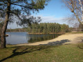
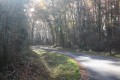
The Montendre region boasts several sites of interest. Stretching right to the town’s outskirts, the vast pine forest of La Double is criss-crossed by walking trails and dotted with numerous ponds, some of which are open for swimming. In Montlieu-la-Garde, the departmental council has established one of its many nature centres: the Maison de la Forêt, which offers visitors a better understanding of the ecosystem of La Double, as well as the traditions associated with it.
The area around Montendre also boasts several ancient towns, such as Montguyon and Mirambeau, famous for their castles. The castle at Montguyon lies in ruins, though these are still quite imposing, whilst the one at Mirambeau was almost entirely rebuilt in the 19th century. A little further on, Jonzac and Pons are two picturesque little towns, preserving old houses, churches characteristic of the Saintonge Romanesque style, and fine examples of medieval military architecture: Jonzac Castle, perched on its cliff, with its 15th-century gatehouse, and Pons Castle, characterised by a mighty Romanesque keep dominating the entire region. Pons is also home to a famous pilgrims’ hospital, listed as a UNESCO World Heritage Site. Finally, to the south of Montendre, in the Gironde department, the citadel of Blaye is a remarkable example of 17th-century defensive architecture. Designed by Vauban, it is also listed as a UNESCO World Heritage Site.
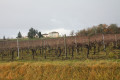
The Montendre region is also rich in vineyards: in Charente-Maritime, these are used to produce cognac, Pineau des Charentes and Charente local wine; in Gironde, they are used to produce Côtes-de-Blaye, one of the Bordeaux appellations.
Sources: Wikipedia (excerpts)



 Country:
 City:
City:




 Visorando Member

 Moderate
 Tourist office