Walk around the lake from the car park at the village hall in Montendre

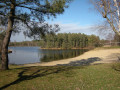
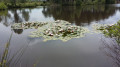
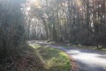
A lovely little walk of about 1 hour 45 minutes, allowing you to explore Lake Montendre with its beach, its water lilies in bloom in May and June, and the distinctive visitor centre of the Mysterra maze park, all set amidst the pine forest.

Details

2575785
Creation:
Last update:
Last review:
  • Walking
    Activity: Walking
  • ↔
    Distance: 3.77 mi
  • ◔
    Average duration: 1h 50 
  • ▲
    Difficulty: Easy

  • ⚐
    Back to start: Yes
  • ↗
    Ascent: + 72 ft
  • ↘
    Descent: - 75 ft

  • ▲
    Highest point: 253 ft
  • ▼
    Lowest point: 167 ft
  • ⚐ Country: France
  • ⚐ City: Montendre (17130)
  • ⚑
    Start/End: N 45.281707° / W 0.413002°
  • ❏
    IGN map(s): Ref. 1534SB
  • Hour-by-hour weather

Photos

Description of the walk

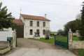
The car park at the village hall is convenient and easy to find, at the start of Rue de Saint-Pierre, and there are plenty of spaces.

(S/E) Leave the car park and turn right onto Rue de Saint-Pierre. Pass the wash house, keeping to the Route du Bois des Barronies. Walk alongside the golf course and a small wood on your left.

(1) Take the road on the left (Route du Golf).

(2) Turn right onto the road leading towards Bussac (Avenue de Onda). Use the pedestrian side path.

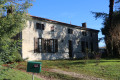
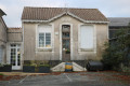
(3) Ignore the first street on the left signposted ‘lac’. You’ll come back this way. Carry on until you reach a detached house set back a little (on the left), cross the road and go over the ditch via a bridge that’s barely visible in the grass.

(4) Follow the barely marked path along the edge of the woodland. You’ll soon come to a marked path that follows a spur of the lake. From there, you’ll have a lovely view of the Mysterra Park building. At the end, there’s a road; turn right onto it to cross the bridge.

(5) Just after the bridge, take the path on the left and follow a sort of channel that connects the two parts of the lake. At its end, you’ll reach the main lake and its beach. Walk round the whole area, following the path anti-clockwise. Along the embankment, on the left, you can usually see water lilies.

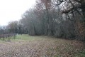
(6) After the embankment, take the path opposite, which climbs slightly into the woods. About 100 to 150 metres further on, walk alongside a fenced-off meadow on your right. To follow the edge of this field, the path first turns right then left for a few metres before reaching a T-junction. Take the new path on the left. It leads to a private entrance, usually closed off by a sort of barrier. At this point, turn left again. This path leads onto a road about a hundred metres further on.

(7) Then take this road to the right. It leads back to Avenue de Onda.

(3) Cross the road and turn right, rejoining the path you took on the way there.

(2) Turn left.

(1) Turn right and return to the starting point (S/E).

Waypoints

  1. S/E : mi 0 - alt. 200 ft - Car park on Rue de Saint-Pierre
  2. 1 : mi 0.57 - alt. 171 ft - Junction. Golf course and woodland on the left
  3. 2 : mi 0.92 - alt. 190 ft - Junction of Rue Onda and Rue du Golf
  4. 3 : mi 1.06 - alt. 210 ft - Out-and-back route
  5. 4 : mi 1.4 - alt. 217 ft - A secluded house set back from the road
  6. 5 : mi 1.66 - alt. 236 ft - Bridge over the channel
  7. 6 : mi 2.02 - alt. 230 ft - Lake embankment
  8. 7 : mi 2.58 - alt. 226 ft - Junction with the Allée du Lac
  9. S/E : mi 3.77 - alt. 200 ft - Car park on Rue de Saint-Pierre

Notes

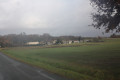
(1) Just before the bend, you might be lucky enough to spot a stag and his herd of does in the fenced-off field on the right.

Worth a visit

If you’ve enjoyed this walk in Montendre, you can also explore the town centre, with its19th-century market halls featuring their distinctive roof structure modelled on an inverted ship’s hull, as well as the remains of its fortified castle, a key site during the Hundred Years’ War. Two towers remain in good condition, along with the ramparts which, in the Middle Ages, encircled the ‘haute-cour’. The ruins of the stately home, built later on the esplanade, have recently been partially restored and serve as a backdrop for open-air performances.
The canton of Montendre (Canton of the Three Mountains) is situated in the far south of the Charente-Maritime department, bordering the Gironde to the south and the Charente and Dordogne to the east. In fact, on the route I am suggesting, when you reach point 2, you will be less than a kilometre from the Gironde.

Reviews and comments

4.4 / 5
Based on 3 reviews

Reliability of the description
4.7 / 5
Ease of following the route
4.3 / 5
Route interest
4.3 / 5
niger-baudry
niger-baudry

Hello Lilo,
Thank you for taking the time to leave a comment. I'm glad you enjoyed it and I hope you had time to visit the town centre to see the castle and the market halls, unless you already knew them. I wish you many more enjoyable walks. Best regards, Gérard.

Machine-translated

lilo
lilo

Overall rating : 4.7 / 5

Date of your route : Nov 07, 2025
Reliability of the description : ★★★★★ Very good
Ease of following the route : ★★★★★ Very good
Route interest : ★★★★☆ Good
Very busy route : No

A lovely route. We even found some mushrooms while walking around the lake. I recommend it.

Machine-translated

niger-baudry
niger-baudry
• Edited:

Hello ARNAUDIN
Thank you for your feedback and your kind comment. I hope you enjoy many more lovely walks in the future.
Kind regards
Gérard

Machine-translated

ARNAUDIN
ARNAUDIN

Overall rating : 4 / 5

Date of your route : Nov 10, 2021
Reliability of the description : ★★★★☆ Good
Ease of following the route : ★★★★☆ Good
Route interest : ★★★★☆ Good
Very busy route : No

A lovely walk, very enjoyable – thank you

Machine-translated

niger-baudry
niger-baudry

Hello Sébastosandrine,
Thank you for taking the time to leave a comment on this walk. Unfortunately, there’s no other way to cross the road, but there’s no real danger as there’s enough visibility on both sides to cross safely. You just need to be careful if you’re with young children. I hope that once the pandemic is over, you’ll be able to enjoy everything this route has to offer. Don’t forget to pop into the town centre to visit Les Halles and the castle.

Machine-translated

Sébastosandrine
Sébastosandrine

Overall rating : 4.7 / 5

Date of your route : Feb 20, 2021
Reliability of the description : ★★★★★ Very good
Ease of following the route : ★★★★☆ Good
Route interest : ★★★★★ Very good
Very busy route : No

A pleasant route, apart from having to cross a busy main road where you need to be very careful – but unfortunately there’s no other way round it.
You arrive at a place where there’s a maze – ‘Mysterra Parc des Labyrinthes’ – which is currently closed due to Covid; it’s a shame, so we’ll be back 😀.
It was very enjoyable

Machine-translated

Other walks in the area

For more walks, use our search engine .

The GPS track and description are the property of this route's author. Please do not copy them without permission.