La Comté to Fontaine d’Ozillac in the Seugne Valley

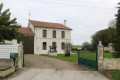
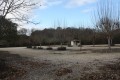
The beautiful church at Fontaines-d’Ozillac features a Romanesque façade to which a nave was added during the Renaissance; take a closer look at the corbels adorned with various figures. After two kilometres across open fields, wooded areas lead to a former nature trail showcasing different tree species. Benches have been set up in a clearing; you will then climb towards a farm before descending through the pastures and taking the path back, on which you will pass a small chapel.

Details

124248
Creation:
Last update:
Last review:
  • Walking
    Activity: Walking
  • ↔
    Distance: 5.60 mi
  • ◔
    Average duration: 2h 40 
  • ▲
    Difficulty: Easy

  • ⚐
    Back to start: Yes
  • ↗
    Ascent: + 112 ft
  • ↘
    Descent: - 112 ft

  • ▲
    Highest point: 308 ft
  • ▼
    Lowest point: 197 ft

Description of the walk

Start at the Town Hall square.

(S/E) Head left, passing in front of the school. At the junction, turn right towards Villexavier, then left just before the railway bridge: the gravel access path continues as a grassy track alongside the railway line. Walk for about 500 metres until you reach the road.

(1) Turn right, cross the railway line and continue to the hamlet known as ‘Chez Savary’. In the hamlet, turn left and take a dirt track that leads into the woods. At the edge of the woodland, follow the path branching off to the right which runs alongside the horse paddock to the small D149 county road. Cross carefully to take the path opposite leading into a chestnut copse.

(2) As you emerge from the undergrowth, cross a small road and continue straight ahead, following a path across the fields. The path leads into the undergrowth and runs along the edge to the left before branching off to the right and heading deep into the forest.

(3) After 350 metres in this direction, you’ll emerge from the woodland and, a few metres further on, rejoin a wide path that branches off to the right along the La Cendronne stream and heads back into the woodland. After about 700 metres, the path curves to the right through a tunnel of shrubs, opening out once more onto a wide path. Follow this path for a few more metres.

(4) The path turns left and leaves the woodland to climb towards La Comté. At the end of the path, when you reach the access road to the farm opposite, do not head up towards the hamlet of La Comté, but turn right to go round the back of the farm. A path leads back down to a small road; follow this to the left as far as the hamlet of Chez Pagnolet.

(5) At the junction with the D154, carry on straight ahead towards Chez Maurin, then at the next junction turn right towards the water tower. Continue in this direction to cross the D149, then turn left and head for the chapel.

(6) At the small chapel, take the road on the right, then the path that passes under the railway line on the left. Come out onto the road again and turn right to return to the starting point (S/E).

Waypoints

  1. S/E : mi 0 - alt. 197 ft - Town Hall Square - Église Saint-Martin (Fontaines-d'Ozillac)
  2. 1 : mi 0.6 - alt. 246 ft - Cross the railway line to the right
  3. 2 : mi 2.05 - alt. 243 ft - Small road junction
  4. 3 : mi 2.59 - alt. 240 ft - Emerging from the woodland - Cendronne (cours d'eau) - Affluent du Maine
  5. 4 : mi 3.37 - alt. 207 ft - Leave the woodland
  6. 5 : mi 4.24 - alt. 279 ft - Crossing the D154
  7. 6 : mi 5.24 - alt. 246 ft - La Chapelle, turn right. Near the - Gare de Fontaines-Ozillac
  8. S/E : mi 5.6 - alt. 197 ft - Town Hall Square - Église Saint-Martin (Fontaines-d'Ozillac)

Notes

Route No. 23.

Reviews and comments

4.1 / 5
Based on 4 reviews

Reliability of the description
4 / 5
Ease of following the route
4.3 / 5
Route interest
4 / 5
chipie33290
chipie33290

Overall rating : 4 / 5

Date of your route : Dec 16, 2023
Reliability of the description : Not used / Not applicable
Ease of following the route : ★★★★☆ Good
Route interest : ★★★★☆ Good
Very busy route : No

Part of this route is not accessible in winter (an area in the woods that is prone to flooding).
It is well signposted.
Thanks for the route.

Machine-translated

andrericheux
andrericheux

Overall rating : 4.3 / 5

Date of your route : Jun 03, 2018
Reliability of the description : ★★★★☆ Good
Ease of following the route : ★★★★★ Very good
Route interest : ★★★★☆ Good

An easily recognisable route. A very pleasant route, with no difficulties;

Machine-translated

moulipat
moulipat

Overall rating : 3.3 / 5

Date of your route : Sep 13, 2017
Reliability of the description : ★★★★☆ Good
Ease of following the route : ★★★☆☆ Average
Route interest : ★★★☆☆ Average

We’re from La Charte; it was a stroll ‘to get some fresh air’. A bit of a let-down – it’s nice in the woods, but the tree interpretation trail no longer exists; only the picnic tables remain, and it’s a nice spot for a break.

Machine-translated

glyngoodall
glyngoodall

Overall rating : 4.7 / 5

Date of your route : Jul 03, 2017
Reliability of the description : ★★★★☆ Good
Ease of following the route : ★★★★★ Very good
Route interest : ★★★★★ Very good

At the start of Point 4 on the route, it’s tricky. 50 metres after coming out of the woods, the path forks … neither of them is the right one … it’s 20 metres BEFORE you come out of the woods that you need to find a (small) path to the right … You can’t see the stream on the left that it follows, as the undergrowth is too dense.... The walk is brilliant, taking you through woods and across various fields (sunflowers, maize, wheat...).

Machine-translated

Other walks in the area

For more walks, use our search engine .

The GPS track and description are the property of this route's author. Please do not copy them without permission.