Fontaines d’Ozillac Castle and a variant of the GR®360

A lovely walk through the countryside near Fontaines-d’Ozillac. The route allows you to discover the beautiful landscapes of this corner of Saintonge, as well as the Seugne and the river linking it to the Pharaon, and also the magnificent Château des Fontaines.

Details

1339782
Creation:
Last update:
Last review:
  • Walking
    Activity: Walking
  • ↔
    Distance: 4.93 mi
  • ◔
    Average duration: 2h 20 
  • ▲
    Difficulty: Easy

  • ⚐
    Back to start: Yes
  • ↗
    Ascent: + 72 ft
  • ↘
    Descent: - 72 ft

  • ▲
    Highest point: 210 ft
  • ▼
    Lowest point: 131 ft

Photos

Description of the walk

The car park is on Route des Halles, on the north side of the church and the cemetery. Alternatively, use the town hall car park situated to the south of the church and the cemetery.

(S/E) Leave the car park by turning right onto Rue des Halles. Follow the road carefully straight ahead until you reach the hamlet of Le Portail Rouge.

(1) Turn right and follow the road carefully towards the hamlet of Chez Pelletan. Drive straight through the hamlet and continue to the junction with a farm track on your right, in a wide left-hand bend in the road.

(2) Turn right and continue to a T-junction. Turn right and carry on to a crossroads where four paths meet. Turn left onto a shaded path which heads towards the Seugne; it runs alongside the river for a while before crossing it via a footbridge at the hamlet known as Le Pible.

(3) The path gives way to a small road. Follow it to where it meets the D142 at a place called Moulin du Geay. Turn left and follow the D142 for about ten metres.

(4) Turn left onto the small road leading to the hamlet of La Verrerie. As soon as you’ve passed the houses in the hamlet, the road becomes a farm track. Further on, cross a stream linking the Seugne to the Pharaon via a small bridge.

Immediately, turn left and follow the stream round the field until you reach a small wood. On reaching it, turn right and join the track that serves all the plots in this area (the track in the middle of the area). Turn left and continue until you reach a small road. Turn left again and follow this road carefully, passing close to the hamlet of Les Grenouillères on your left.

(5) Shortly afterwards, turn right onto the path which leads to Château de Fontaines after crossing a seasonal stream near a small pond.
Note: if the stream is flowing too strongly, you can wade across it before the small pond and join the path leading to the château by walking along the edge of the field.
Walk round the Château de Fontaines on the left-hand side.

(6) When you reach the road leading to the château, continue round it, then turn left in front of the outbuildings. Go straight on until you reach a T-junction.

(7) Turn left onto the path which joins a small road. Turn right, then keep left, and follow the road carefully until you return to the hamlet known as Le Portail Rouge.

(1) Finish the walk by following the road, which becomes Rue des Halles as you enter Fontaines-d’Ozillac. Just before reaching the church, the route returns to the car park on the left (S/E).

Waypoints

  1. S/E : mi 0 - alt. 203 ft - Car park next to the cemetery
  2. 1 : mi 0.19 - alt. 207 ft - Road junction at the Portail Rouge
  3. 2 : mi 0.63 - alt. 171 ft - Junction of road and farm track
  4. 3 : mi 1.45 - alt. 135 ft - Footbridge over the - Seugne (rivière)
  5. 4 : mi 2.26 - alt. 144 ft - Via the D142 and the road leading to La Verrerie
  6. 5 : mi 3.47 - alt. 135 ft - Junction of road and footpath near Les Grenouillères
  7. 6 : mi 3.87 - alt. 141 ft - Fontaines Castle
  8. 7 : mi 4.34 - alt. 164 ft - T-junction
  9. S/E : mi 4.94 - alt. 203 ft - Car park next to the cemetery

Notes

This walk across varied terrain requires suitable footwear.

This walk is signposted at the start of the route, up to the D142 road at a place called La Verrerie:GR® 360, an alternative route signposted in red and white. The rest of the route is unmarked. Consequently, it is advisable to follow the directions in the description and on the map, whilst also paying close attention to the landscape. The waypoints (with their GPS coordinates and the distance from the starting point) serve as aids for walkers exploring the route for the first time.

Hike completed by the author on 5 December 2019

Worth a visit

Fontaines-d’Ozillac is one of the stops on a signposted long-distance walking route, theGR® 360.

Places and monuments

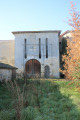
Saint-Martin Church in Fontaines-d’Ozillac. A 12th-century church damaged during the Wars of Religion. It is notable for its Romanesque portal with three arches decorated with monsters, birds, angels and knights. It has been listed as a historic monument since 2002.

Tumuli of the Fief des Rois: aerial photographs reveal the outlines of tumuli forming a necropolis.
Source: Wikipedia (excerpts)

Always be cautious and plan ahead when you're outdoors. Visorando and the author of this route cannot be held responsible for any accidents occurring on this route.

The GR® and PR® markings are the intellectual property of the Fédération Française de Randonnée Pédestre.

Reviews and comments

3.9 / 5
Based on 4 reviews

Reliability of the description
4 / 5
Ease of following the route
3.8 / 5
Route interest
4 / 5
chipie33290
chipie33290

Overall rating : 4 / 5

Date of your route : Dec 16, 2023
Reliability of the description : Not used / Not applicable
Ease of following the route : ★★★★☆ Good
Route interest : ★★★★☆ Good
Very busy route : No

We’d already done this route in the spring without any problems, but at this time of year it’s impossible to cross the ford before the castle.
So we turned back and took the road
Thanks for this route

Machine-translated

Pat et Ro
Pat et Ro

Overall rating : 3.3 / 5

Date of your route : Sep 28, 2023
Reliability of the description : ★★★★☆ Good
Ease of following the route : ★★★☆☆ Average
Route interest : ★★★☆☆ Average
Very busy route : No

Hello everyone,
The route is a bit of a problem between points 5 and 6. Especially from point 6 onwards, which we followed and which crosses a ploughed field. Point 4 also seems rather unclear. That said, the app is generally satisfactory once you’ve got to grips with it.
As for visitor numbers, we’ve ticked ‘no’, but it’s late September, so perhaps that explains it!!!

Machine-translated

chipie33290
chipie33290

Overall rating : 4.5 / 5

Date of your route : Apr 03, 2023
Reliability of the description : Not used / Not applicable
Ease of following the route : ★★★★☆ Good
Route interest : ★★★★★ Very good
Very busy route : No

A very pleasant route, especially in spring when the meadows and verges are in bloom.
Do be careful, however, when crossing private property (the castle on the way back)
Thank you for this route

Machine-translated

véroniquemarchand33
véroniquemarchand33

Overall rating : 4 / 5

Date of your route : Feb 20, 2022
Reliability of the description : ★★★★☆ Good
Ease of following the route : ★★★★☆ Good
Route interest : ★★★★☆ Good
Very busy route : No

A lovely walk through the Saintonge countryside. The banks of the Seugne and Fontaine d’Ozillac Castle are wonderful discoveries, even for local walkers! A short detour via Saint-Médard might be worth it. A visit to the village and the church is a must.
The route description holds no surprises, although at point 7 it appears that the path leading to a small road has been ploughed by farmers.

Machine-translated

Other walks in the area

For more walks, use our search engine .

The GPS track and description are the property of this route's author. Please do not copy them without permission.