


Refine your search for walks in Benidorm
Benidorm walks


 The Les Caletes Tower in Benidorm
 Visorando Member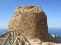
 5.01 mi
 +1,184 ft
 -1,161 ft
 3h 20
3h 20
 Moderate
 Departure from Benidorm (Alacant / Alicante)
La Torre de Les Caletes, also known as Torre Punta de Cavall, is a classic and easy hike, as the route to reach it involves following tarmac roads – which, after a while, are closed to traffic – and thus takes you through unspoilt countryside along the coast, with the added bonus of discovering numerous stunning coves. As for the return journey, which can of course be done via the same route as the outward leg (which is what everyone does, in fact), the walk offers a lovely little path along the mountainside. This path runs along the cliffs overlooking the sea (which may be daunting for some) and includes a few rocky sections which, whilst not exactly rock climbing, do require you to use your hands to climb. So, before setting off on this return route, consider your abilities and do not take any unnecessary risks.
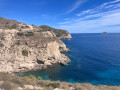
The Aguiló Tower as seen from Villajoyosa
 3.58 mi
+581 ft
-577 ft
2h 10
3.58 mi
+581 ft
-577 ft
2h 10
 Easy
Departure from la Vila Joiosa / Villajoyosa (Alacant / Alicante)
Easy
Departure from la Vila Joiosa / Villajoyosa (Alacant / Alicante)
This walk is known as the ‘Sender de la Costa’ and is maintained by the Generalidad Valenciana, the provincial government. It is therefore a wide path lined with benches and tables, making it suitable for the whole family. Along the way, you can enjoy superb views of various coves and, out to sea, you can make out a large fish farm.
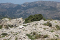
El Penyo Mulero in the Serra d'Aitana
 6.88 mi
+2,651 ft
-2,638 ft
5h 30
6.88 mi
+2,651 ft
-2,638 ft
5h 30
 Difficult
Departure from Benimantell (Alacant / Alicante)
Difficult
Departure from Benimantell (Alacant / Alicante)
The Sierra de Aitana has the highest peaks in the province of Alicante. This route explores an extreme part of the sierra, on the Benimantell side, with a climb to a peak over 1,300 m. This hike is rated difficult due to the long climbs and constant exposure to the sun.
La Font de Partegat and La Font del Moli: a circular route from Benifato
 5.96 mi
+1,280 ft
-1,253 ft
3h 50
Moderate
Departure from Benifato (Alacant / Alicante)
5.96 mi
+1,280 ft
-1,253 ft
3h 50
Moderate
Departure from Benifato (Alacant / Alicante)
This is a very classic walk between two springs that were of great importance in people’s lives. The suggested route comprises two shared sections (there and back) near the two springs and a circular section. The walk follows wide paths with no particular difficulty, set in exceptional scenery at the foot of the Sierra d’Aitana, which includes the highest peak in the province of Alicante.
Relleu footbridge
 5.73 mi
+801 ft
-761 ft
3h 20
Easy
Departure from Relleu (Alacant / Alicante)
5.73 mi
+801 ft
-761 ft
3h 20
Easy
Departure from Relleu (Alacant / Alicante)
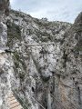
The footbridge is a wooden walkway attached to the wall of the canyon formed by the Amadoria River and known as Estret del Pantà (the strait of the dam). Below, there is a drop of between 20 m and 60 m, depending on the location. There are also two glass overhangs for the more daring. The walkway, which is a round trip, was installed in 2022. It is a vertiginous walkway above the ravine and is not recommended for those who suffer from vertigo.
Serra d'Olta
 5.66 mi
+1,575 ft
-1,572 ft
4h 00
Difficult
Departure from Calp (Alacant / Alicante)
5.66 mi
+1,575 ft
-1,572 ft
4h 00
Difficult
Departure from Calp (Alacant / Alicante)
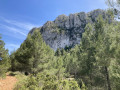
A loop on the Serra d'Olta, offering magnificent 360° panoramic views of the region.
Els Arcs de Castell de Castells or Arc d'Atancos, Province of Alicante
 3.59 mi
+512 ft
-489 ft
2h 05
Easy
Departure from Castell de Castells (Alacant / Alicante)
3.59 mi
+512 ft
-489 ft
2h 05
Easy
Departure from Castell de Castells (Alacant / Alicante)
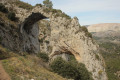
This is a hike that is an absolute must, offering a chance to see a natural wonder: two enormous natural arches carved out of soft rock by erosion, which are now part of a protected area.
What’s more, it’s an easy hike that’s suitable for the whole family.
La Moleta de Aitana from Font de l'Arbre near Confrides
 2.99 mi
+948 ft
-968 ft
2h 10
Moderate
Departure from Confrides (Alacant / Alicante)
2.99 mi
+948 ft
-968 ft
2h 10
Moderate
Departure from Confrides (Alacant / Alicante)
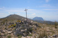
In the Sierra de Aitana, the highest point is called Aitana and, at 1,559 metres above sea level, it is also the highest point in the entire province of Alicante. Just behind it, Moleta d'Aitana, at an altitude of 1,499 metres, is the second highest peak and easier to access by following this route. See Practical Information for details of the difficulties encountered.
The Sierra de la Grana circular walk starting from Torre de les Maçanes
 6.60 mi
+1,217 ft
-1,217 ft
4h 05
Moderate
Departure from la Torre de les Maçanes / Torremanzanas (Alacant / Alicante)
6.60 mi
+1,217 ft
-1,217 ft
4h 05
Moderate
Departure from la Torre de les Maçanes / Torremanzanas (Alacant / Alicante)
The Sierra de la Grana is surrounded by much higher mountain ranges; as a result, it is somewhat overlooked and far less visited. But this makes it an excellent vantage point for all the region’s iconic peaks, such as Cabeço d’Or, Peña Migjorn, Menajador, Els Plans, Aitana, Puig Campana, etc. What’s more, the route is very pleasant and combines forest tracks, footpaths and lightly marked sections with no technical difficulties.
Pou del Rentonar in Torremanzana
 2.97 mi
+512 ft
-515 ft
1h 50
Easy
Departure from Benifallim (Alacant / Alicante)
2.97 mi
+512 ft
-515 ft
1h 50
Easy
Departure from Benifallim (Alacant / Alicante)
From the 17th century right up until almost the middle of the 20th century, harvesting snow and turning it into ice was a very important livelihood for the mountain dwellers. However, with the invention of the fridge, this source of income dried up.
The walk described here is both easy and short, and offers the chance to admire a superb snow well.
The coves of Benitatxell, from Cala Moraig to Cala Llebeig
 2.72 mi
+2,976 ft
-2,995 ft
3h 50
Easy
Departure from el Poble Nou de Benitatxell / Benitachell (Alacant / Alicante)
2.72 mi
+2,976 ft
-2,995 ft
3h 50
Easy
Departure from el Poble Nou de Benitatxell / Benitachell (Alacant / Alicante)
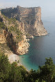
This itinerary combines sightseeing with a walk. Sightseeing because these magnificent coves at the foot of impressive cliffs are very popular with swimmers. A walk because the route described here follows a path halfway up the cliffs, between two of the region’s most famous coves.
The suggested route leads from the very popular Cala del Moraig to the almost inaccessible Cala Llebeig. The views along the entire route are extraordinary, taking in both the sea and the cliffs.
Barranc de l’Encantada in Planes de la Baronia
 8.09 mi
+1,355 ft
-1,355 ft
4h 55
Moderate
Departure from Planes (Alacant / Alicante)
8.09 mi
+1,355 ft
-1,355 ft
4h 55
Moderate
Departure from Planes (Alacant / Alicante)
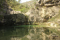
A fabulous walk in a magical place that gave rise to the legend of the Encantada, the guardian of a treasure. According to tradition, she only appears once every 100 years, and the treasure will belong to whoever meets her.
Climb up to the Ermita de Santa Barbara in Jijona
 1.54 mi
+259 ft
-259 ft
0h 55
Easy
Departure from Xixona / Jijona (Alacant / Alicante)
1.54 mi
+259 ft
-259 ft
0h 55
Easy
Departure from Xixona / Jijona (Alacant / Alicante)
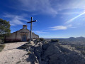
A little way from the historic centre and tourist routes, this short walk will show you the town of Jijona from a different angle through the eyes of the Ermita de Santa Barbara, a small 15th-century chapel, forgotten by all, perched on a hill of the same name. From its summit, you will not only have an unusual view of Jijona and its castle, but also of Alicante and the entire surrounding valley. Although there is a slight incline, this walk is relatively easy and accessible to all.
Pou del Canonge in Ibi
 7.21 mi
+1,289 ft
-1,283 ft
4h 25
Difficult
Departure from Ibi (Alacant / Alicante)
7.21 mi
+1,289 ft
-1,283 ft
4h 25
Difficult
Departure from Ibi (Alacant / Alicante)
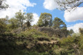
The word "pou" is Valencian and means snow well. This was a very important trade involving the manufacture of ice from snow, which was more abundant at that time. This activity, which began in the 16th or 17th century, came to an end in the mid-20th century with the advent of the refrigerator.This trail offers a chance to see the remains of the snow well known as del Canonge, but most of the route is off-trail and requires some mountain experience and good navigation skills. This hike is therefore only suitable for experienced hikers.
Please note: Due to the difficulty of navigating this route, it is strongly recommended that you use the app (or a hiking GPS)
Mas de Tetuan from Font Roja near Alcoi
 3.50 mi
+932 ft
-902 ft
2h 25
Easy
Departure from Alcoi / Alcoy (Alacant / Alicante)
3.50 mi
+932 ft
-902 ft
2h 25
Easy
Departure from Alcoi / Alcoy (Alacant / Alicante)
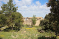
In the Font Roja Natural Park, there is an easy hike to stretch your legs or enjoy with the family (but wear hiking boots), following wide trails through the forest.
Tibi Dam from Sabinar
 9.04 mi
+1,788 ft
-1,781 ft
5h 45
Moderate
Departure from Sant Vicent del Raspeig / San Vicente del Raspeig (Alacant / Alicante)
9.04 mi
+1,788 ft
-1,781 ft
5h 45
Moderate
Departure from Sant Vicent del Raspeig / San Vicente del Raspeig (Alacant / Alicante)
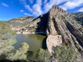
This is a hilly hike that takes you to the Tibi Dam, one of the oldest dams in Europe (1580) still in operation, via a circular route through the surrounding hills. The route offers beautiful views of the coast at the start and finish, but overall, it is more typical of the "Sierra Alicantina" landscape. The route goes up and down quite a bit, but the slopes are not very steep or very long. It is therefore a relatively accessible hike for people with a minimum level of fitness.
The Mos del Bou and Moleta peaks near Tibi
 4.16 mi
+1,181 ft
-1,175 ft
2h 55
Difficult
Departure from Tibi (Alacant / Alicante)
4.16 mi
+1,181 ft
-1,175 ft
2h 55
Difficult
Departure from Tibi (Alacant / Alicante)
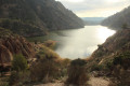
A superb hike with exceptional views of Lake Tibi and impressive peaks to climb. However, it is a difficult hike with some very steep climbs and a path that is quite difficult to follow.
A GPS track is essential to avoid getting lost.
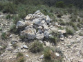
The Cabeço Redondo and Cabec Redo peaks as seen from Tibi
 4.57 mi
+2,415 ft
-2,425 ft
4h 10
Moderate
Departure from Tibi (Alacant / Alicante)
4.57 mi
+2,415 ft
-2,425 ft
4h 10
Moderate
Departure from Tibi (Alacant / Alicante)
This walk takes you to two peaks over 1,000 metres in altitude amidst fantastic scenery near Penya Mitjorn. It is a fairly short walk but has an elevation gain of almost 600 metres, which means the climb is quite steep right from the start and continues steadily.
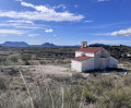
Pla del Totxar
 7.84 mi
+774 ft
-771 ft
4h 15
Moderate
Departure from Sant Vicent del Raspeig / San Vicente del Raspeig (Alacant / Alicante)
7.84 mi
+774 ft
-771 ft
4h 15
Moderate
Departure from Sant Vicent del Raspeig / San Vicente del Raspeig (Alacant / Alicante)
A circular loop that branches off onto the last (and most beautiful) section of the PR®-CV 282, a marked trail that follows the route of the old "Cañada Real", a network of transhumance routes dating back to the time of King Alfonso X el Sabio. You will set off from the Ermita de Nuestra Señora del Carmen to cross small inhabited areas with modest country houses before starting a circular route through the mountains where you can enjoy beautiful views of the coast. Half of the walk is on small, quiet asphalt roads and the other half on a very accessible path with gentle slopes. You won't even notice the 275 m elevation gain. It is also possible to bypass two crossing points, which shortens the walk to 10 km.
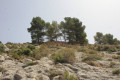
The summit of Fernoveta and Castell Vell in Ibi
 4.82 mi
+1,079 ft
-1,053 ft
3h 10
Difficult
Departure from Ibi (Alacant / Alicante)
4.82 mi
+1,079 ft
-1,053 ft
3h 10
Difficult
Departure from Ibi (Alacant / Alicante)
A hike involving the ascent of two peaks. Whilst access to the first is relatively easy, the same cannot be said for the second. Indeed, the route to the second peak is off-track and involves a steep gradient, both on the ascent and the descent. You must therefore be accustomed to this type of terrain, which means this hike is only suitable for experienced hillwalkers. Following the marked trail is strongly recommended.
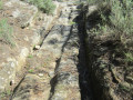
The Mill Trail in Tibi
 3.29 mi
+607 ft
-449 ft
2h 05
Easy
Departure from Tibi (Alacant / Alicante)
3.29 mi
+607 ft
-449 ft
2h 05
Easy
Departure from Tibi (Alacant / Alicante)
Here, we suggest exploring the old mills of Tibi, which once produced flour or paper. There were once as many as 11 mills in the area. You can see the main gate of the Groc mill at the crossroads at the entrance to Tibi. For your information, the rating established by the French Hiking Federation (FFR) gives an IBP of 22, which classifies this walk as ‘easy’.
It is an easy walk that generally follows the river known as the ‘Riu de Montnègre’ or ‘Rio Verde’.
The summit of Escobella near Agost
 6.78 mi
+1,371 ft
-1,352 ft
4h 20
Moderate
Departure from Tibi (Alacant / Alicante)
6.78 mi
+1,371 ft
-1,352 ft
4h 20
Moderate
Departure from Tibi (Alacant / Alicante)
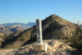
A hike in an almost desert environment to climb two peaks: La Mosca and L'Escobella. Don't forget to bring plenty of water, as the entire route is on paths exposed to the sun.
Cava de Don Miguel and Bolumini Cave in the Sierra de Mariola
 4.81 mi
+938 ft
-912 ft
3h 00
Moderate
Departure from Bocairent (Valencia)
4.81 mi
+938 ft
-912 ft
3h 00
Moderate
Departure from Bocairent (Valencia)
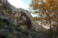
A superb, secluded road through the countryside, offering the chance to visit snow pits and a huge cave that was once inhabited, as well as the opportunity to climb a few peaks along the way to enjoy a 360° view of the Sierra de Mariola.
Summit of Fontcalent starting from Alicante
 4.56 mi
+1,329 ft
-1,332 ft
3h 15
Difficult
Departure from Alacant / Alicante
4.56 mi
+1,329 ft
-1,332 ft
3h 15
Difficult
Departure from Alacant / Alicante
Hike to one of the closest peaks to Alicante, crossing desert areas and ultimately rewarded with a 360° view of Alicante and all the peaks surrounding the city.
Circular around Fontcalent
 7.63 mi
+522 ft
-522 ft
4h 00
Moderate
Departure from Alacant / Alicante
7.63 mi
+522 ft
-522 ft
4h 00
Moderate
Departure from Alacant / Alicante
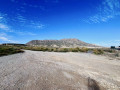
This hike takes you around the Serra de Fontcalent, allowing you to see it from all angles, but from below! It's an easy alternative to climbing to the summit, which is 700 metres high. Ideal for hikers who don't want to or can't climb. Admittedly, the view will not be the same. But this circular still offers some beautiful views: between the industrial and agricultural areas, you will see the major roads and railways. In short, life around Fontcalent.
The Del Humo Cave in the Sierra de Fontcalent
 2.54 mi
+400 ft
-377 ft
1h 30
Easy
Departure from Alacant / Alicante
2.54 mi
+400 ft
-377 ft
1h 30
Easy
Departure from Alacant / Alicante
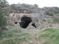
In the Sierra de Fontcalent, the mountain range closest to Alicante, there are numerous caves, but some are difficult to access. This walk takes you to explore a cave that is easily accessible. It is a short walk with little elevation gain that can be enjoyed by the whole family.
Clot de Galvany in Los Arenales del Sol
 5.11 mi
+98 ft
-98 ft
2h 25
Easy
Departure from Elx / Elche (Alacant / Alicante)
5.11 mi
+98 ft
-98 ft
2h 25
Easy
Departure from Elx / Elche (Alacant / Alicante)
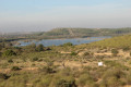
Explore a protected nature reserve by following a circular path, suitable for the whole family and almost entirely flat. As well as numerous species of birds, you’ll discover two sites that bear witness to our history: one, more recent, with bunkers, and the other, older, with a Roman barn.
Sierra de Santa Pola
 8.94 mi
+643 ft
-630 ft
4h 40
Easy
Departure from Elx / Elche (Alacant / Alicante)
8.94 mi
+643 ft
-630 ft
4h 40
Easy
Departure from Elx / Elche (Alacant / Alicante)
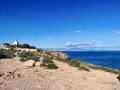
This circular will take you along the coast, below the mountains. The return journey is higher up (144 metres above sea level), passing by the Torre de las Escaletes and the Santa Pola lighthouse, which offer spectacular views of Santa Pola and Alicante. The route is easy and relatively flat. The only slight difficulty is the climb to the Torre de las Escaletes. However, this is equipped with ramps and stairs. And once you reach the top, you won't regret it! The Sierra de Santa Pola is a fossil reef and a protected site, which also houses remains from the Civil War that you will come across along the way.
Cueva de la Gota as seen from the Santa Pola lighthouse
 4.44 mi
+203 ft
-233 ft
2h 15
Moderate
Departure from Santa Pola (Alacant / Alicante)
4.44 mi
+203 ft
-233 ft
2h 15
Moderate
Departure from Santa Pola (Alacant / Alicante)
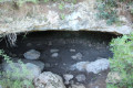
A lovely walk in the Sierra de Santa Pola near the lighthouse, spiced up a little by the search for a well-hidden cave and, for a bit of history, a visit to military ruins dating from the Civil War.
The road from Salt to Santa Pola
 6.09 mi
+305 ft
-279 ft
3h 05
Easy
Departure from Santa Pola (Alacant / Alicante)
6.09 mi
+305 ft
-279 ft
3h 05
Easy
Departure from Santa Pola (Alacant / Alicante)
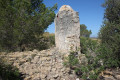
This is an almost entirely flat, easy hike that allows you to discover the wild surroundings of Santa Pola, but it is always in full sun. You will discover traces of human activity from the early 20th century, such as a mill and water management systems for agriculture, as well as the beautiful landscape of the Barranc de Salt.
Tour of the Santa Pola salt flats
 15.61 mi
+56 ft
-59 ft
7h 15
Difficult
Departure from Santa Pola (Alacant / Alicante)
15.61 mi
+56 ft
-59 ft
7h 15
Difficult
Departure from Santa Pola (Alacant / Alicante)
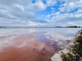
This hike takes you around the Santa Pola salt flats. As the site is in operation, it is not possible to cross it. You will therefore need to skirt around it by following the GR®232. It is a long walk, but easy as there are no hills. There are long straight stretches, sometimes several kilometres long, but the landscape will quickly make you forget the monotony. In places, the paths may be damp or even slightly flooded, depending on the season.
Important note: at (17), you will need to take off your shoes to cross the Río Vinolopo for a few metres. So if you don't like water or are afraid of it, it is best to avoid this hike as you will have no other choice. But don't let that put you off: the salt flats are part of a wild nature reserve that is home to extraordinary flora and fauna.