Country:
 City:
City:


The starting point for this walk is in the village of Planes on the CV-700.
To get to this starting point by car, see the ‘Practical Information’ section below.
(S/E) Right from the start, there’s a superb view of the village. A short tour of the village will be offered at the end of the walk. For now, from the car park, carry on in the same direction and take the first street on the left.
(1) Turn into the first street on the right and, at the end of this street, turn left.
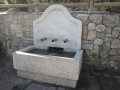
(2) You’ll soon reach the remains of a medieval aqueduct, a spring (Font Nova) and an old washhouse. Do take your time to have a look around. Continue along this tarmac road, cross a bridge, then, at the junction with another road, turn left (do not follow the sign for “Ermita, cami de Colao”).
(3) You’ll soon leave this tarmac road and take a cobbled path on the right, which forms a Way of the Cross with its thirteen stations. The climb is steep, but there’s a lovely view of the village and the surrounding countryside.
(4) You’ll arrive at the Ermita (the chapel), which you can admire from the outside (its original structure dates from the 15th century and forms the current sacristy).
There is a playground next to it and, if you’re still feeling up to it, you can even climb – with care –to the small, very rocky peak 50 metres away, known as “Llomes del Cantalar” (592 m). You retrace your steps and turn right.
I should point out that much of the route follows tracks that are now tarmacked or concrete-paved. “They are very quiet, but you can enjoy the exceptional surroundings at every turn.
There’s a superb view of the vast Lake Beniarrés (a reservoir) and you can admire the terraced fields, typical of mountain farming. Throughout the route, you’ll be surrounded by olive, almond and cherry orchards (Planes is the cherry capital).''
The route is straightforward; you simply need to follow the road. I’ll just point out two tricky spots.
(5) Turn right and you’ll come onto a new tarmac road.
(6). Head right and, following the road as it winds its way, you’ll reach the bottom.
(7) At this point, you’ll walk about fifty metres there and back to the middle of the bridge to admire the gorges and the river on one side, and the dam on the other, from above. (Take care when crossing the road).
Retracing our steps, we’ll head onto the section that allows us to follow the river as closely as possible.
A few metres further on, you’ll see that the road is closed to all traffic (this has been the case for several years due to the high number of visitors in summer). A car park has been built here to accommodate vehicles. Walkers are permitted to pass through.
So, follow the road after passing through the barrier. After a while, you’ll notice a lovely little lake on the right-hand side.
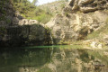
(8) Then, a few metres further on, carefully make your way down the steps to reach an absolutely fantastic spot called “Gorg del Salt” (the Salt Gorge). A superb waterfall, with a lake at its base, enclosed by vertical rock faces. A truly magical place. You can swim in the lake (at your own risk), but the water is cold.
You then climb back up the stairs and continue the walk, heading to the right.
(9) We leave the wide track and head left onto the dirt path.
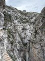
(10) Leave the path for a moment, near a ruined house, to take in the view. You’ll see a small dam, a small lake and, above all, a superb view of the river, which flows through a narrow gorge between the rocks. Return to the path, which will become increasingly narrow and turn into a proper mountain track.
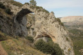
(11) We arrive at the ruins of an old mill. Then, a few metres further on, we take a moment to admire a pretty lake formed by the riverbed narrowing further and further, hemmed in between two steep walls. We are in an area known as ‘l’estret’ (the narrows).
(12) We come to a road which we take to the left. We follow this road at a leisurely pace; it will lead us to the village of Planes. Planes’ strategic location has given it an important role throughout history, as it allows control over communications passing through the Serpis River valley.
(3) Carry on straight ahead to the village.
(1) Turn right for a short tour, taking in the main monuments.
(13) We’ll pass in front of (and underneath) the ayuntamiento (i.e. the town hall). “Part of it dates from the 18th century, and an adjacent house was added to form the current town hall.
Next to it, you’ll notice an 18th-century sundial.”
Then we’ll head towards the castle from the rear.
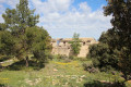
(14) We’ll pass by the church, then make our way up to the castle (currently undergoing restoration; not open to visitors). Originally, it was a Muslim castle from the 12th and 13th centuries, built under the rule of Al-Azraq, followed by a further phase of construction after the Reconquista.
All that remains is to return to the car park (S/E).

 Visorando Member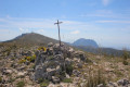

 Easy
Easy 
 Difficult