


Refine your search for walks in Beaumont-les-Autels
Beaumont-les-Autels walks


 The Étang des Panses
 Tourism professional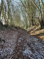
 7.73 mi
 +299 ft
 -272 ft
 3h 50
3h 50
 Moderate
 Departure from Beaumont-les-Autels (Eure-et-Loir)
The Étang des Panses lake can be seen along a path where it is not uncommon to encounter forest animals. After the forest, you will discover Percheron fruit trees at the Miermaigne conservation orchard; in mid-November, you can take part in the Apple Festival.
The Berthe Valley starting from Rougemont
4.66 mi
+512 ft
-518 ft
2h 35
 Easy
Departure from Vichères (Eure-et-Loir)
Easy
Departure from Vichères (Eure-et-Loir)
From the Church of Notre-Dame (listed building), you can admire the traditional architecture of Vichères, built from red sandstone and white stone. This rural route, with its ups and downs, links Rougemont Hill (the highest point in Eure-et-Loir at 285 m) to the picturesque Berthe Valley via sunken paths.
Near Thiron-Gardais Abbey
7.06 mi
+233 ft
-210 ft
3h 25
Moderate
Departure from Thiron-Gardais (Eure-et-Loir)
At the start, visit Thiron-Gardais Abbey, its themed gardens and the Grange aux Dîmes, then the route continues through the Perche countryside to Saint-Denis-d’Authou.
 Les Terres Douces
14.13 mi
+433 ft
-410 ft
3 hrs
Moderate
Departure from Authon-du-Perche (Eure-et-Loir)
The "Terres Douces" countryside reveals a heritage full of charm: the former Priory of Les Châtaigniers and the Manoir de la Guillerie.
Around La Vinette
 Visorando Member9.94 mi
+823 ft
-823 ft
5h 15
Moderate
Departure from Coudreceau (Eure-et-Loir)
Visorando Member9.94 mi
+823 ft
-823 ft
5h 15
Moderate
Departure from Coudreceau (Eure-et-Loir)
Beautiful views of the hills of Perche and the Vinette Valley. This route follows paths and small roads with little traffic.
Frazé Castle and manor houses
7.32 mi
+131 ft
-131 ft
3h 30
Moderate
Departure from Frazé (Eure-et-Loir)
Frazé’s architectural heritage is exceptional. Frazé Castle and Carcahu Manor are prime examples of this. The castle comprises various structures (15th, 17th and 19th centuries), whilst Carcahu Manor (16th–17th centuries) is unlike any other…
In the footsteps of the Maquis fighters in Plainville
 Association / Club / Walk leader
 7.41 mi
+630 ft
-600 ft
3h 55
Easy
Departure from Marolles-les-Buis (Eure-et-Loir)
7.41 mi
+630 ft
-600 ft
3h 55
Easy
Departure from Marolles-les-Buis (Eure-et-Loir)
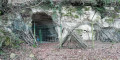
As you walk along the paths once used by the Maquis fighters, discover a key site of the Resistance in Eure-et-Loir: the Plainville Maquis.
Nogent-le-Rotrou, town of the Counts of Rotrou
 2.25 mi
+157 ft
-171 ft
1h 10
Easy
Departure from Nogent-le-Rotrou (Eure-et-Loir)
2.25 mi
+157 ft
-171 ft
1h 10
Easy
Departure from Nogent-le-Rotrou (Eure-et-Loir)
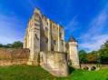
A historical and heritage tour of the capital of the Perche region, following in the footsteps of Rotrou III, Count of the Perche, Maximilien de Béthune, Duke of Sully, and Rémy Belleau, poet of the Pléiade.
The Yerre Valley
7.32 mi
+33 ft
-33 ft
3h 25
Easy
Departure from La Bazoche-Gouet (Eure-et-Loir)
A beautiful walk in the former fiefdom of the turbulent Gouet barons. Like Brou, La Bazoche continues a long tradition of fairs and markets. For over 100 years, the Percheron foal fair has been held on thefirst Saturday in November.
Tour of the Perche Hills
 289.61 mi
+14,616 ft
-14,731 ft
8 days
289.61 mi
+14,616 ft
-14,731 ft
8 days
 Difficult
Departure from Nogent-le-Rotrou (Eure-et-Loir)
Difficult
Departure from Nogent-le-Rotrou (Eure-et-Loir)
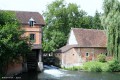
The Tour des Collines du Perche will take you on a journey through the Perche regions of Orne and Eure-et-Loir, with its bocage, hills, valleys and forests (offspring of the famous Forêt des Carnutes), all set against the backdrop of its many manor houses, churches, chapels and a thousand other sites.
You are sure to be amazed by the diversity of the landscapes you will pass through during a journey that takes you through typical Perche towns and villages, steeped in history.
From Nogent-le-Rotrou to Rémalard
17.21 mi
+902 ft
-814 ft
8h 40
Difficult
Departure from Nogent-le-Rotrou (Eure-et-Loir)
This walk is the first stage of an eight-day, 220 km route, the Tour des Collines du Perche.
This first stage, from Nogent-Le-Rotrou to Rémalard, will be your first taste of what characterises the splendid landscapes of the Perche: forests criss-crossed by sunken lanes, meandering rivers, and, along the way, chapels, fountains, wells and a few manor houses.
The Cloche ponds
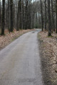 4.50 mi
+312 ft
-312 ft
2h 20
Easy
Departure from Montlandon (Eure-et-Loir)
4.50 mi
+312 ft
-312 ft
2h 20
Easy
Departure from Montlandon (Eure-et-Loir)
Warning! Do not rely on the signposts – there are paths leading in all directions! However, this walk is very pleasant. A quarter of the route is through woodland, whilst the rest follows quiet tarmac roads.
The Woods of Roussigny
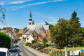 11.28 mi
+758 ft
-751 ft
5h 50
Moderate
Departure from Saint-Ulphace (Sarthe)
11.28 mi
+758 ft
-751 ft
5h 50
Moderate
Departure from Saint-Ulphace (Sarthe)
Like the neighbouring village of Gréez, the medieval development of Saint-Ulphace is linked to the settlement, between the Braye and the Saint-Ulphace stream, of a hermit monk in the6th century. The Hermitage of Saint-Ulphace led to the clearing of the surrounding land and the settlement of Christianised populations, followed by the establishment of the parish, first mentioned in 802.
The Abbeys of the Loir
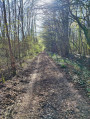 6.58 mi
+98 ft
-98 ft
3h 05
Moderate
Departure from Champrond-en-Gâtine (Eure-et-Loir)
6.58 mi
+98 ft
-98 ft
3h 05
Moderate
Departure from Champrond-en-Gâtine (Eure-et-Loir)
On the edge of the Perche region, the Chemin de César winds its way through the forest to the Abbayes du Loir.
Bois Landry
7.71 mi
+171 ft
-174 ft
3h 40
Moderate
Departure from Champrond-en-Gâtine (Eure-et-Loir)
The route alternates between open countryside and woodland. The private Bois Landry forest is managed sustainably. It also serves as a venue for forest school and nature discovery trips. Along the way stands the fortified farm of Grand Bois Landry (17th century), still surrounded by moats.