Tour of the Perche Hills

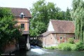
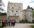
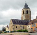
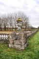
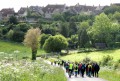
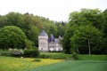
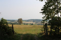
The Tour des Collines du Perche will take you on a journey through the Perche regions of Orne and Eure-et-Loir, with its bocage, hills, valleys and forests (offspring of the famous Forêt des Carnutes), all set against the backdrop of its many manor houses, churches, chapels and a thousand other sites.
You are sure to be amazed by the diversity of the landscapes you will pass through during a journey that takes you through typical Perche towns and villages, steeped in history.

Details

65691
Creation:
Last update:
Last review:
  • Walking
    Activity: Walking
  • ↔
    Distance: 289.61 mi
  • ◔
    Average duration: 8 days 
  • ▲
    Difficulty: Difficult

  • ⚐
    Back to start: Yes
  • ↗
    Ascent: + 14,616 ft
  • ↘
    Descent: - 14,731 ft

  • ▲
    Highest point: 971 ft
  • ▼
    Lowest point: 302 ft

Photos

Stages of the route

This route needs several days, find the details below:

  1. S
  2. 2
  3. 3
  4. 4
  5. 5
  6. 6
  7. 7
  8. 8
  9. 9
  10. E

Notes

The Tour des Collines du Perche is an 8-day multi-stage walk organised by the Itinéraires Ruraux association, whose main aim is to preserve the Perche’s walking trails.

The towns and villages along the route have been chosen not only because they are typical and representative of our region, Le Perche, but also because they offer a range of facilities for walkers: shops, accommodation (hotels, guesthouses, stopover lodges, etc.) and, in some cases, a hospital (Bellême, Mortagne-au-Perche, Nogent-le-Rotrou).

For your bookings, we suggest you visit the websites of the tourist offices in the Orne (Bellême, Mortagne-au-Perche, Tourouvre) and Eure (Nogent-le-Rotrou).
https://www.reservation-tourisme28.com/f…

Not to mention the many websites dedicated to guesthouses.

Two ‘cross-country’ routes make it easy to reduce the number of stages by cutting across the Perche region: the greenway (east-west route from Condé-sur-Huisne to Mortagne-au-Perche) and theGR®22(south-north route from La Perrière to Tourouvre via Bellême and Boissy-Maugis).

Stage 7 has an alternative route:
https://www.visorando.com/randonnee-tour...

Worth a visit

Over 8 stages, you’ll discover the Perche region’s diverse landscapes and its equally rich historical heritage, ranging from the remains of Roman camps and feudal mounds to manor houses and residences from all eras.

Always be cautious and plan ahead when you're outdoors. Visorando and the author of this route cannot be held responsible for any accidents occurring on this route.

The GR® and PR® markings are the intellectual property of the Fédération Française de Randonnée Pédestre.

Reviews and comments

4.7 / 5
Based on 2 reviews

Reliability of the description
5 / 5
Ease of following the route
4.5 / 5
Route interest
4.5 / 5
SebETC
SebETC

Overall rating : 4.7 / 5

Date of your route : Aug 02, 2026
Reliability of the description : ★★★★★ Very good
Ease of following the route : ★★★★☆ Good
Route interest : ★★★★★ Very good
Very busy route : No

I cycled the Tour des Collines du Perche in early August 2026, travelling in the opposite direction, starting from Mortagne-au-Perche.
I set off completely self-sufficient, including my own food supplies. It turned out to be a wise decision, as in early August I found many shops closed along the route; a special mention goes to Saint-Germain-de-la-Coudre, a ghost village! (Tourism in the Perche in summer…!? Oh no…!? )
The route was very quiet; I only came across a few day trippers, but no other walkers tackling the full circuit.
The Tour des Collines du Perche requires commitment; 220 km is a long way, and in August it’s hot!
I found it easy to camp almost anywhere in decent conditions. The campsites at Nogent-le-Rotrou and Rémalard are more than decent and not very busy.
Water is easily available in all the villages you pass through, so there’s no need to lug around 3 litres of water.
Finally, the route is very pleasant; the stages, though sometimes long, are by no means monotonous, and you quickly move from a sunken track to woodland, or from a slight stony incline to a plateau offering a priceless view of… the Perches hills (well, obviously!).
Having walked the route in the opposite direction, I can’t really comment on the signposting, but the little orange signs seem to me to be placed just right and sparingly enough to avoid being overly signposted. For my part, Google Maps, a GPX track and a bit of memory were enough to ensure I never went astray.
In short, an ideal route for exploring the Perche region, its landscapes, architecture and forests, easily accessible from the Paris area (train to Nogent-le-Rotrou, then a coach connection from L’Aigle station for a start from Mortagne or Tourouvre...).

A final word for the volunteers at the ‘Itinéraires Ruraux’ association who have mapped out and maintain this lovely route: Well done!

Machine-translated

ODDAD78
ODDAD78

Hello,
I am no longer personally involved with the Tour des Collines du Perche… though the event is still going ahead. You can still get in touch with the team members via the following link:

https://itinerairesduperche.org/contact/

They’ll be delighted to provide you with information and support your efforts.
In the meantime, I hope you and those in your care enjoy a lovely walk. It’s a great cause.
Kind regards
ODDAD78

Machine-translated

olyvis
olyvis

Hello,

I’m a PE teacher working with young people facing difficulties, and in May 2018 we’re planning to organise a mountain bike trip with a partner secondary school, also starting from Tourouvre. Our pupils are aged between 14 and 17.

I have some questions regarding the difficulty of the route, accommodation and signposting… Your experience might help us avoid making any mistakes.
Would you be willing to get in touch so we can discuss this?

Best regards

Machine-translated

gnome 55
gnome 55

Good evening

Just a quick question: is it your intention for the signposting to remain very basic, or do you plan to add more signposts over time? Bear in mind that some walkers find it reassuring to see signposts and don’t want the hassle of using maps or GPS.
Kind regards

Gnome 55

Machine-translated

ODDAD78
ODDAD78

Thank you very much, Gnome55. The TCP team of volunteers really appreciate your compliments.
Please do not hesitate to share any ideas or suggestions that might improve the quality of our walk and contribute to the well-being of those undertaking this multi-stage route, which certainly still has room for improvement.
We hope to see you again on the beautiful trails of Le Perche
Kind regards
Didier Orsal

Machine-translated

gnome 55
gnome 55

Overall rating : 4.7 / 5

Date of your route : Oct 05, 2016
Reliability of the description : ★★★★★ Very good
Ease of following the route : ★★★★★ Very good
Route interest : ★★★★☆ Good

Hello

In September 2016, I completed the Tour des collines du Perche, a four-stage mountain bike ride, semi-self-supported, starting from Nogent-le-Rotrou. A very lovely ride with everything you could want in terms of terrain, apart from the elevation gain, which is fairly modest; but be warned, the elevation gain can be misleading due to the nature of the terrain, which is grassy and sticky in wet weather.
Quiet, traffic-free roads, superb villages, exceptional architectural heritage, and very good-quality accommodation.
To be enjoyed to your heart’s content.
To do this, visit the ‘Tour des collines du Perche’ website and download the IGN maps and the GPS track.
A big thank you to the volunteers who helped create this route and who enabled us to spend four days in a region that’s little known but well worth discovering.
Go on, don’t hesitate – give it a go.

Best regards

Gnome 55

Machine-translated

Other walks in the area

For more walks, use our search engine .

The GPS track and description are the property of this route's author. Please do not copy them without permission.