


Refine your search for walks in Bazincourt-sur-Saulx
Bazincourt-sur-Saulx walks


 Circular of the Côtes from Bazincourt-sur-Saulx
 Visorando Member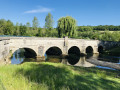
 14.63 mi
 +1,227 ft
 -1,240 ft
 7h 50
7h 50
 Difficult
 Departure from Bazincourt-sur-Saulx (Meuse)
This 24 km circular is quite difficult with an elevation gain of 400 m, hence its name.
Picnic tables are available in all the villages along the route.
The route takes 6 hours (including a picnic). 40% of the route is shaded.
In Stainville, visit the 16th-century Saint-Mathieu Church with its baldachin altar, oil paintings of Christ, the Château de Choiseul and the 19th-century stone fountain.
Belvédère de Tannois circular
 5.58 mi
+623 ft
-594 ft
3h 05
5.58 mi
+623 ft
-594 ft
3h 05
 Easy
Departure from Tannois (Meuse)
Easy
Departure from Tannois (Meuse)
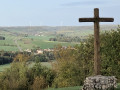
This 9km circular takes you to the Belvédère de Tannois and offers exceptional views over the Ornain valley.
Circular Golf course loop from Véel
 7.66 mi
+440 ft
-456 ft
3h 55
7.66 mi
+440 ft
-456 ft
3h 55
 Moderate
Departure from Fains-Véel (Meuse)
Moderate
Departure from Fains-Véel (Meuse)
This route, starting from Véel, passes through Fains-les-Sources before reaching the 18-hole golf course at Combles-en-Barrois. It will take you past the churches of Saint-Martin (15th century) in Véel, Sainte-Catherine (15th and 16th centuries) in Fains-les-Sources, and the Saint-Joseph Chapel (19th century) between Fains and Combles.
It is an easy walk with little shade. There is a shaded picnic area (4 tables) in front of the Saint-Joseph Chapel.
From Robert-Espagne to Trois Fontaines
 13.59 mi
+466 ft
-440 ft
6h 40
Difficult
Departure from Robert-Espagne (Meuse)
13.59 mi
+466 ft
-440 ft
6h 40
Difficult
Departure from Robert-Espagne (Meuse)
A hike through the Trois Fontaines Forest will allow you to discover the karstic relief of the area with its numerous chasms, sinkholes and resurgences, and offer a historical glimpse of the region with its Trois Fontaines Abbey and the monument to those shot on 29 August 1944 in Robert-Espagne.
Resson Plateau
 5.34 mi
+515 ft
-512 ft
2h 55
Easy
Departure from Bar-le-Duc (Meuse)
5.34 mi
+515 ft
-512 ft
2h 55
Easy
Departure from Bar-le-Duc (Meuse)
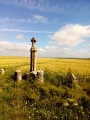
A short route that will take you to the Plateau de Resson. You can enjoy a full 360° panorama.
The Chapel of the Poor in Bayard-sur-Marne, starting from Bienville
6.04 mi
+276 ft
-269 ft
3h 00
Easy
Departure from Eurville-Bienville (Haute-Marne)
A walk to discover the Chapel of Our Lady of the Poor in Bayard-sur-Marne, built in 1954 by volunteers. Legend has it that a chapel had been built on the same site in the 17th century. A stone weighing 800 kg, which was discovered, serves as the altar in this chapel.
 In the footsteps of the Tacot
 9.69 mi
+233 ft
-115 ft
1.5 hrs
Easy
Departure from Mognéville (Meuse)
9.69 mi
+233 ft
-115 ft
1.5 hrs
Easy
Departure from Mognéville (Meuse)
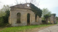
A lovely walk, best done by bike, along the route of the old railway lines in the Saulx Valley, including the line known as the ‘Tacot’ or the ‘Meusien’, which was in service from 1883 to 1971.
It is not a circular route, but the return journey is easy as there is little incline.
The route is often shaded.
Route des Gouffres (Caves Route) in Trois-Fontaines-l'Abbaye
 7.42 mi
+430 ft
-407 ft
3h 45
Moderate
Departure from Trois-Fontaines-l'Abbaye (Marne)
7.42 mi
+430 ft
-407 ft
3h 45
Moderate
Departure from Trois-Fontaines-l'Abbaye (Marne)
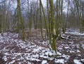
Well-marked hike mainly in the forest, passing near the developed chasms (wooden barriers).
Yellow, white and redPR® markings for theGR® 14 and 14B.
Route des granges à Trois-Fontaines-l’Abbaye
 9.97 mi
+367 ft
-338 ft
4h 55
Moderate
Departure from Trois-Fontaines-l'Abbaye (Marne)
9.97 mi
+367 ft
-338 ft
4h 55
Moderate
Departure from Trois-Fontaines-l'Abbaye (Marne)
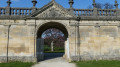
A lovely walk starting from Trois-Fontaines Abbey, passing by the barns – a key site in the region’s history.
Long circular around Saint-Dizier
 5.29 mi
+26 ft
-26 ft
2h 25
Easy
Departure from Saint-Dizier (Haute-Marne)
5.29 mi
+26 ft
-26 ft
2h 25
Easy
Departure from Saint-Dizier (Haute-Marne)
Route around the town of Saint-Dizier, along the Marne and the canals. Markings: large blue dots on the pavements, pedestrian crossings marked "La grande boucle" and blue circle wooden markers.
Sommeville via Le Châtelet and the Haute-Borne menhir
 5.09 mi
+397 ft
-381 ft
2h 40
Easy
Departure from Chevillon (Haute-Marne)
5.09 mi
+397 ft
-381 ft
2h 40
Easy
Departure from Chevillon (Haute-Marne)
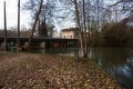
This route offers panoramic views of several villages in the Marne Valley and takes you on a tour of several archaeological sites.
Val d’Ornain – Fains-les-Sources circular route
 8.92 mi
+456 ft
-453 ft
4h 30
Moderate
Departure from Val-d'Ornain (Meuse)
8.92 mi
+456 ft
-453 ft
4h 30
Moderate
Departure from Val-d'Ornain (Meuse)
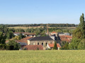
This circular route, which passes through the villages of Bussy-la-Côte, Varney, Fains-les-Sources and Mussey, is very easy and allows you to explore the churches of Saint-André (19th century) in Bussy, Sainte-Catherine (15th and 16th centuries) in Fains and Saint-Nicolas (12th–16th centuries) in Mussey.
Le Haut de Crémont from Chevillon
5.76 mi
+272 ft
-302 ft
2h 55
Easy
Departure from Chevillon (Haute-Marne)
A very pretty walk through the forest and then along the canal, with a slightly steep climb at the beginning but which quickly becomes easier with the descent towards Sommeville. Picturesque spot: the passage under the railway line, then over the river on a metal footbridge.
La Genièvre and Le Tremblot from Chevillon
5.22 mi
+561 ft
-551 ft
2h 55
Moderate
Departure from Chevillon (Haute-Marne)
A short walk along the Ruisseau de Chevillon, a small Category1 stream for anglers, then through the forest on the slopes of Chevillon. Easy to follow, it becomes a bit of a physical challenge when you leave the valley and start the climb. Some lovely views lie ahead.
Curel via Haut de Fosse from Chevillon
7.74 mi
+463 ft
-463 ft
4h 00
Moderate
Departure from Chevillon (Haute-Marne)
A beautiful summer walk along the canal, then discover the pretty village of Curel and climb through the forest to reach Chevillon. Beautiful views of the Marne Valley and the Châtonrupt Viaduct (in good weather).
La Belle Maison in the Forêt du Val, starting from Villiers-aux-Bois
 5.34 mi
+164 ft
-144 ft
2h 35
Easy
Departure from Troisfontaines-la-Ville (Haute-Marne)
5.34 mi
+164 ft
-144 ft
2h 35
Easy
Departure from Troisfontaines-la-Ville (Haute-Marne)
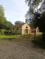
A walk through the Val Forest, one of the largest forests in Haute-Marne. Discover the Maquis du Val house and the ‘La Belle Maison’ roundabout.
The Great Oak of Humbécourt
6.12 mi
+62 ft
-62 ft
2h 50
Easy
Departure from Humbécourt (Haute-Marne)
A pleasant walk in the Forêt du Der, between Humbécourt and the Grand Étang, offering the chance to visit the centuries-old Gros Chêne.
The Bois de Rougemont in Curel
6.75 mi
+873 ft
-863 ft
3h 50
Moderate
Departure from Curel (Haute-Marne) (Haute-Marne)
A lovely walk in the hills above Curel. The paths, tracks and trails are magnificent, offering beautiful views over the Marne valley.
Villers-aux-Vents circular
7.81 mi
+285 ft
-305 ft
3h 50
Moderate
Departure from Villers-aux-Vents (Meuse)
A walk through the Meuse countryside, taking in woods, meadows and ponds.
La Wasseyenne
5.46 mi
+125 ft
-125 ft
2h 35
Easy
Departure from Wassy (Haute-Marne)
A short walk taking you to Lac des Leschères, then along the banks of the Blaise, ending in the heart of Wassy. It’s a route that’s at once idyllic, touristy and historic. You’ll pass by the old foundries of Montreuil-sur-Blaise.
Lac des Leschéres and Belle Faysse Forest
4.79 mi
+82 ft
-85 ft
2h 15
Easy
Departure from Wassy (Haute-Marne)
Walk to Lac des Leschères, then through the Belle Faysse Forest. An easy route along a footpath that runs alongside the embankment, followed by a path through the forest. This walk is a shorter route between Lac des Leschères and the Montreuil-sur-Blaise Forest and is suitable for everyone.
Lac des Leschères and Montreuil-sur-Blaise Communal Forest
 5.82 mi
+82 ft
-82 ft
2h 45
Easy
Departure from Wassy (Haute-Marne)
5.82 mi
+82 ft
-82 ft
2h 45
Easy
Departure from Wassy (Haute-Marne)
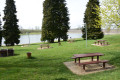
A pleasant walk around Lac des Leschères and through the Montreuil-sur-Blaise Communal Forest. It is utterly peaceful, with birdsong or the rustling of leaves in the wind, depending on the season. Lac des Leschères, known locally as ‘Digue’, is a former 40-hectare reservoir that fed the canal linking Brousseval to Saint-Dizier. The route takes you through the forest and along paths that are sometimes not shown on maps:the Visorando app is recommended.
Lac des Leschères in Wassy
3.97 mi
+180 ft
-190 ft
2h 00
Easy
Departure from Wassy (Haute-Marne)
A picturesque walk around the Leschères Reservoir; well-maintained and signposted, this short walk is suitable for all ages and fitness levels. There are several picnic tables and a small open-air café available for your use.