Refine your search for walks in Auxi-le-Château
Auxi-le-Château walks
 Loop to the north-west of Auxi-le-Château
This loop allows you to discover the banks of the Authie and its marshes before leaving the valley and climbing up to the plateau. It finally skirts around the Pâture Mille Trous nature reserve. There is a beautiful view of Auxi-le-Château and its 15th-century listed church.
 Discover three "Heritage Villages" starting from Auxi-le-Château
This hike through hills and valleys allows you to discover the three "Heritage Villages" surrounding Auxi-le-Château. It offers a variety of landscapes that testify to the inhabitants' attachment to their heritage and respect for diversity.
 Loop east of Auxi-le-Château via the old railway line
This walk allows you to discover the Authie valley on the east side. We pass by the old Auxi-le-Château railway station, which is a fine example of the restoration and conversion of existing heritage. Also worth noting is the small military cemetery, which reminds us of the horrors of war. Finally, enjoy the superb views of the valley and the charming town of Auxi.
 The Authie river, the ravine and the moor

This nearly roadless route takes in the wild Ravin des Cavernes and the astonishing moorland of Nœux-lès-Auxi (le Rietz).
Le Rietz de Nœux is a protected nature reserve. In spring, it's home to the most beautiful orchids. Goes without saying, don't pick them!
This circuit takes up a large part of the "Sentier de l'Étoile" (Path of the Star), of which there are a few routes, but no description. What's more, there are very few markings. The gates are near the fence on the right.
Before tackling this route, I advise you to watch the 2 videos linked in Denis' commentary.
 The Canche, the moorland and the Ravin des Cavernes
In the Riez de Nœux-les-Auxi, there is a beautiful walk along the Canche in Boubers and Ligny. With the climb up the Ravin des Cavernes, you really feel like you are in another world (even more so now, with the final chaos). The route becomes very difficult in wet weather in the Riez and the ravine.
 L'ubac de Rebreuve-sur-Canche

A short, unpretentious and easy route.Very small roads and paths for a relaxing half-day out.
 De la Canche au Bois de Mortagne

An easy start on good paths, then a passage along the Sentier des Culs Trempés (which unfortunately is no longer maintained) before a beautiful climb up to Canettemont.
 Southern Lucheux circuit: La Cavée

There is very little tarmac on this route , which is best done in dry weather.Discover La Cavée, ravaged by storms a few years ago and beautifully restored.A good stretch of the route is on the old railway line (well shaded) before descending to the beautiful village of Grouches-Luchuel.
 Discovering remarkable trees in the Crécy Forest

This walk in the Crécy Forest will enchant you with its four majestic trees, among other things. The IGN map is highly recommended for following the route.
 Loop via Monflières, Bellancourt and Saint-Riquier from Abbeville
This 20 km circuit between Abbeville and Saint-Riquier takes you to the Monflières Chapel, then the Scardon Valley, seen from above, before returning via the Traverse du Ponthieu.
 From La Planquette to Bois de Fressin

A succession of small roads and paths for a day in the great outdoors.The icing on the cake: a good elevation gain with a superb climb in the Bois de Fressin.
For very experienced hikers, I highly recommend the alternative route described in the practical information section.
 The hedgerows
The old marked trail around Ambricourt is unfortunately poorly maintained or not maintained at all. We have been walking it for 25 years and have encountered difficulties every time (poor signage, paths buried under nettles or difficult to walk on).The start at Teneur allows you to pass (twice) in front of the superb limestone hillside of Teneur. Deer are often visible in or around the Bois de Crépy
The path is in very poor condition between points (2) and (6).
If possible, avoid the period between mid-June and mid-August. The passage after point (3) will be easier if the field is not too far into the growing season or has already been harvested.
 In the footsteps of Saint Benedict

The Ternois is a beautiful region in northern France. There used to be an abbey where good cheese was made, and there is still a shop selling local products.
 Route du Marais des Cavins

A pleasant little walk that can be enjoyed with the family, discovering the local flora and fauna.
 The ponds and marshes of Mareuil-Caubert

This hike is an invitation to discover the fish-filled ponds and marshes of the Somme. You will enjoy the fauna (grey heron) and flora (wild fritillary) characteristic of the region.
 Where Justice can lead to Hell

Another lovely route in the Ternois hills. Few roads and, in good weather, beautiful panoramic views.
If you're lucky, you may also spot a few deer (a herd of six at the end of February 2019).
 Eps and Herbeval mountains

A short but very hilly route (carto-explorer even gives 230m elevation gain) around the village of Eps, unjustly excluded by the marked trails. Beautiful views.Best done on a sunny day - it's magical!
 The humpback bridge at the start of Équirre
Starting from Équirre Castle, which was reduced by half following a fire, this walk takes you to the small village of Prédefin and back via the Lisbourg plain. The paths taken by the GRP® Tour du Ternois Nord are partly cultivated between points (8) and (9), but don't hesitate to cross them as they are often used by farmers.
 La Creuse de Boyaval
In the Ternois, after a loop on the small roads of Sains-les-Pernes, head towards Fiefs, before descending to Boyaval via a wild hollow and returning to Sains-les-Pernes via the Chemin Vert, which would benefit from regular maintenance.
It is best to walk this route in dry weather, as some sections are difficult.
This is a difficult route because the paths are tricky and you need to be careful not to miss the entrances to some of the trails.
 Bours keep

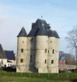
The walk starts from the Donjon de Bours (Bours keep) and takes you up to the plateau with its remarkable views. You'll then head back down to the village, finishing with a stroll through the narrow streets of Bours.
 In the footsteps of the Bours family
From the Bours Keep, passing by the Fontaine de la Baloche fountain, then through the Bois de Lanoy woods and past Antigneul Castle, the hike follows grassy paths offering beautiful views.
 Path from the keep starting from Bours

This hike starts at the Bours keep and takes us along paths and through woods to the top of a hill with remarkable views. You will descend via Les Eguerguettes towards the village. Please note: the descent is difficult in wet weather. The hike ends with a short tour of the narrow streets of Bours.
More walks in Auxi-le-Château
Select a point of interest below:
