Country:

 City:
City:


Park in the Châtains car park.
(S/E) Do not take the RD211a but head down towards Les Grands Châtains for about 150 metres. At the sign for ‘Grands Châtains 1163 m’, turn right onto the Chemin de la Chapelle: if you continue straight on, you can visit the Fontaine des Châtains 100 metres away, followed by the chapel itself.
Just past a large old house, take a small path on the left that leads down alongside the house. The path is well marked but partially obstructed by vegetation; however, it can be negotiated without too much difficulty: a pair of secateurs may, however, come in handy. Continue the descent through the forest for 400 to 500 metres, until you reach a hairpin bend where you’ll see a rather imposing concrete ventilation shaft protruding from the ground.
(1) Turn left: after 50 m, you’ll see the Italians’ black wooden hut. Once you reach the hut, look down below for a large penstock covered in leaves. Head towards the penstock and take the path that runs over it. Continue along the path, veering slightly to the right, to cross a second section of the penstock whilst passing over two streams in succession. Head towards a large concrete structure situated higher up, resembling an access chamber to the penstock: the climb is very steep.
(2) Once at the structure, continue to the left along a concrete water pipe until you reach a small concrete reservoir.
(3) Cross the stream via the makeshift dam and follow the stream upstream until you see the ruins of an old mill swept away by an avalanche, then, just above it, a small canyon-like gorge.
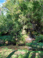
(4) Walk back a few dozen metres and take the path on the left, which winds its way up through the forest amongst some majestic trees.
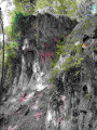
(5) Once you reach the hamlet of Mailloz, continue to the right along the tarmac road, then take a path on the right before reaching its end. Pass a fountain on your left and continue across the field, following the GPX track. This track leads to the old baths. You can see a stone structure with walls on three sides, and on the ground you can still see slate slabs, remnants of the old roof. A few metres below, you can see a magnificent cliff face of tufa and moss, evidence of water once flowing through this spot.
(6) Head back up towards the hamlet of Mailloz along the path you took earlier.
(5) Continue straight on along the tarmac road which climbs towards the departmental road. Navigate the hairpin bend to the right and carry on for about fifty metres.
(7) Turn left onto the path leading to the Mailloz lake. Here you can see an active tufa formation, as water is flowing through it. Once at the lake, follow the path as it climbs up to the district road (D211a). Turn left and continue along this road until you reach the car park where you started (S/E).

 Visorando Member
 Easy
Easy 
 Moderate

 Very difficult